MyTopo
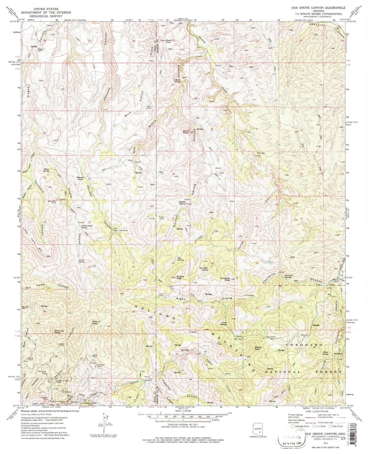
Classic USGS Oak Grove Canyon Arizona 7.5'x7.5' Topo Map
Couldn't load pickup availability
Historical USGS topographic quad map of Oak Grove Canyon in the state of Arizona. Map scale may vary for some years, but is generally around 1:24,000. Print size is approximately 24" x 27"
This quadrangle is in the following counties: Graham, Pinal.
The map contains contour lines, roads, rivers, towns, and lakes. Printed on high-quality waterproof paper with UV fade-resistant inks, and shipped rolled.
Contains the following named places: Bitter Spring, Black Butte, Bleak Spring, Bluebird Mine, Bluebird Spring, Brown Jug Spring, Cement Tank Spring, Childs and Altwilkle Mine, Cooly Spring, Copper Creek, Copper Prince Mine, Don Jose Corral, Fourmile Ranch, Fourmile Springs, Garden Spring, Garden Spring Canyon, Glory Hole Mine, Hanks Corral, Ison Spring, Jackson Spring, Left Prong Fourmile Canyon, Lime Camp, Little Table Mountain, Manzanita Spring, Manzanita Tank, Marics Canyon, Mescal Peak, Mescal Tank, Negro Henry Canyon, Oak Grove Canyon, Oak Spring, Oak Spring Tank, Parsons Grove, Peach Spring, Pipeline Canyon, Reliable Mine, Right Prong Fourmile Canyon, Right Prong Fourmile Creek, Saddle Canyon, Saloon Canyon, Sixtysix Peak, Soda Spring, Sycamore Canyon, Table Mountain Mine, The Hendrickson, Turquoise Peak, Van Dyke Spring, Walnut Spring, Willow Spring, Wire Corral