MyTopo
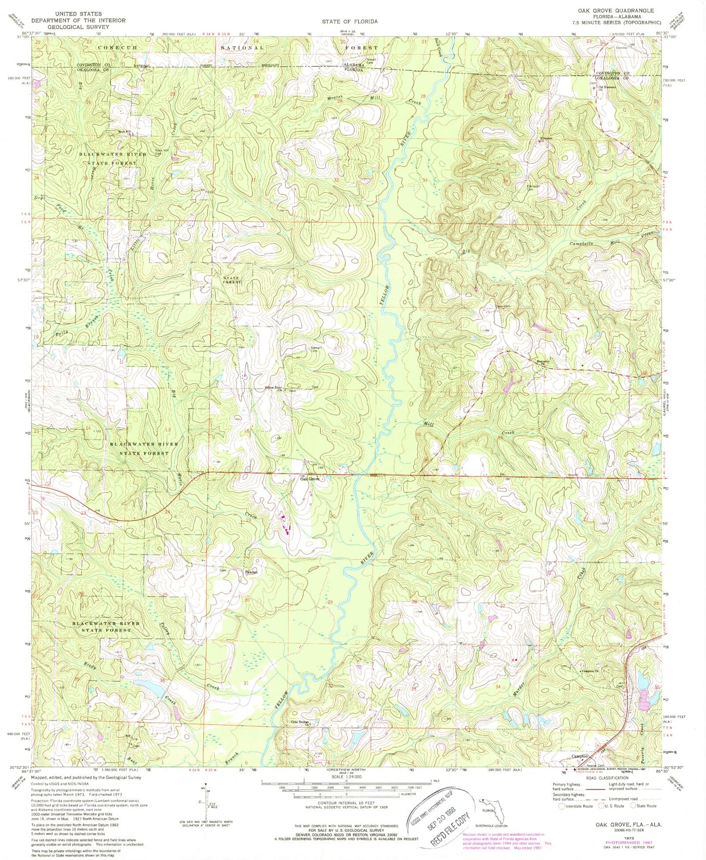
Classic USGS Oak Grove Florida 7.5'x7.5' Topo Map
Couldn't load pickup availability
Historical USGS topographic quad map of Oak Grove in the states of Florida, Alabama. Map scale may vary for some years, but is generally around 1:24,000. Print size is approximately 24" x 27"
This quadrangle is in the following counties: Covington, Okaloosa.
The map contains contour lines, roads, rivers, towns, and lakes. Printed on high-quality waterproof paper with UV fade-resistant inks, and shipped rolled.
Contains the following named places: Alva Davidson Pond, Bailey Branch, Bear Branch, Big Creek, Big Horse Creek, Buck Creek, Campbells Mill Creek, Campton Church, Clear Springs Church, Dry Ford Branch, Ebenezer Cemetery, Ebenezer Church, Little Horse Creek, Magnolia Cemetery, Magnolia Church, Mill Creek, Moores Mill Creek, Newell Cemetery, Oak Grove, Old Ebenezer Church, Peaden, Polley Creek, Reeder Cemetery, Reedy Creek, Rock Hill Cemetery, Rock Hill Church, Stewart Cemetery, Yellow River Church