MyTopo
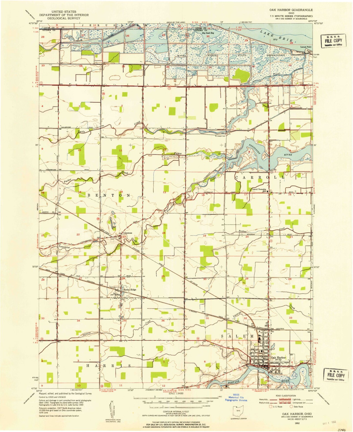
Classic USGS Oak Harbor Ohio 7.5'x7.5' Topo Map
Couldn't load pickup availability
Historical USGS topographic quad map of Oak Harbor in the state of Ohio. Map scale may vary for some years, but is generally around 1:24,000. Print size is approximately 24" x 27"
This quadrangle is in the following counties: Lucas, Ottawa.
The map contains contour lines, roads, rivers, towns, and lakes. Printed on high-quality waterproof paper with UV fade-resistant inks, and shipped rolled.
Contains the following named places: Big Sand Bay, Carroll Township Emergency Medical and Fire Services, Carroll Township Police Department, Carroll Township School, Continental Marsh, Crane Creek State Park, Eisenhour Marsh, France Marsh, Hunter Marsh, Limestone, Limestone Cemetery, Limestone Post Office, Locust Point, Magee Marsh, Magee Marsh Wildlife Area, Maple Grove, Mid County Emergency Medical Services, Moore Orchards, Oak Harbor, Oak Harbor High School, Oak Harbor Middle School, Oak Harbor Post Office, Oak Harbor Public Library, Oak Harbor United Methodist Church, Oak Harbor Village Police, Packer Creek, Portage Fire District, R C Waters Elementary School, Ritter Marsh, Rocky Ridge, Rocky Ridge Elementary School, Rocky Ridge Post Office, Rocky Ridge Quarry, Rocky Ridge Volunteer Fire Department, Saint Boniface Catholic Church, Saint Boniface Elementary School, Saint Johns Evangelical Lutheran Church, Saint Joseph Cemetery, Saint Paul United Church of Christ, Sportsmen Migratory Bird Center, Toussaint Creek, Toussaint Creek Wildlife Area, Township of Benton, Turtle Creek, Turtle Creek Bay, Turtle Creek Lake Area, Union Cemetery, Village of Oak Harbor, Village of Rocky Ridge, Wolf Creek, ZIP Codes: 43449, 43458