MyTopo
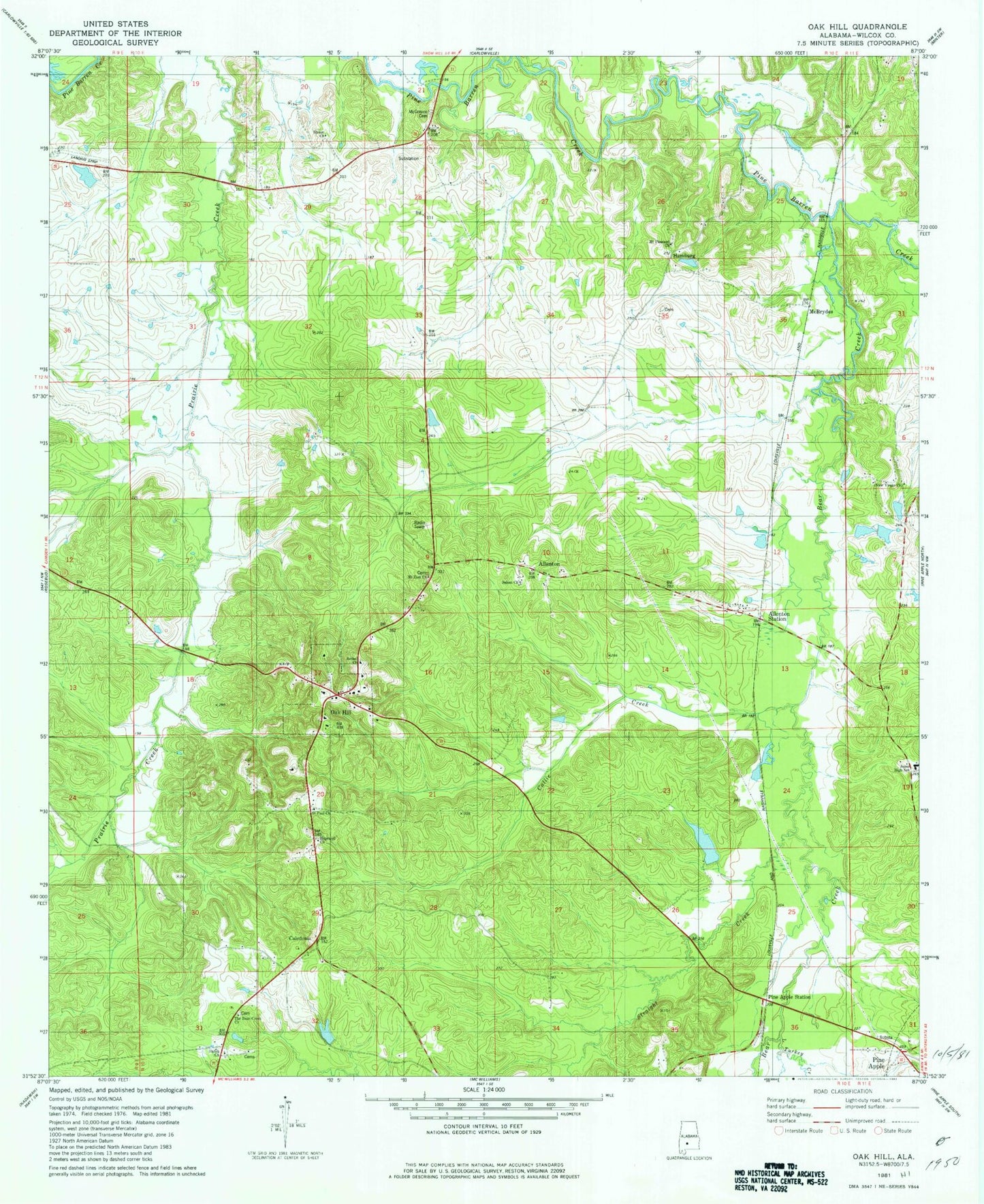
Classic USGS Oak Hill Alabama 7.5'x7.5' Topo Map
Couldn't load pickup availability
Historical USGS topographic quad map of Oak Hill in the state of Alabama. Map scale may vary for some years, but is generally around 1:24,000. Print size is approximately 24" x 27"
This quadrangle is in the following counties: Wilcox.
The map contains contour lines, roads, rivers, towns, and lakes. Printed on high-quality waterproof paper with UV fade-resistant inks, and shipped rolled.
Contains the following named places: Allenton, Allenton Station, Bear Creek, Bear Creek Church, Bethel Church, Black Creek Park, Blue Creek, Caledonia, Callie Creek, Hale Lake, Hale Lake Dam, Halls Creek, Hamburg, Hopewell Church, Jones High School, Lambert Bama Ranch Dam, Lambert Bama Ranch Lake, Little Turkey Creek, McBrydes, McConico Cemetery, Mount Pleasant Baptist Church, Mount Zion Church, New Virgin Church, Oak Hill, Oak Hill Post Office, Oak Hill Volunteer Fire Department, Pine Apple Division, Pine Apple Station, Saint Paul Church, Salem Church, Shiloh Church, Siloam Church, Siloam School, Straight Creek, The Bear Creek Church, Town of Oak Hill, ZIP Codes: 36766, 36768