
MyTopo
Classic USGS Oak Mound Bayou Louisiana 7.5'x7.5' Topo Map
Couldn't load pickup availability
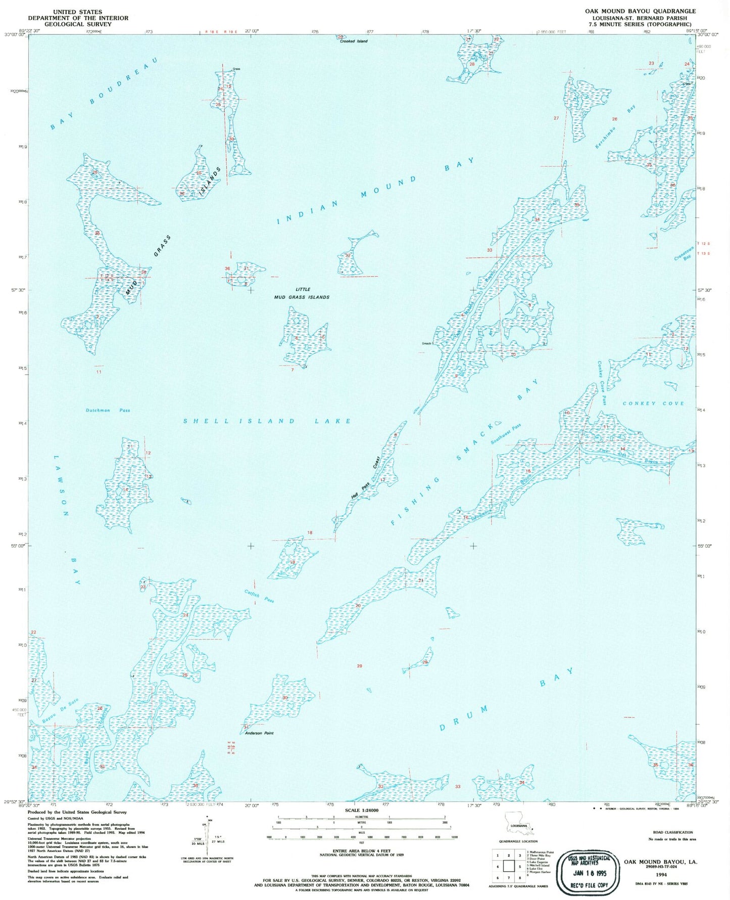
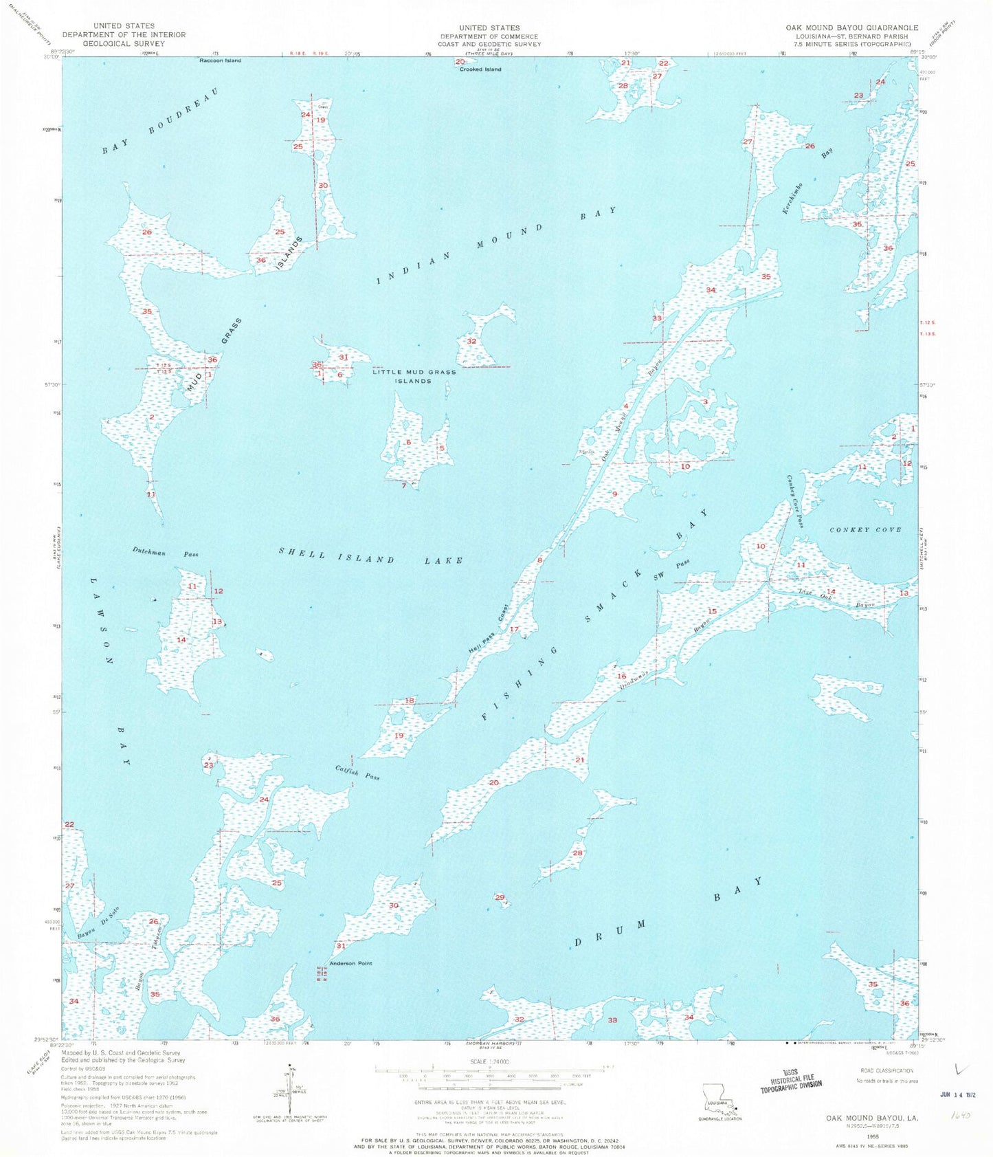
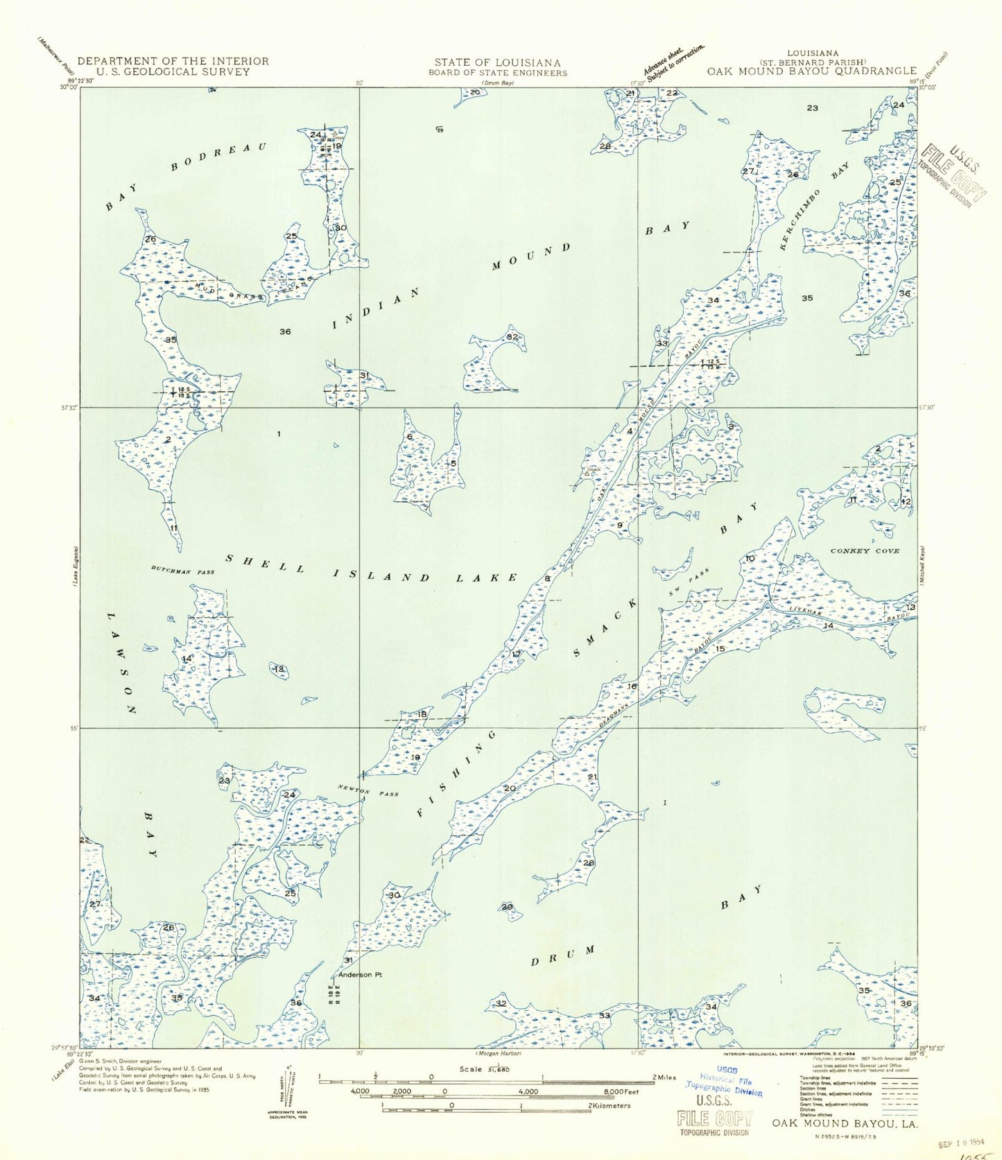
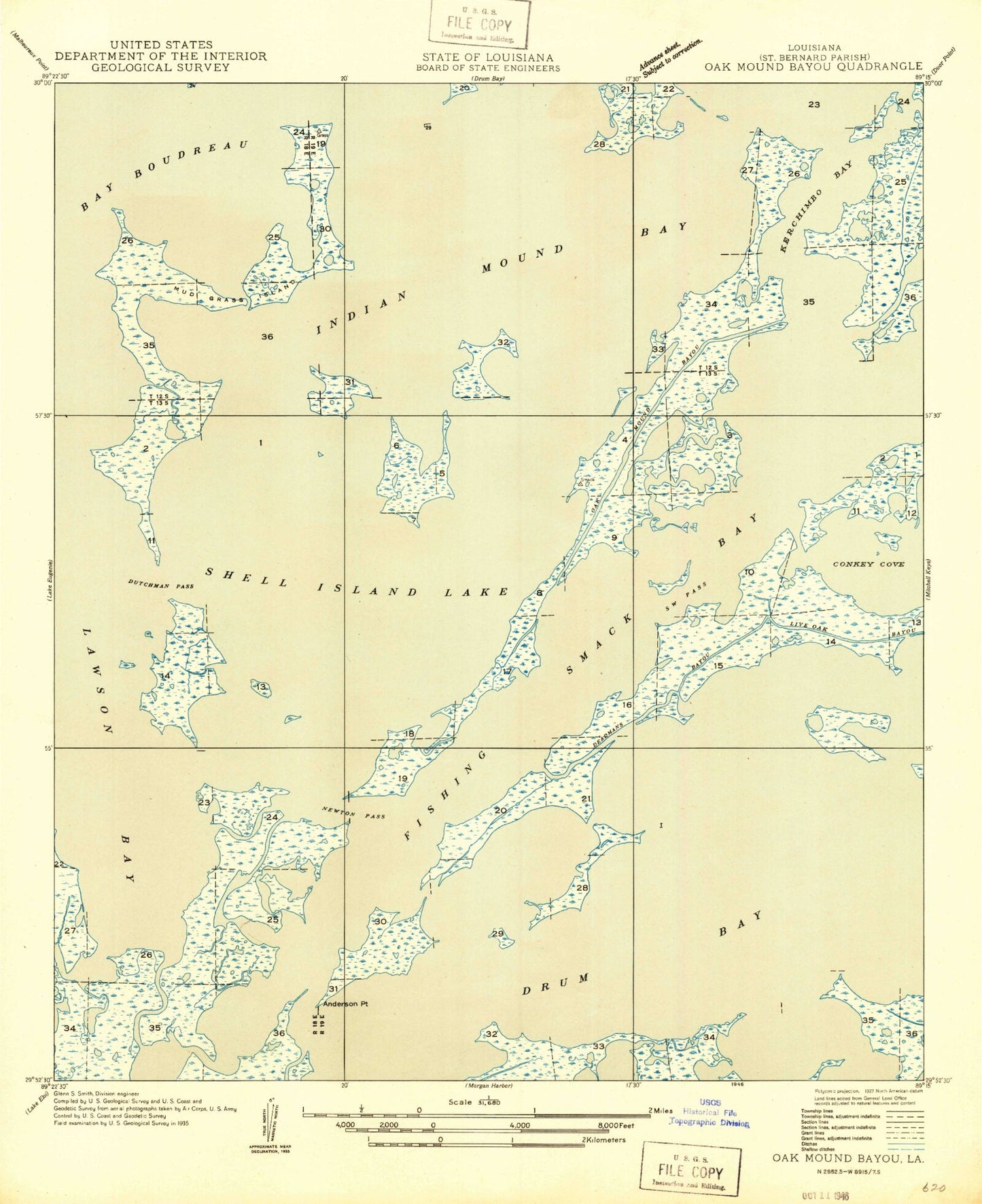
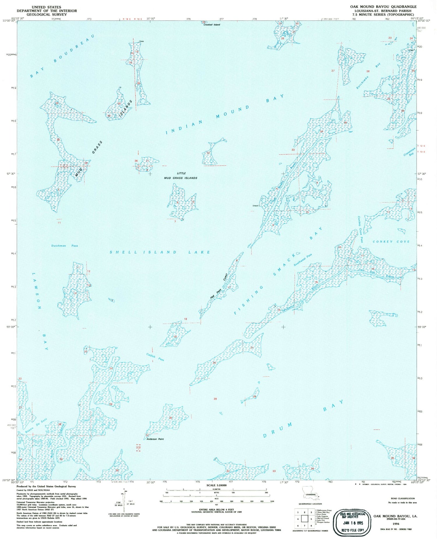
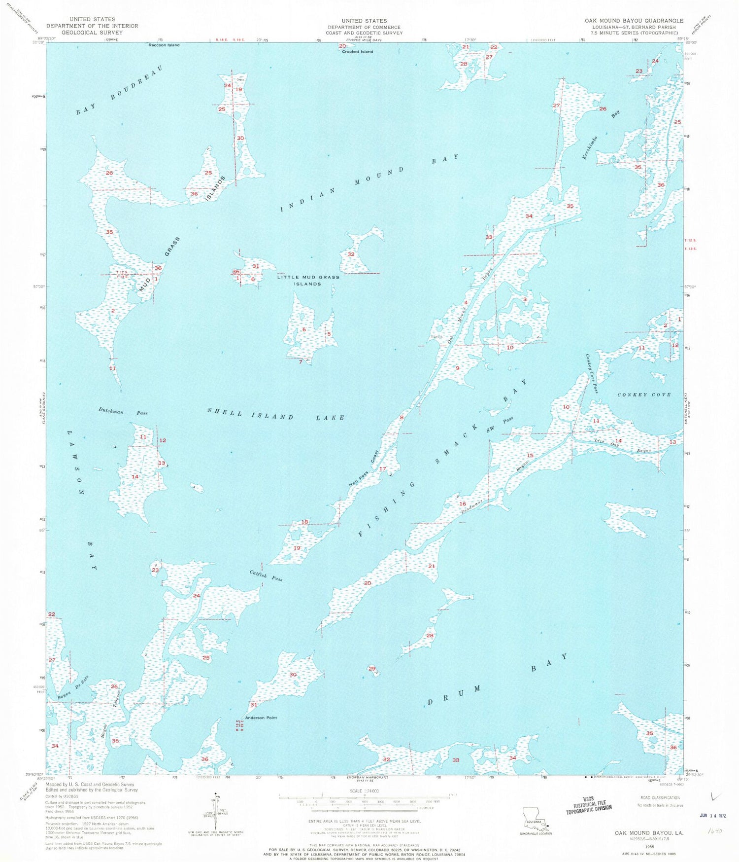
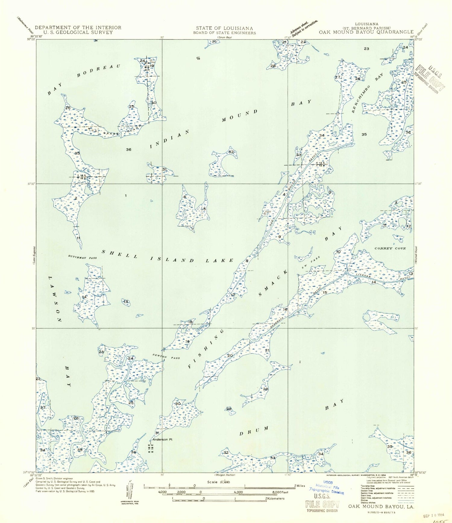
Historical USGS topographic quad map of Oak Mound Bayou in the state of Louisiana. Map scale may vary for some years, but is generally around 1:24,000. Print size is approximately 24" x 27"
This quadrangle is in the following counties: St. Bernard.
The map contains contour lines, roads, rivers, towns, and lakes. Printed on high-quality waterproof paper with UV fade-resistant inks, and shipped rolled.
Contains the following named places: Anderson Point, Bay Boudreau, Bayou De Soto, Bayou Tobacco, Catfish Pass, Conkey Cove, Conkey Cove Pass, Deadmans Bayou, Drum Bay, Dutchman Pass, Fishing Smack Bay, Hell Pass Coast, Indian Mound Bay, Kerchimbo Bay, Lawson Bay, Little Mud Grass Islands, Live Oak Bayou, Mud Grass Islands, Oak Mound Bayou, Parish Governing Authority District E, Saint Bernard Parish, Shell Island Lake, Southwest Pass