MyTopo
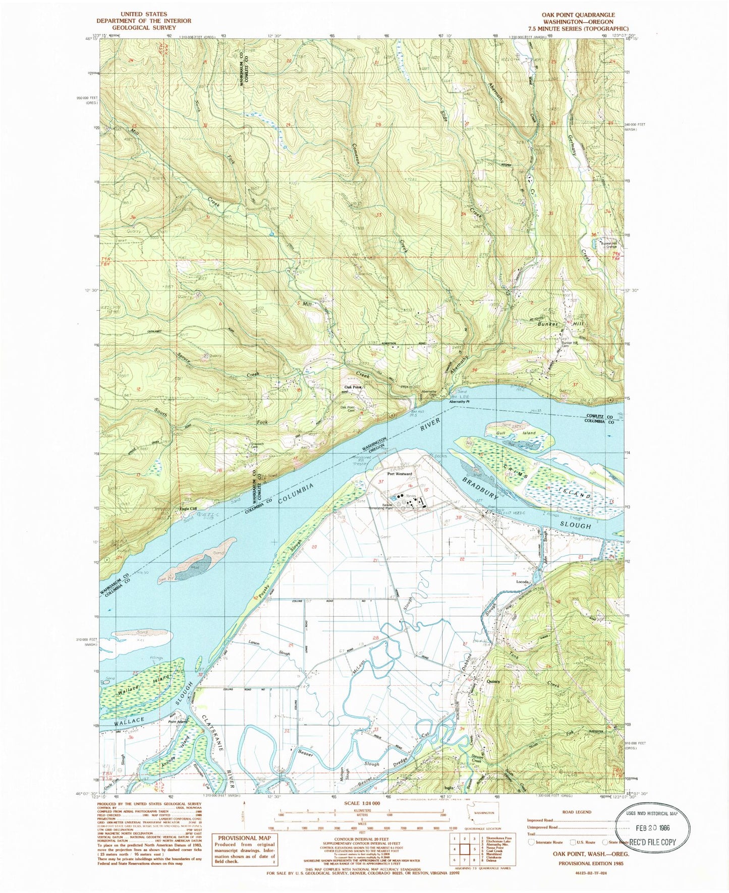
Classic USGS Oak Point Washington 7.5'x7.5' Topo Map
Couldn't load pickup availability
Historical USGS topographic quad map of Oak Point in the states of Washington, Oregon. Map scale may vary for some years, but is generally around 1:24,000. Print size is approximately 24" x 27"
This quadrangle is in the following counties: Columbia, Cowlitz, Wahkiakum.
The map contains contour lines, roads, rivers, towns, and lakes. Printed on high-quality waterproof paper with UV fade-resistant inks, and shipped rolled.
Contains the following named places: Abernathy Assembly of God Church, Abernathy Cemetery, Abernathy Fish Technology Center, Abernathy Point, Abernethy Creek, Anunde Island, Beaver Creek, Beaver Power Plant, Beaver Slough, Bradbury Post Office, Bradbury Slough, Bunker Hill, Bunker Hill Cemetery, Bunker Hill Grange, Cameron Creek, Cascade Grain Products Ethanol Production Facility, Clatskanie Rural Fire Quincy Station, Cowlitz 2 Fire and Rescue Station 26 Bunker Hill, Cries Creek, Crims Island, Dobbins Slough, Eagle Cliff, Eureka Bar, Eureka Channel, Eureka Upper Channel, Grasseth Cemetery, Gull Island, Gull Island Turn and Channel, Inglis, Inglis Post Office, Inglis Station, John Slough, Kinnunen Cut, Larson Slough, Locoda, Marshland Division, McLean Slough, Memaloose Rock, Michigan Slough, Mill Creek, Mill Creek Truck Trail, North Fork Mill Creek, North Fork Stewart Creek, Oak Point, Oak Point Cemetery, Oak Point Channel, Oak Point Community Church, Point Adams, Port Westward, Port Westward Generating Project, Port Westward Spur, Poysky Slough, Quincy, Quincy Post Office, Quincy Reservoir, Quincy School, Quinn Post Office, Slide Creek, South Fork Mill Creek, Spruce Creek, Stella Lutheran Chapel, Stewart Creek, Stewart Creek Cemetery, Swampy Lake, Tank Creek, Wiest Creek


