MyTopo
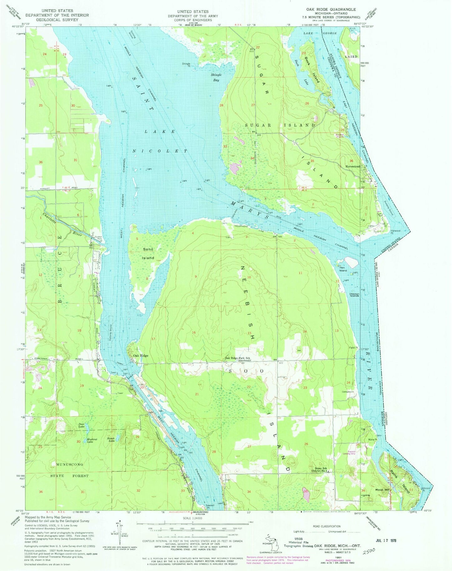
Classic USGS Oak Ridge Michigan 7.5'x7.5' Topo Map
Couldn't load pickup availability
Historical USGS topographic quad map of Oak Ridge in the state of Michigan. Map scale may vary for some years, but is generally around 1:24,000. Print size is approximately 24" x 27"
This quadrangle is in the following counties: Chippewa.
The map contains contour lines, roads, rivers, towns, and lakes. Printed on high-quality waterproof paper with UV fade-resistant inks, and shipped rolled.
Contains the following named places: Charlotte River, Chicken Islands, Deer Lake, Duck Island, Duck Island Cemetery, Duck Lake, Dunbar Forest Experiment Station Michigan State University, Dunbar Park, East Neebish Channel, Elisha Point, Field Point, Franklin's Airport, Haynes Family Cemetery, Hen Island, Indian Point, Laitinen Family Cemetery, Lower Nicolet Ranges, Middle Neebish Channel, Middle Neebish Channel Range, Muskrat Lake, Neebish Island, Neebish Island Catholic Cemetery, Neebish Island Presbyterian Church Cemetery, Neebish Island Volunteer Fire Department, Oak Ridge, Oak Ridge Park Post Office, Oak Ridge Park School, Roach Lake, Sand Island, Shingle Bay, Shingle Point, Stone School District Number 4, Township of Soo, West Neebish Channel, West Neebish Channel Range, West Noebish Channel Upper Range, ZIP Code: 49710