MyTopo
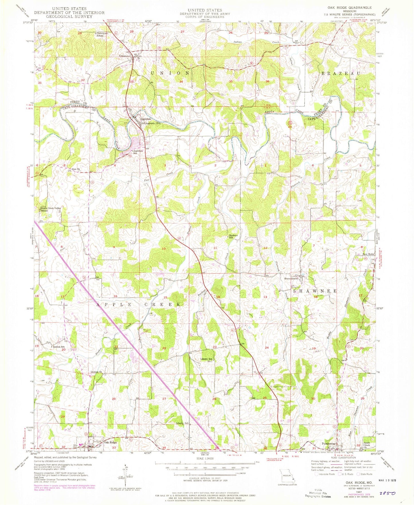
Classic USGS Oak Ridge Missouri 7.5'x7.5' Topo Map
Couldn't load pickup availability
Historical USGS topographic quad map of Oak Ridge in the state of Missouri. Map scale may vary for some years, but is generally around 1:24,000. Print size is approximately 24" x 27"
This quadrangle is in the following counties: Cape Girardeau, Perry.
The map contains contour lines, roads, rivers, towns, and lakes. Printed on high-quality waterproof paper with UV fade-resistant inks, and shipped rolled.
Contains the following named places: Apple Creek, Apple Creek Church, Apple Creek Valley School, Appleton School, Buckeye Creek, Buckeye School, Concord, Flatrock Creek, Fruitland Area Fire Protection District Station 2, Goshen Church, Goshen School, Grace Lutheran Cemetery, Hughes Creek, Immanuel Lutheran Cemetery Old, Indian Creek, Liberty School, Liberty School Number 1, Oak Ridge, Oak Ridge Cemetery, Oak Ridge Post Office, Old Appleton, Old Appleton Post Office, Pocahontas, Pocahontas Post Office, Poor Creek, Shawneetown, Shawneetown Census Designated Place, Town of Old Appleton, Town of Pocahontas, Uniontown, Uniontown School, Zion Church, ZIP Codes: 63769, 63770, 63783