MyTopo
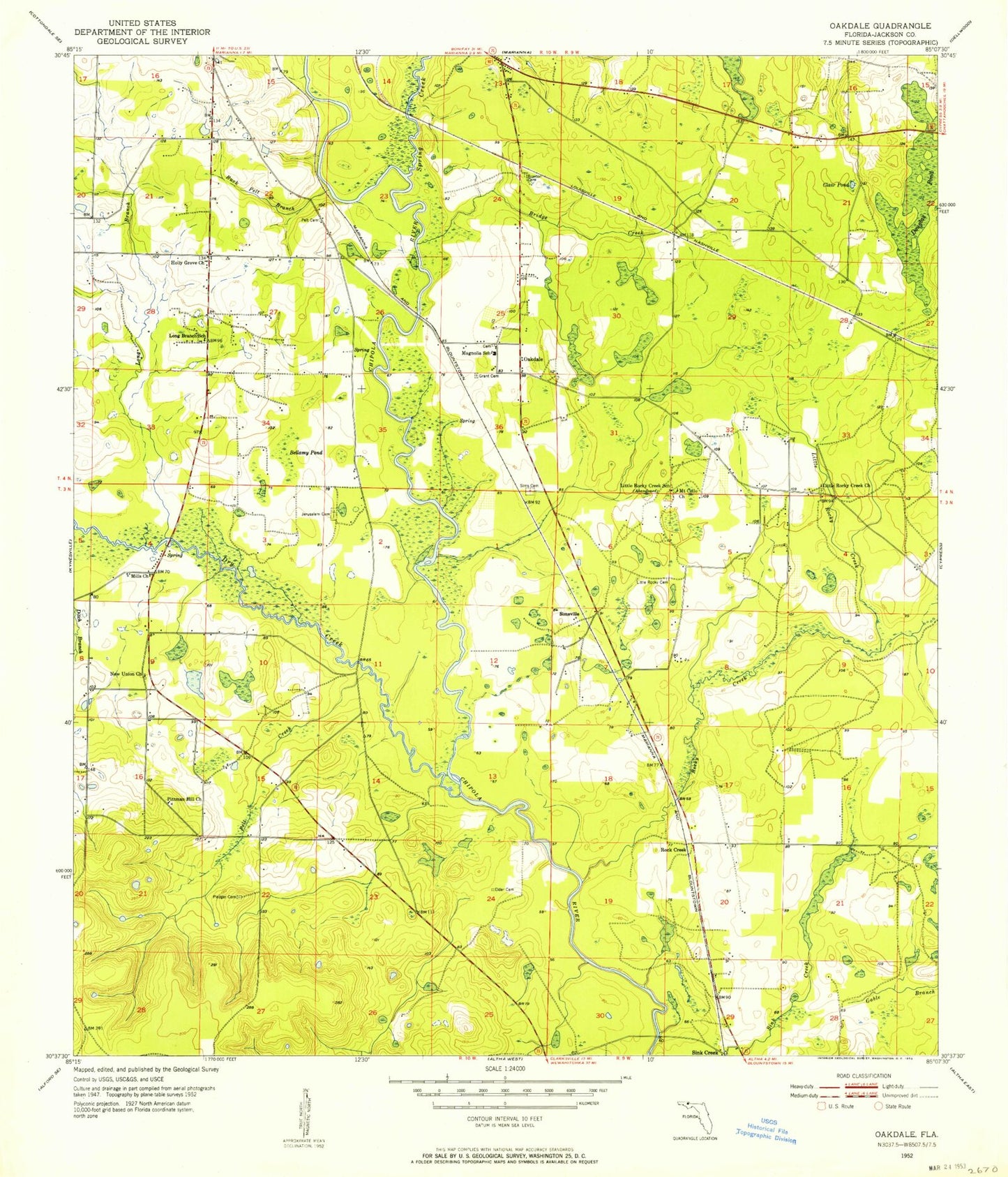
Classic USGS Oakdale Florida 7.5'x7.5' Topo Map
Couldn't load pickup availability
Historical USGS topographic quad map of Oakdale in the state of Florida. Map scale may vary for some years, but is generally around 1:24,000. Print size is approximately 24" x 27"
This quadrangle is in the following counties: Jackson.
The map contains contour lines, roads, rivers, towns, and lakes. Printed on high-quality waterproof paper with UV fade-resistant inks, and shipped rolled.
Contains the following named places: Bellamy Pond, Braxton Cemetery, Bridge Creek, Buck Pelt Branch, Clair Pond, Douglas Pond, Dry Creek, Elder Cemetery, Gable Branch, Grant Cemetery, Holly Grove Church, Hope School, Jerusalem Cemetery, Little Rocky Cemetery, Little Rocky Creek, Little Rocky Creek Church, Little Rocky Creek School, Long Branch, Long Branch School, Maddox Slough, Magnolia School, Mills Church, Mount Cello Church, New Union Church, Oakdale, Pelt Cemetery, Pelt Creek, Pittman Hill Church, Pledger Cemetery, Rock Creek, Rocky Creek, Sesa, Sims Cemetery, Simsville, Spring Creek, Star, Union City, United Church, ZIP Code: 32448