MyTopo
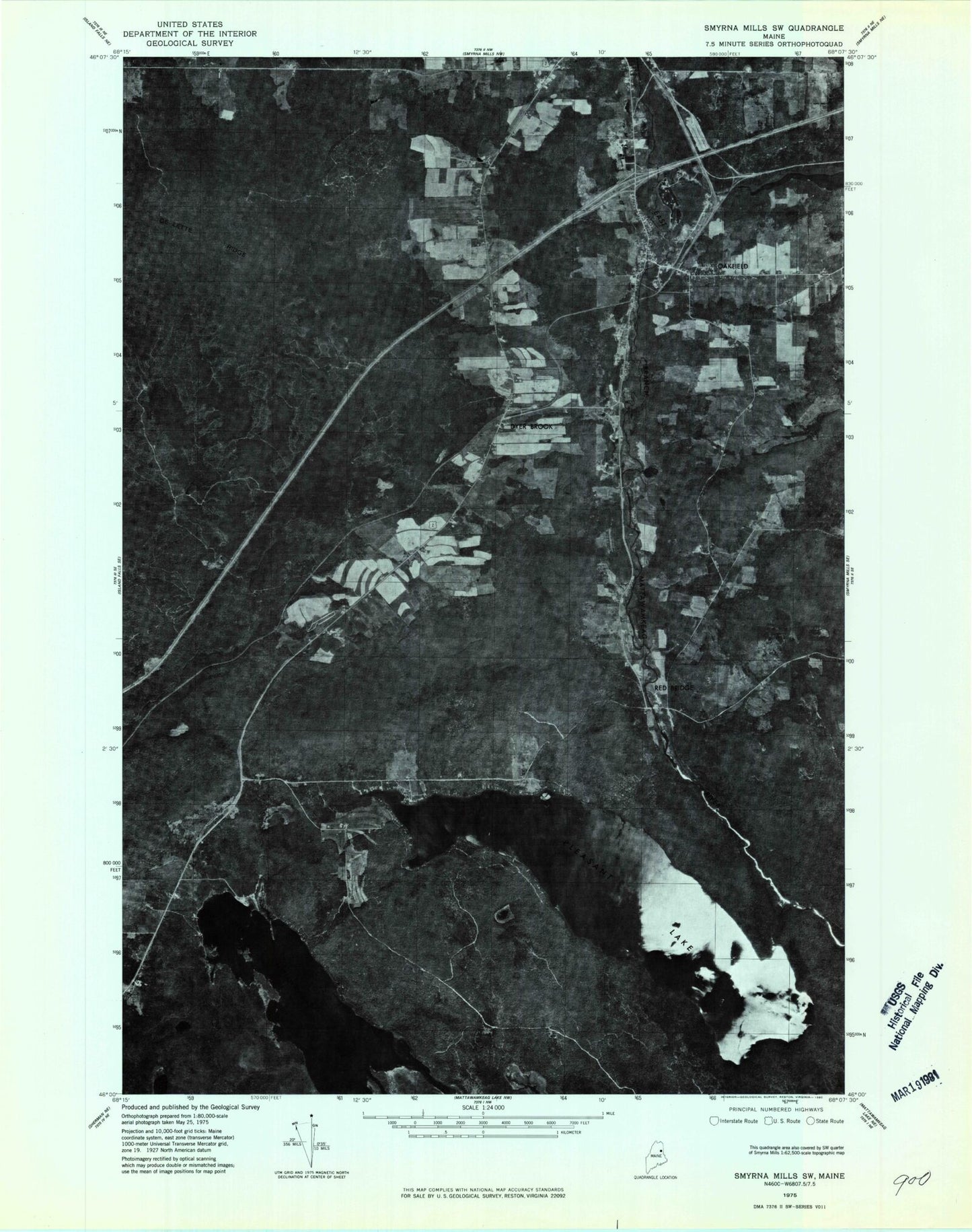
Classic USGS Oakfield Maine 7.5'x7.5' Topo Map
Couldn't load pickup availability
Historical USGS topographic quad map of Oakfield in the state of Maine. Map scale may vary for some years, but is generally around 1:24,000. Print size is approximately 24" x 27"
This quadrangle is in the following counties: Aroostook.
The map contains contour lines, roads, rivers, towns, and lakes. Printed on high-quality waterproof paper with UV fade-resistant inks, and shipped rolled.
Contains the following named places: Barrows Chambers Cemetery, Battle Brook, Beaverdam Point, Birch Point, Clark Pond, Colbroth Brook, DeLette Ridge, Dinsmore Cove, Downing Brook, Dyer Brook, Dyer Brook Cemetery, Dyer Brook Community Church, Huntley Brook, Long Lake, Lost Pond, Moose Brook, Morgridge Pond, Oakfield, Oakfield Cemetery, Oakfield Census Designated Place, Oakfield Post Office, Oakfield Seventh Day Adventist Church, Oakfield Volunteer Fire Department, Outlet Mountain, Pea Cove, Pleasant Lake, Pratt Cove, Red Bridge, Sand Cove, Southern Aroostook Community School, Tarbell Cemetery, The Bluff, Thomas Brook, Town of Dyer Brook, Upper Mattawamkeag Lake, Va-Jo-Wa Golf Club, Walker Settlement, Whitney Point, ZIP Code: 04747