MyTopo
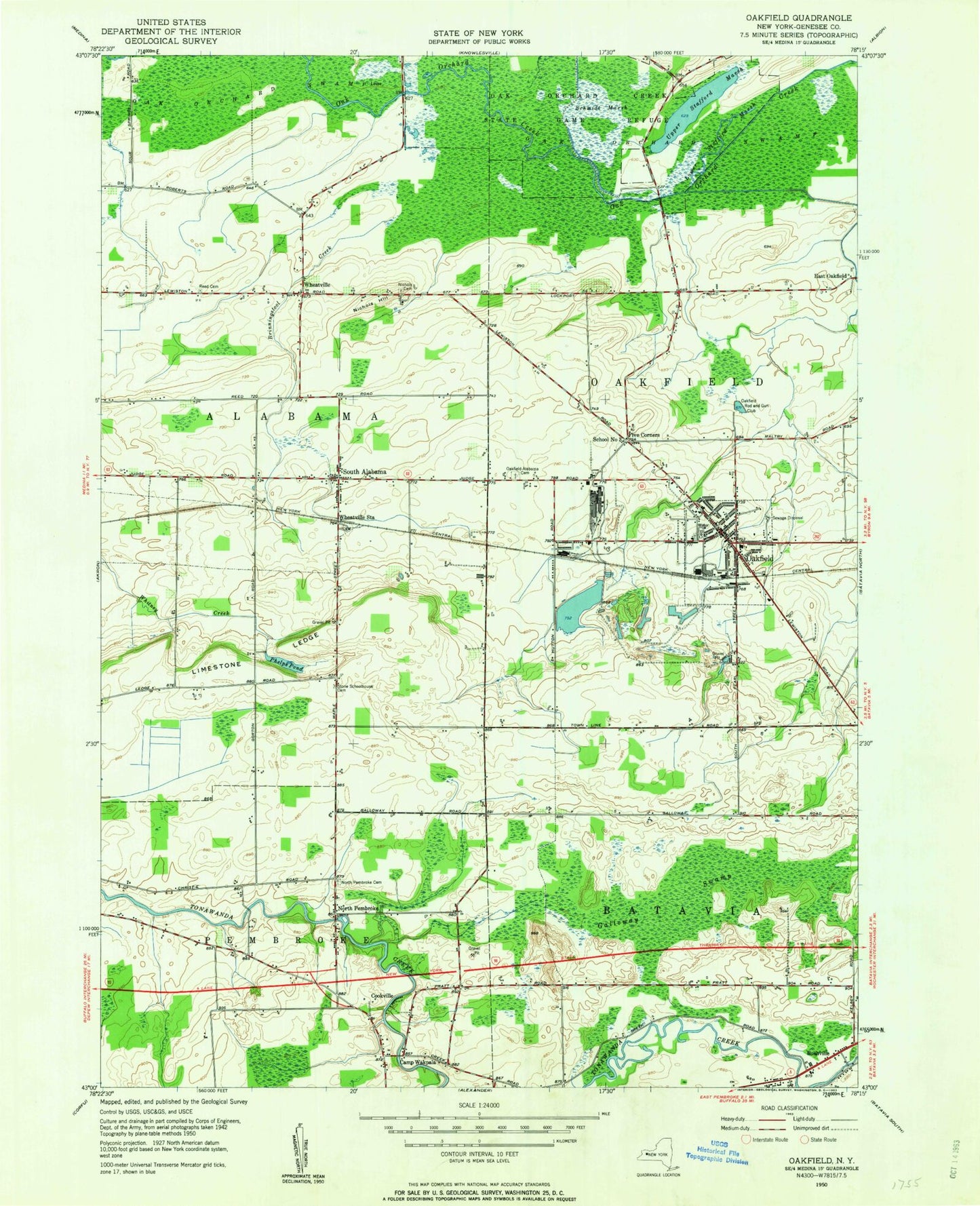
Classic USGS Oakfield New York 7.5'x7.5' Topo Map
Couldn't load pickup availability
Historical USGS topographic quad map of Oakfield in the state of New York. Map scale may vary for some years, but is generally around 1:24,000. Print size is approximately 24" x 27"
This quadrangle is in the following counties: Genesee.
The map contains contour lines, roads, rivers, towns, and lakes. Printed on high-quality waterproof paper with UV fade-resistant inks, and shipped rolled.
Contains the following named places: Alabama Volunteer Fire Department Station 1, Apple Grove Mobile Home Park, Arnold Hotel, Brinningstool Creek, Bushville, Camp Wakpala, Cary Cemetery, Cookville, Del Mar Farms, First Presbyterian Church, Five Corners, Galloway Swamp, Genesee Country Church, Haxton Memorial Library, Lamb Farms, Limestone Ledge, Lower Stafford Marsh, Mogadore Chapel, Nichols Cemetery, Nichols Hill, North Pembroke, North Pembroke Cemetery, Oak Orchard Creek State Game Refuge, Oak Orchard Swamp, Oakfield, Oakfield Fire Department, Oakfield High School, Oakfield Post Office, Oakfield Rod and Gun Club, Oakfield Town Hall, Oakfield United Methodist Church, Oakfield Village Sewage Treatment Plant, Oakfield-Alabama Elementary School, Oakfield-Alabama Middle School-High School, Pembroke Eastbound Rest Area, Phelps Pond, Reed Cemetery, Ridgewood Village, Ross Cemetery, Saint Cecilia Cemetery, Saint Cecilia's Roman Catholic Church, Saint Michael's Episcopal Church, Schmidt Marsh, School Number 12, School Number 2, School Number 3, School Number 4, South Alabama, Stone Schoolhouse Cemetery, Town of Oakfield, Town of Oakfield Highway Department, Upper Stafford Marsh, Village of Oakfield, Wheatville, Wheatville Station, ZIP Code: 14125