MyTopo
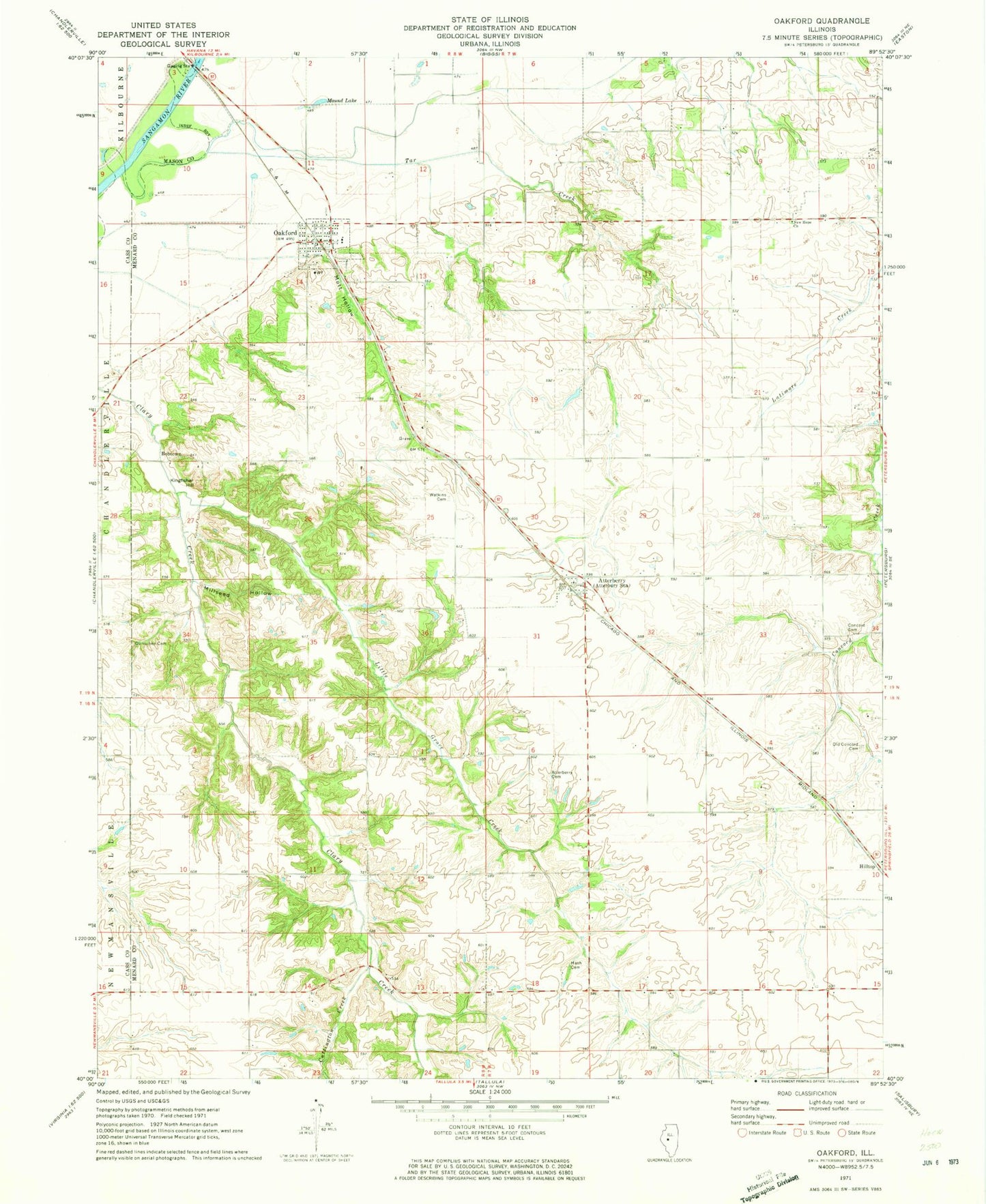
Classic USGS Oakford Illinois 7.5'x7.5' Topo Map
Couldn't load pickup availability
Historical USGS topographic quad map of Oakford in the state of Illinois. Map scale may vary for some years, but is generally around 1:24,000. Print size is approximately 24" x 27"
This quadrangle is in the following counties: Cass, Mason, Menard.
The map contains contour lines, roads, rivers, towns, and lakes. Printed on high-quality waterproof paper with UV fade-resistant inks, and shipped rolled.
Contains the following named places: Atterberry, Atterberry Cemetery, Atterberry Community Baptist Church, Atterberry Number 10 Election Precinct, Atterberry Post Office, Bobtown, Concord Cemetery, Cuttington Creek, Dunschen Cemetery, Hash Cemetery, Hazel Dell School, Hilltop, Kay Watkins School, Kingfisher Hill, Lafayette School, Little Grove Creek, Little Grove School, Millseed Hollow, Mott Hollow, Mound Lake, New Hope Baptist Church, Oakford, Oakford Fire Department, Oakford Number 9 Election Precinct, Oakford Post Office, Oakford United Methodist Church, Old Concord Cemetery, Panther School, Tar Creek, Tebrugge Mine, Village of Oakford, Watkins Cemetery, William Watkins School, ZIP Code: 62673