
MyTopo
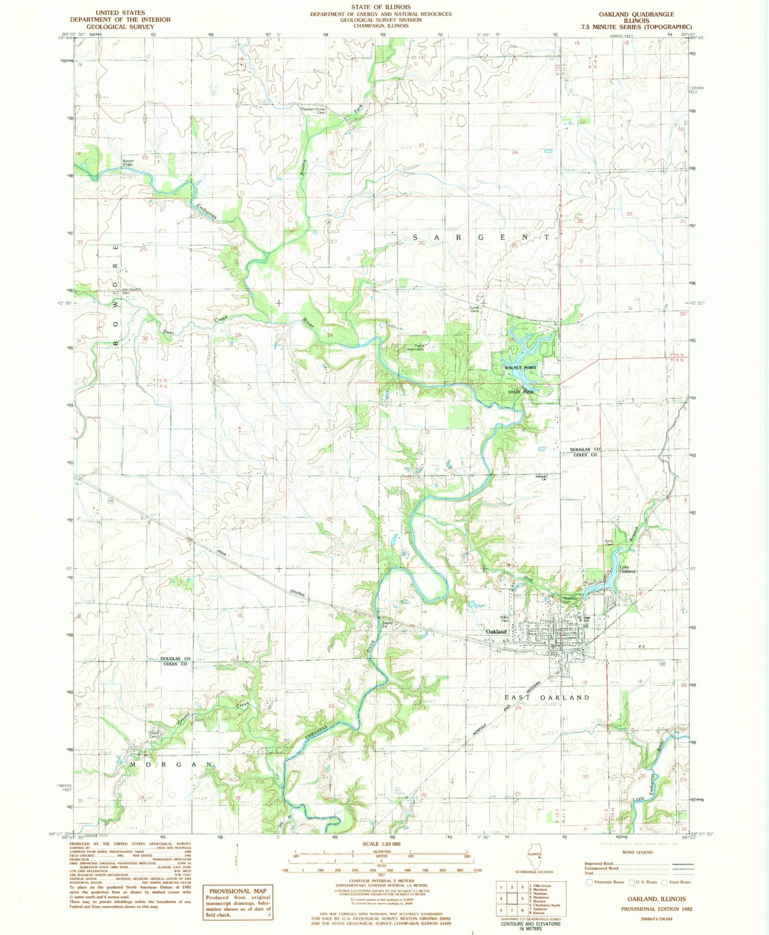
Classic USGS Oakland Illinois 7.5'x7.5' Topo Map
Couldn't load pickup availability
Historical USGS topographic quad map of Oakland in the state of Illinois. Map scale may vary for some years, but is generally around 1:24,000. Print size is approximately 24" x 27"
This quadrangle is in the following counties: Coles, Douglas.
The map contains contour lines, roads, rivers, towns, and lakes. Printed on high-quality waterproof paper with UV fade-resistant inks, and shipped rolled.
Contains the following named places: Antioch Baptist Church, Antioch School, Barnett Bridge, Beasley School, Berry Cemetery, Berry School, Brushy Fork, Brushy Fork Post Office, Brushy Fork Town Hall, Busbey School, City of Oakland, Deer Creek, Deer Creek School, Dry Branch, Egypt School, Greasy Creek, Greasy Point Church, Greenwood School, Gwinn Cemetery, Helen Parkes Old Tower Park, Hoagland, Hog Branch, Howard Miller Memorial Park, Jack Oak School, Lake Crest Elementary School, Lake Oakland, Lake Oakland Dam, Memorial Library, Miller Lake, Miller Lake Dam, Mount Carmel School, Norton Knolls Golf Course, Oakland, Oakland Cemetery, Oakland Centennial City Park, Oakland Christian Church, Oakland Community Fire Protection District, Oakland High School, Oakland Swimming Pool, Oakland United Methodist Church, Pleasant Grove Cemetery, Pleasant Grove School, Prairie Observatory, Township of East Oakland, Township of Sargent, Union Cemetery, Upper Embarras Woods Nature Preserve, Van Voorhis Cemetery, Walnut Point State Park, Walnut Point State Park Lake, Walnut Point State Park Lake Dam, Watertower Park, West Donica School, ZIP Code: 61943


