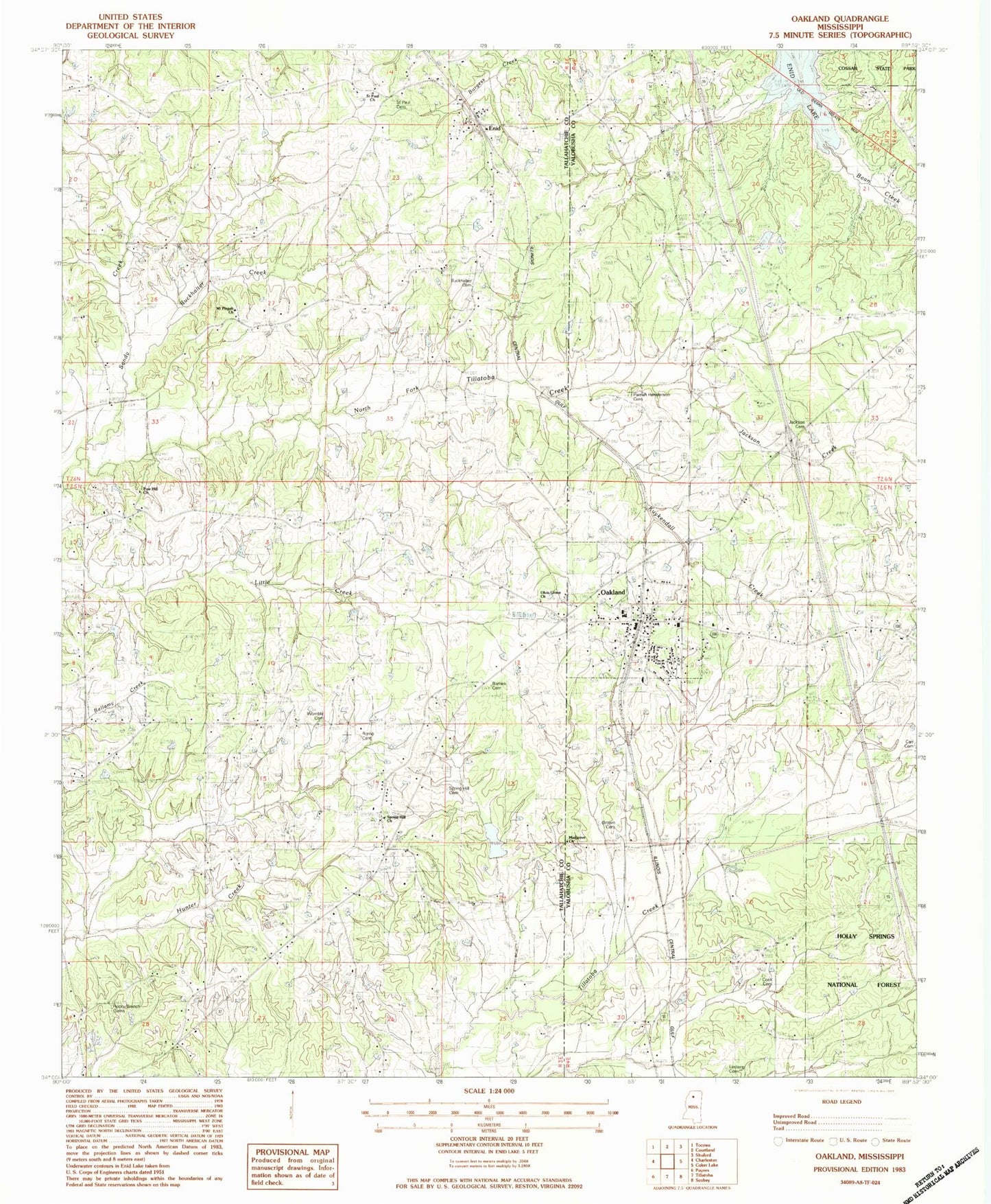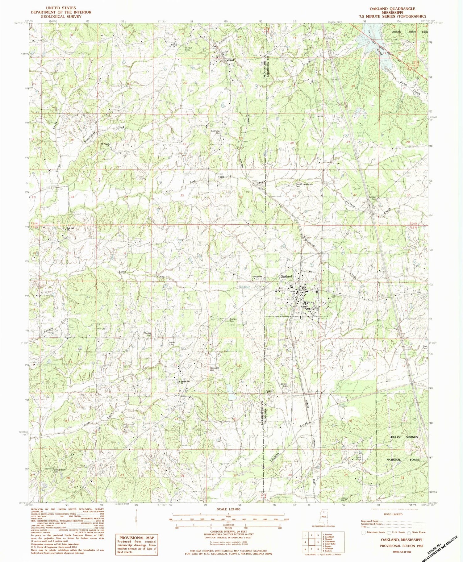
MyTopo
Classic USGS Oakland Mississippi 7.5'x7.5' Topo Map
Couldn't load pickup availability
Historical USGS topographic quad map of Oakland in the state of Mississippi. Map scale may vary for some years, but is generally around 1:24,000. Print size is approximately 24" x 27"
This quadrangle is in the following counties: Tallahatchie, Yalobusha.
The map contains contour lines, roads, rivers, towns, and lakes. Printed on high-quality waterproof paper with UV fade-resistant inks, and shipped rolled.
Contains the following named places: Barnes Cemetery, Blanche, Brown Cemetery, Burkhalter Cemetery, Burkhalter Creek, Carr Cemeteries, Center Point, Cook Cemetery, Enid, Enid Volunteer Fire Department, House Lake Dam, Indian Church, Jackson Cemetery, Jackson Creek, Kuykendall Creek, Lesters Cemetery, Masgrove Church, Masgrove School, Mount Pisgah Cemetery, Mount Pisgah Church, Oakland, Oakland Elementary School, Oakland High School, Oakland Post Office, Oakland Volunteer Fire Department, Olvis Cemetery, Olvis Grove Church, Paris Grove Church, Parrish Henderson Cemetery, Pine Hill Cemetery, Pine Hill Church, Rocky Branch Cemeteries, Rome Cemetery, Saint Paul Cemetery, Saint Paul Church, Sandy Church, Sandy Creek, Spring Hill Cemetery, Spring Hill Church, Tillatoba Creek Y-17b-17 Dam, Tillatoba Creek Y-17b-7 Dam, Town of Oakland, Union Church, Walnut Grove Church, Womble Cemetery, ZIP Code: 38948