MyTopo
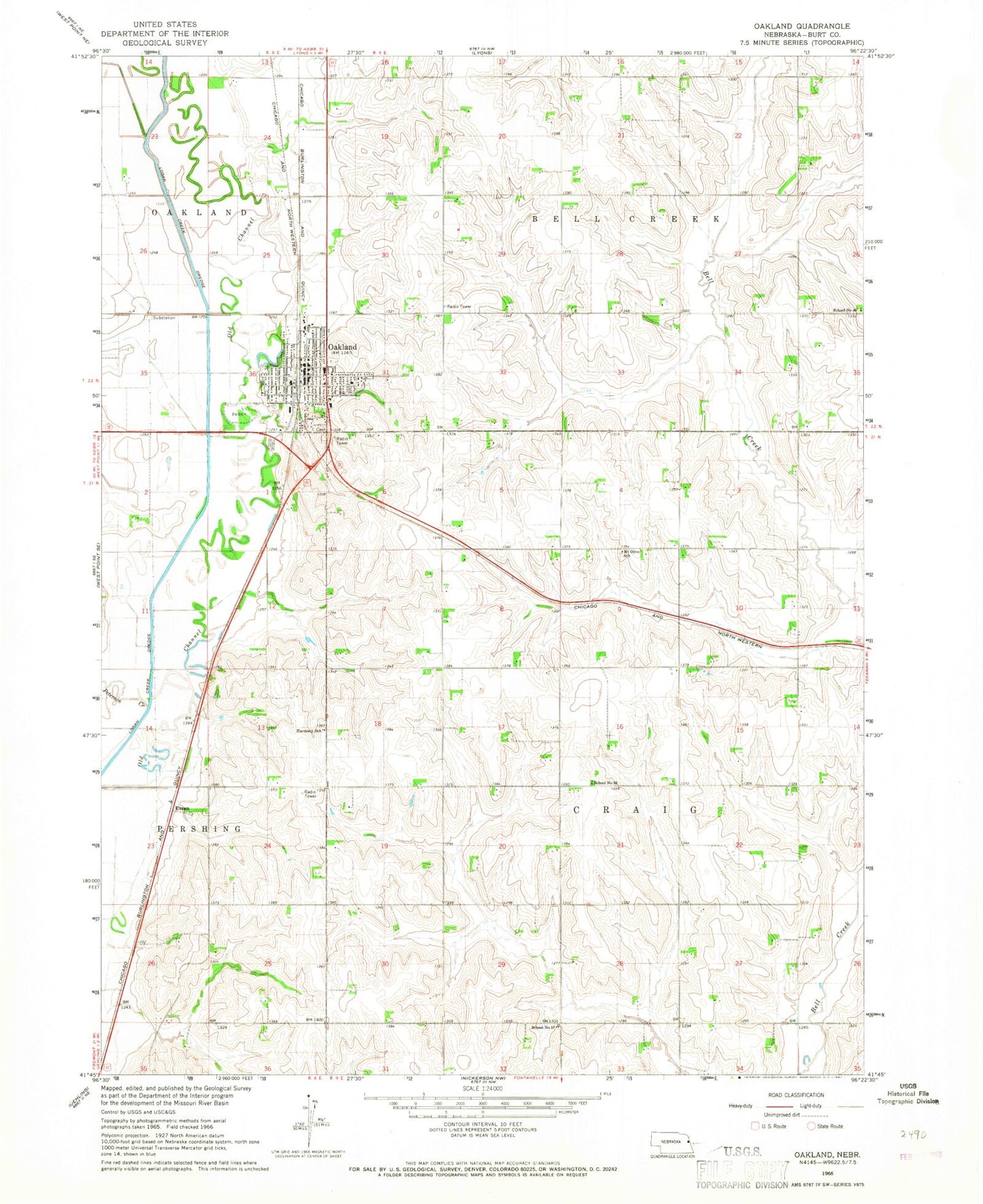
Classic USGS Oakland Nebraska 7.5'x7.5' Topo Map
Couldn't load pickup availability
Historical USGS topographic quad map of Oakland in the state of Nebraska. Map scale may vary for some years, but is generally around 1:24,000. Print size is approximately 24" x 27"
This quadrangle is in the following counties: Burt.
The map contains contour lines, roads, rivers, towns, and lakes. Printed on high-quality waterproof paper with UV fade-resistant inks, and shipped rolled.
Contains the following named places: Agland Co-op Elevator, Burt County Fairground, City of Oakland, Essen, Evangelical Free Church, Family Vision Center, First Baptist Church, First Evangelical Church, First United Methodist Church, Harmony School, Logan Creek Site Historical Marker, Mount Olive School, Oakland, Oakland City Park, Oakland City Park Campground, Oakland Craig Elementary School, Oakland Craig Senior High, Oakland Family Practice, Oakland Golf Club, Oakland Heights, Oakland Medical Clinic, Oakland Mercy Hospital, Oakland Post Office, Oakland Public Library, Oakland Volunteer Fire and Rescue, School Number 46, School Number 57, School Number 62, Swedish Heritage Center, Township of Bell Creek, Township of Craig, ZIP Codes: 68019, 68045