MyTopo
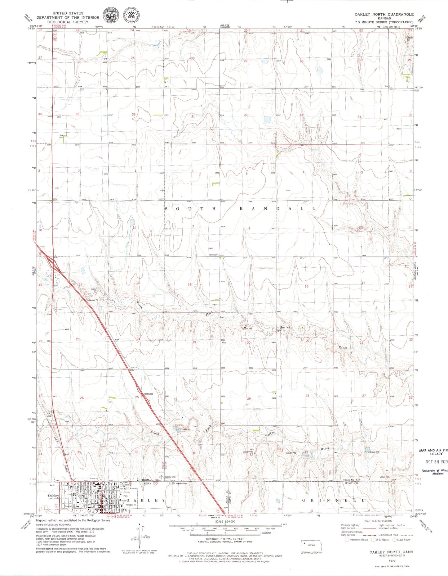
Classic USGS Oakley North Kansas 7.5'x7.5' Topo Map
Couldn't load pickup availability
Historical USGS topographic quad map of Oakley North in the state of Kansas. Map scale may vary for some years, but is generally around 1:24,000. Print size is approximately 24" x 27"
This quadrangle is in the following counties: Gove, Logan, Thomas.
The map contains contour lines, roads, rivers, towns, and lakes. Printed on high-quality waterproof paper with UV fade-resistant inks, and shipped rolled.
Contains the following named places: Annie Oakley Park, Bertrand Park, Fick Fossil and History Museum, Gateway Fellowship Church, High Plains Camping Facility, Immanuel Lutheran Church, Kansas Highway Patrol Troop D Logan, Logan County Courthouse, Logan County Emergency Medical Services, Logan County Fairgrounds, Logan County Health Department, Logan County Hospital, Logan County Sheriff's Office, Mount Olive Baptist Church, Northwest Kansas Educational Service Center, Oakley, Oakley Area Chamber of Commerce, Oakley Cemetery, Oakley Christian Church, Oakley Church of Christ, Oakley City Hall, Oakley City Jail, Oakley Community Church, Oakley Elementary School, Oakley Fire Department, Oakley Middle School, Oakley Municipal Power Plant, Oakley Police Department, Oakley Post Office, Oakley Public Library, Oakley Senior High School, Oakley United Methodist Church, Oakley Wesleyan Church, Saint Joseph Catholic School, Saint Joseph Cemetery, Saint Josephs Catholic Church, Sunrise Baptist Church, Township of South Randall