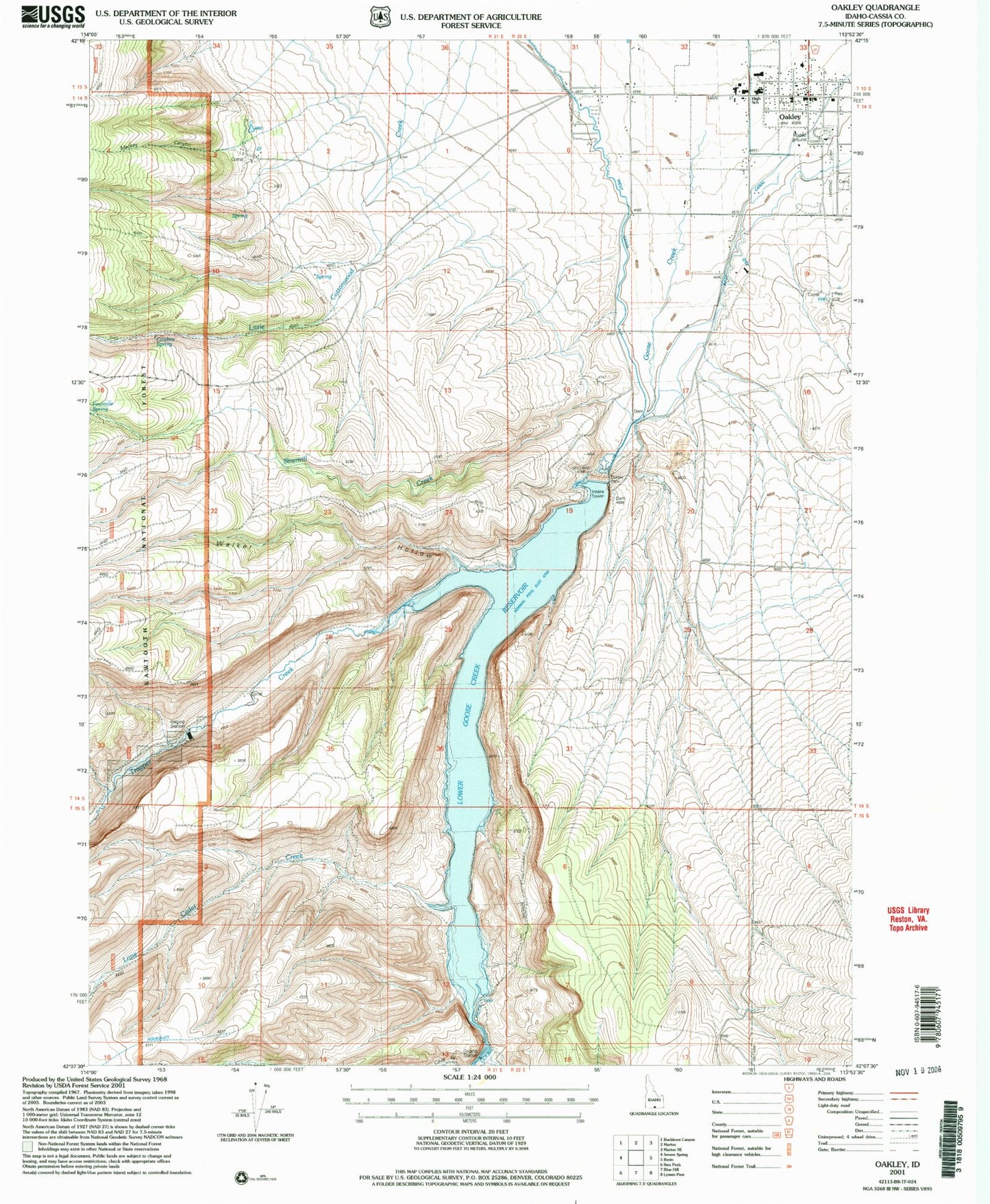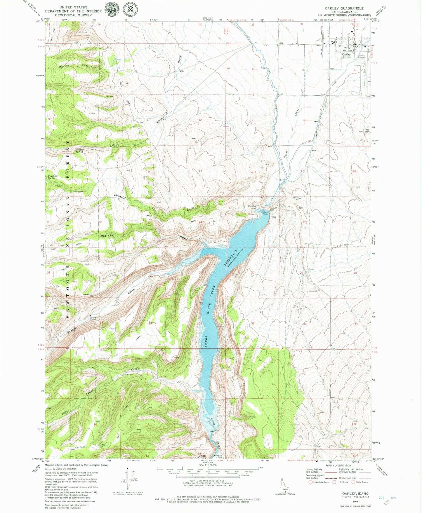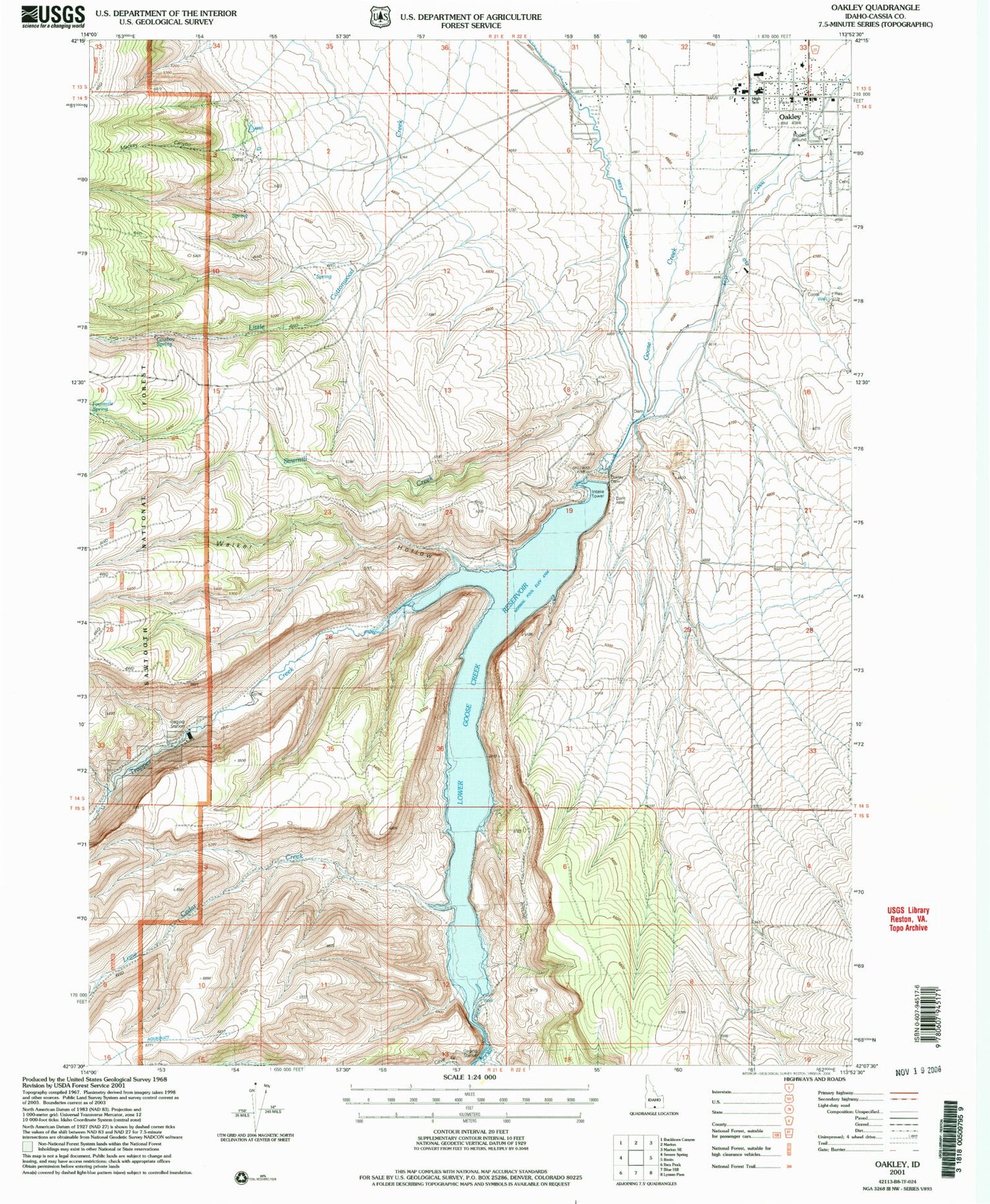

MyTopo
Classic USGS Oakley Idaho 7.5'x7.5' Topo Map
Couldn't load pickup availability
Historical USGS topographic quad map of Oakley in the state of Idaho. Map scale may vary for some years, but is generally around 1:24,000. Print size is approximately 24" x 27"
This quadrangle is in the following counties: Cassia.
The map contains contour lines, roads, rivers, towns, and lakes. Printed on high-quality waterproof paper with UV fade-resistant inks, and shipped rolled.
Contains the following named places: City of Oakley, Cowboy Spring, Fourmile Spring, Lone Cedar Creek, Lower Goose Creek Reservoir, Mackey Canyon, Oakley, Oakley Dam, Oakley Elementary School, Oakley Fire Department, Oakley Junior - Senior High School, Oakley Municipal Airport, Oakley Post Office, Oakley Quick Response Unit, Sawmill Creek, South Cottonwood Creek, Trapper Creek, Walker Hollow, West Canal