MyTopo
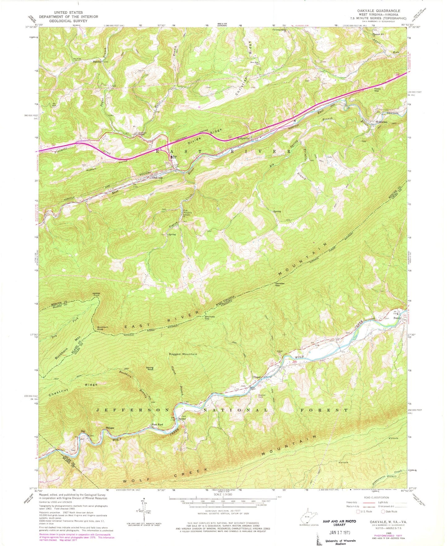
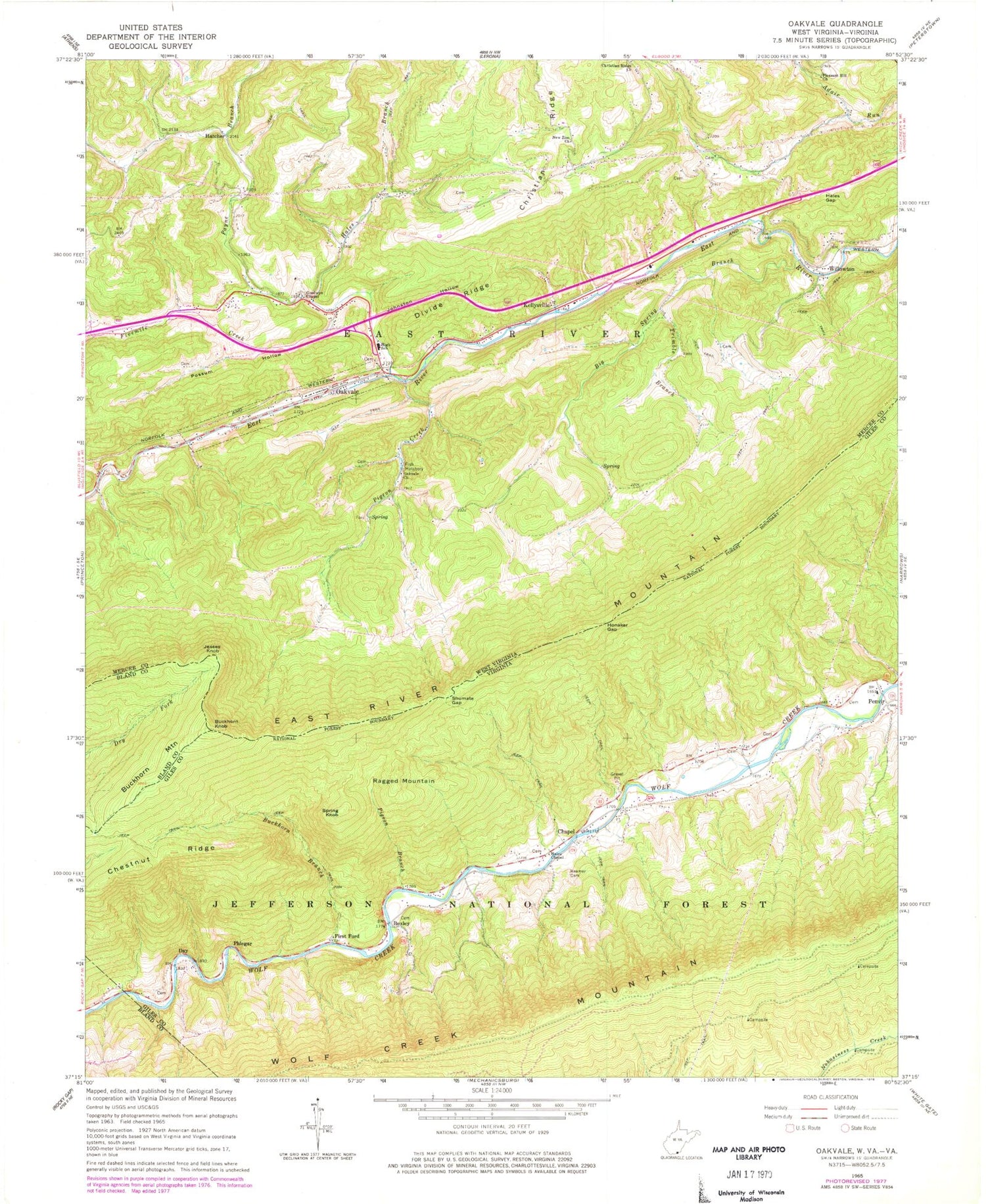
Classic USGS Oakvale West Virginia 7.5'x7.5' Topo Map
Couldn't load pickup availability
Historical USGS topographic quad map of Oakvale in the states of West Virginia, Virginia. Map scale may vary for some years, but is generally around 1:24,000. Print size is approximately 24" x 27"
This quadrangle is in the following counties: Bland, Giles, Mercer.
The map contains contour lines, roads, rivers, towns, and lakes. Printed on high-quality waterproof paper with UV fade-resistant inks, and shipped rolled.
Contains the following named places: Adair Run School, Beamer Cemetery, Big Spring, Big Spring Branch, Boxley, Buckhorn Branch, Buckhorn Knob, Buckhorn Mountain, Chapel, Chesnut Ridge, Christian Ridge Church, Day, Divide Ridge, First Ford, Fivemile Creek, Goodwyn Chapel, Hales Branch, Hales Chapel, Hales Chapel Cemetery, Hales Gap, Hales Gap Tunnel, Hatcher, Hatcher Union Church, Honaker Gap, Jesses Knob, Johnston Hollow, Kellysville, Kellysville Post Office, Neel School, New Zion Church, New Zion School, Oakvale, Oakvale Cemetery, Oakvale Church, Oakvale Elementary School, Oakvale School, Oakvale Volunteer Fire Department, Payne Branch, Penvir, Phlegar, Pigeon Branch, Pigeon Creek, Pigeon Creek School, Pigeon Creek Spring, Pleasant Hill Church, Possum Hollow, Possum Hollow School, Ragged Mountain, Shumate Gap, Spring Knob, Stengel, Tate Lohr Wildlife Management Area, Thomas School, Thompson School, Town of Oakvale, Trimble Branch, Willowton, Willowton Christian Church, Wolf Creek Mountain, Wright School