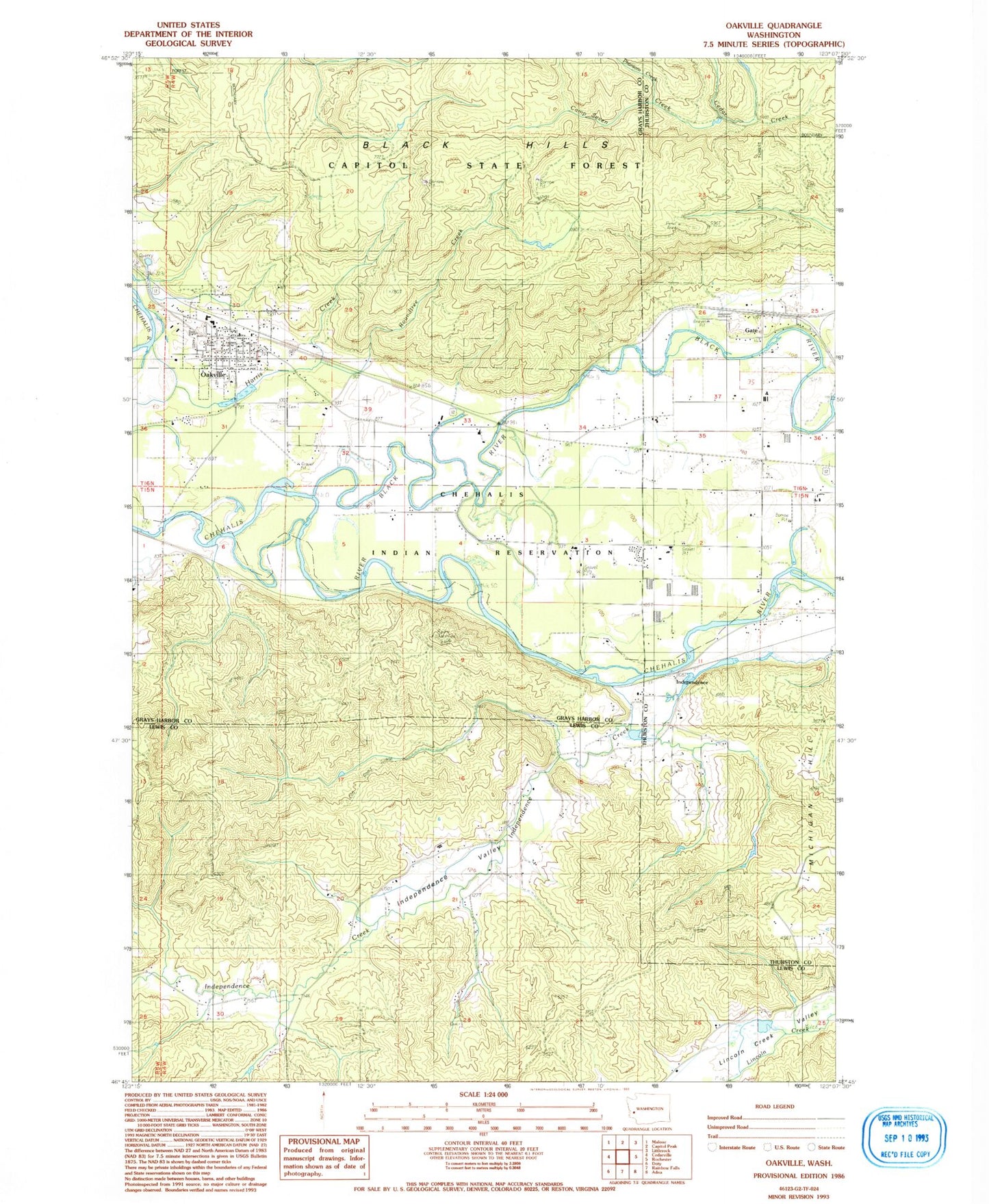
MyTopo
Classic USGS Oakville Washington 7.5'x7.5' Topo Map
Couldn't load pickup availability
Historical USGS topographic quad map of Oakville in the state of Washington. Map scale may vary for some years, but is generally around 1:24,000. Print size is approximately 24" x 27"
This quadrangle is in the following counties: Grays Harbor, Lewis, Thurston.
The map contains contour lines, roads, rivers, towns, and lakes. Printed on high-quality waterproof paper with UV fade-resistant inks, and shipped rolled.
Contains the following named places: Balch, Black River, Camp Seven Creek, Capitol Ridge Quarry, Chehalis Reservation, Chehalis Village, Chehalis Village Census Designated Place, City of Oakville, Finnish Cemetery, Gate, Grays Harbor Fire District 1 Station 1, Harris Creek, Independence, Independence Creek, Independence Valley, Lewis County Fire District 12 Riverside Fire Authority Station 7, Lincoln Creek Grange, Oakville, Oakville Assembly of God Church, Oakville Elementary School, Oakville Middle - High School, Oakville Pioneer Cemetery, Oakville Police Department, Oakville Post Office, Oakville Quarry, Oakville School District Office, Oakville Timberland Library, Phantom Creek, Roundtree Creek, United Methodist Church of Oakville, ZIP Code: 98579