MyTopo
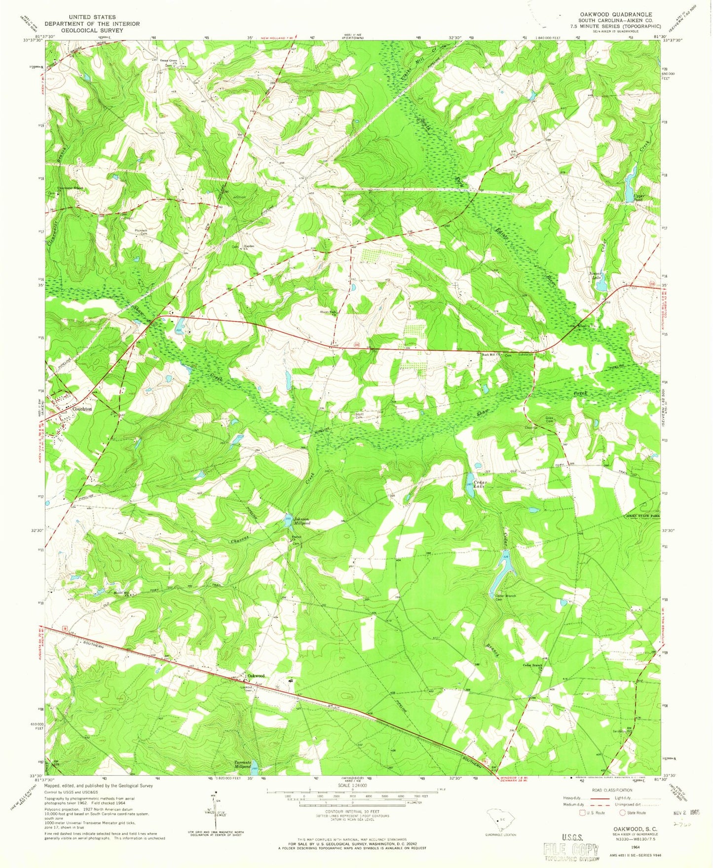
Classic USGS Oakwood South Carolina 7.5'x7.5' Topo Map
Couldn't load pickup availability
Historical USGS topographic quad map of Oakwood in the state of South Carolina. Map scale may vary for some years, but is generally around 1:24,000. Print size is approximately 24" x 27"
This quadrangle is in the following counties: Aiken.
The map contains contour lines, roads, rivers, towns, and lakes. Printed on high-quality waterproof paper with UV fade-resistant inks, and shipped rolled.
Contains the following named places: Apia, Cedar Branch, Cedar Branch Cemetery, Cedar Branch Church, Cedar Creek, Cedar Lake, Cedar Lake School, Chavous Creek, Clarks Mill Creek, Clearwater Branch, Clearwater Branch Church, Couchton, Couchton Fire Department Station 2, Couchton Fire Rescue, Darien Baptist Church, Darien Cemetery, Goss Cemetery, Haden School, Hayden Baptist Church, Hayden Church, Hayden School, Johnson Millpond, Joyce Branch School, Jumping Branch Farm, Livingstons Mill, Mack's Patch-Derrick Field, Mount Hill Memorial Baptist Church, Neeses Lake, Oak Ridge Hunting Preserve Pond, Oakwood, Oakwood Baptist Church, Oakwood School, Oakwood Windsor Elementary School, Ocean Grove Church, Ocean Grove School, Plunkett Cemetery, Polecat Aerodrome, Rock Hill Church, Round Top School, Scott Cemetery, Scotts Lake, Shaw Creek, Shaw Fork School, Shaws Fork Baptist Church, Shaws Fork School, South Carolina Noname 02010 D-1994 Dam, South Carolina Noname 02037 D-2028 Dam, South Carolina Noname 02060 D-2013 Dam, South Carolina Noname 02082 D-2019 Dam, Tarrants Millpond, Upper Pond, Upper Pond Dam D-2027