MyTopo
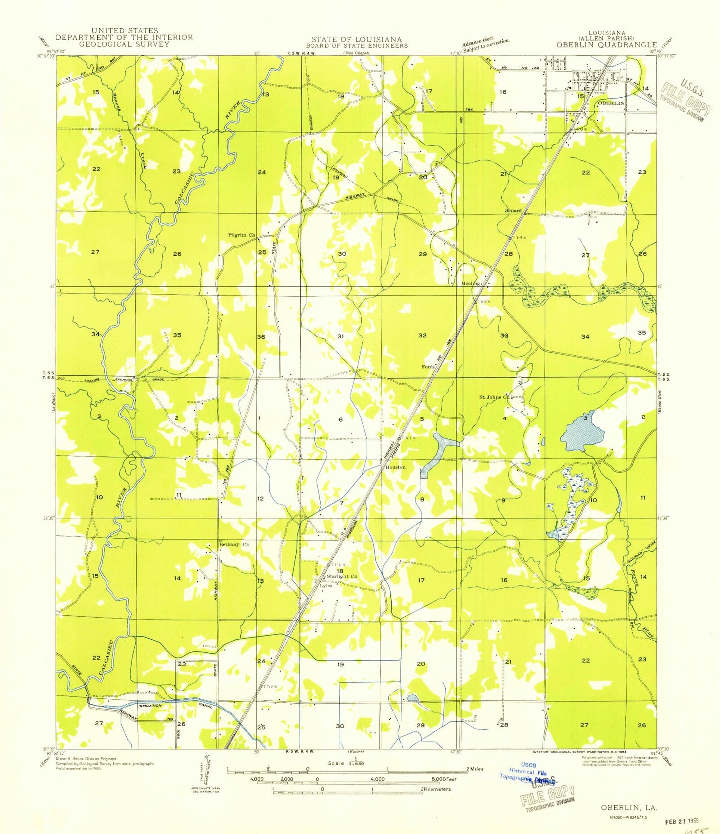
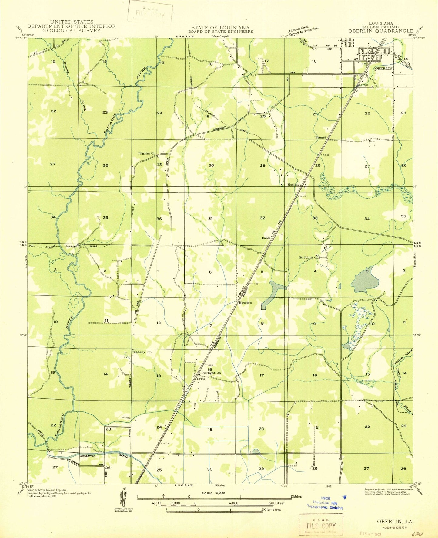
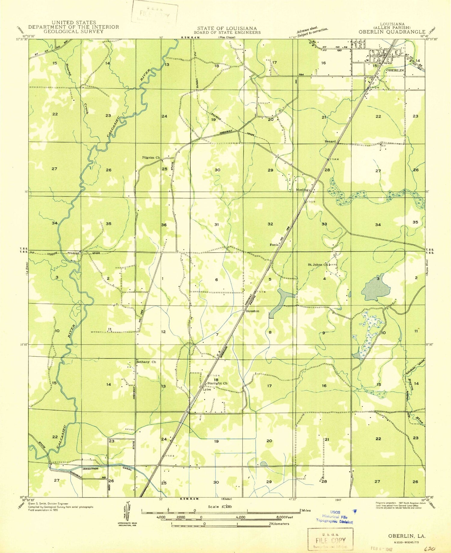
Classic USGS Oberlin Louisiana 7.5'x7.5' Topo Map
Couldn't load pickup availability
Historical USGS topographic quad map of Oberlin in the state of Louisiana. Map scale may vary for some years, but is generally around 1:24,000. Print size is approximately 24" x 27"
This quadrangle is in the following counties: Allen.
The map contains contour lines, roads, rivers, towns, and lakes. Printed on high-quality waterproof paper with UV fade-resistant inks, and shipped rolled.
Contains the following named places: Allen Correctional Center, Allen Parish Correctional Center Special Services District Facility, Allen Parish Correctional Center Wastewater Treatment Plant, Allen Parish Library, Allen Parish Office, Allen Parish Police Jury, Allen Parish Sheriff's Office, Bernard, Bethany Church, Bible Way Revival Center, Coushatta Reservation, Elder, Emad, First Baptist Church, Fords, Grandview Mobile Estates, Gray's Temple Church of God, Green Oak Cemetery, Hebron Church, Houston, Kinder - McRill Memorial Cemetery, Kinder Oil Field, Koasati Pines at Coushatta, Le Jeune, Long Gully, Lyles, Lyles Cemetery, Lyles Gas Field, Moeling, New Beginnings Church, Oberlin, Oberlin Baptist Church, Oberlin Elementary School, Oberlin High School, Oberlin Lookout Tower, Oberlin Police Department, Oberlin Post Office, Oberlin Sewage Treatment Plant, Oberlin Volunteer Fire Department, Pilgrim Church Gas Field, Progress Church of God in Christ, Reeves Creek, Saint Joan of Arc Catholic Church, Saint Johns Church, Saint Joseph Church, Saint Luke's Cemetery, Saint Paul Church, South Oberlin Oil Field, Starlight Church, Stines Creek, Town of Oberlin, True Faith Pentecostal Church, Wilder Airport