
MyTopo
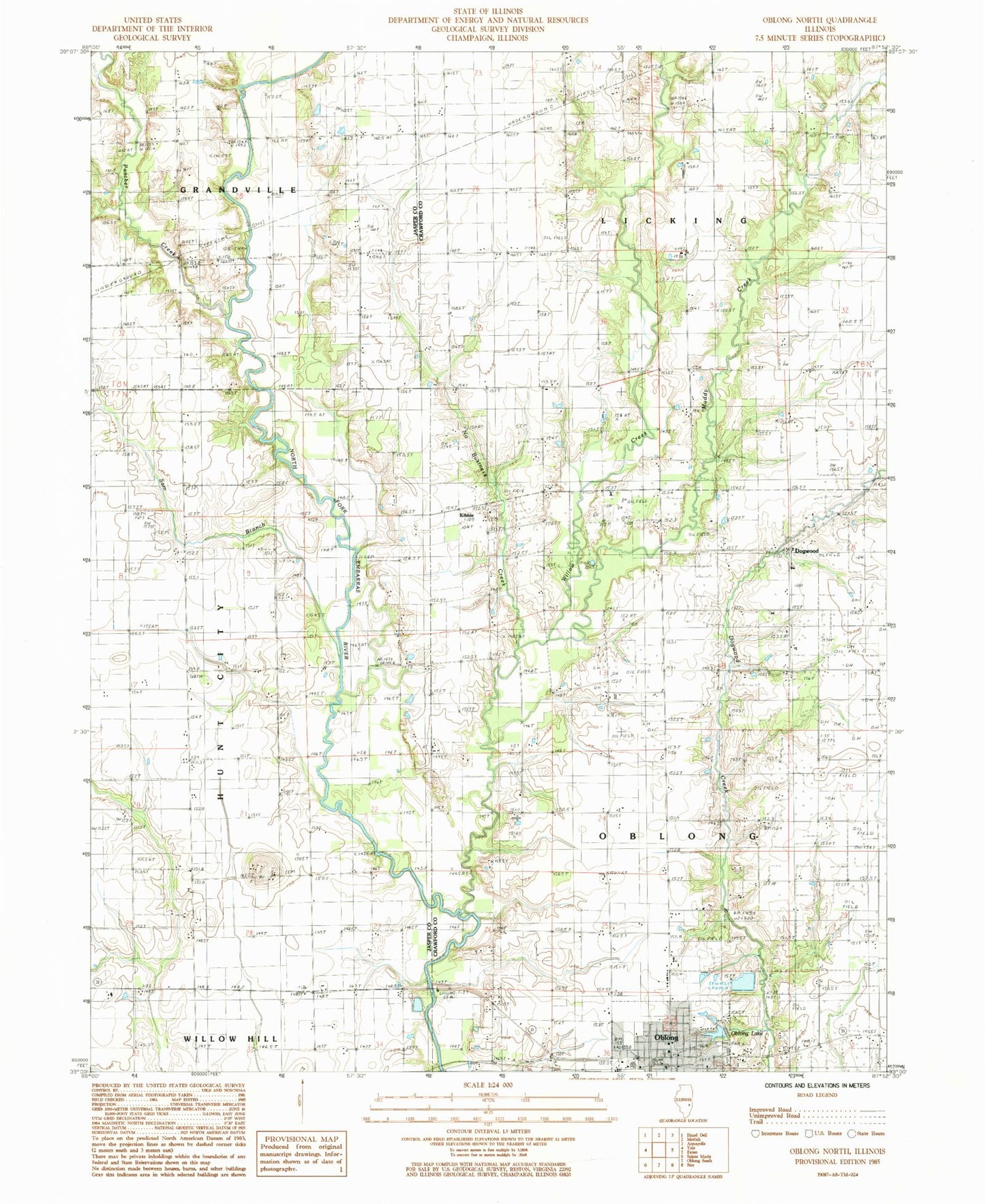
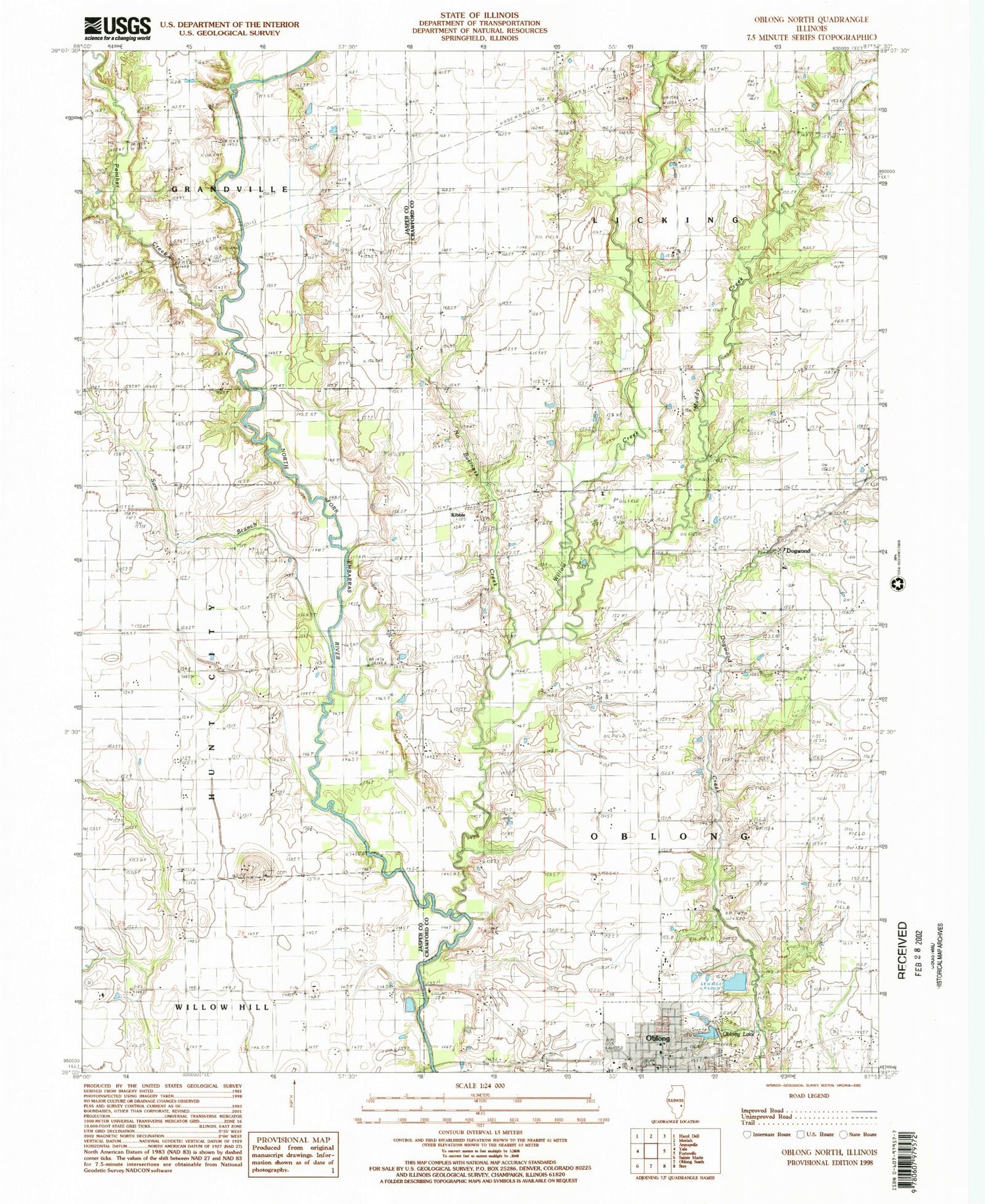
Classic USGS Oblong North Illinois 7.5'x7.5' Topo Map
Couldn't load pickup availability
Historical USGS topographic quad map of Oblong North in the state of Illinois. Map scale may vary for some years, but is generally around 1:24,000. Print size is approximately 24" x 27"
This quadrangle is in the following counties: Crawford, Jasper.
The map contains contour lines, roads, rivers, towns, and lakes. Printed on high-quality waterproof paper with UV fade-resistant inks, and shipped rolled.
Contains the following named places: Bailey Cemetery, Bailey Farms, Bethany Church, Central United Methodist Church, Dart Farm, Dogwood, Dogwood Creek Farm, Evangelical United Methodist Church, First Baptist Church of Oblong, First Christian Church, Harmony Cemetery, Kibbie, Meese Farms, Mound Cemetery, Mound Church, Muddy Creek, Musgrave Farms, Nethery Farms, New Harmony Church, Newbold Farms, No Business Creek, Oblong, Oblong Cemetery, Oblong Elementary School, Oblong Lake, Oblong Police Department, Oblong Post Office, Oblong Township Fire Protection District, Our Lady of Lourdes Church, Panther Creek, Randolph Cemetery, Sackrider Farms, Sam Branch, Township of Licking, Township of Oblong, Village of Oblong, Weaver Cemetery, White Oak Cemetery, Willow Creek, ZIP Code: 62449