
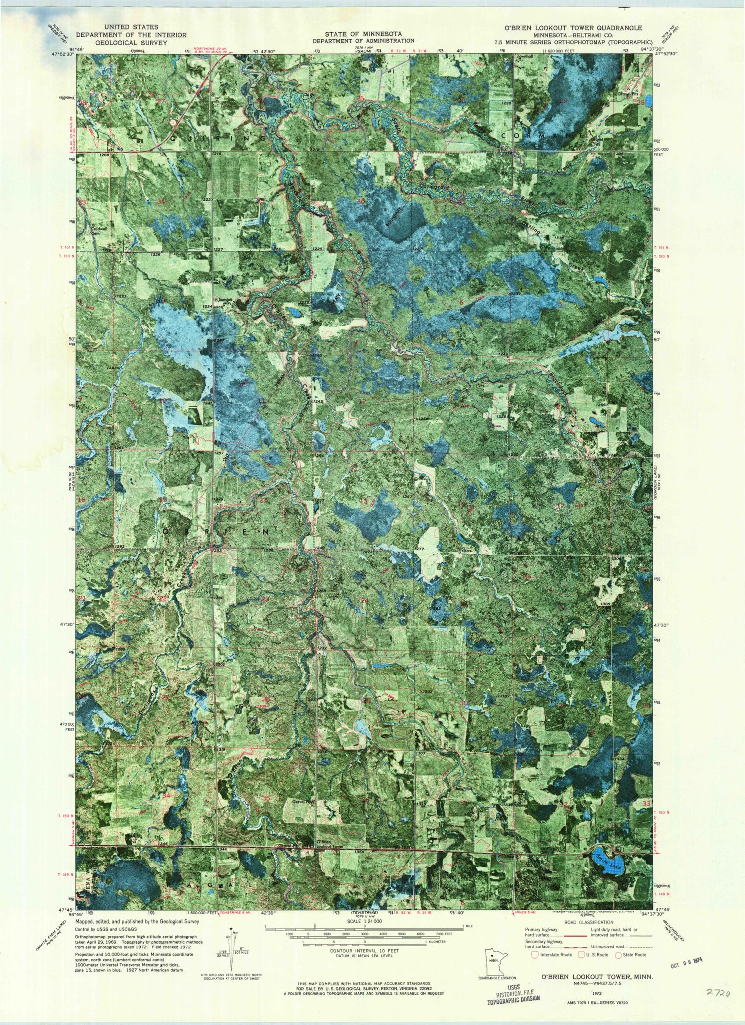
MyTopo
Classic USGS O'Brien Lookout Tower Minnesota 7.5'x7.5' Topo Map
Regular price
$16.95
Regular price
Sale price
$16.95
Unit price
per
Couldn't load pickup availability
Historical USGS topographic quad map of O'Brien Lookout Tower in the state of Minnesota. Map scale may vary for some years, but is generally around 1:24,000. Print size is approximately 24" x 27"
This quadrangle is in the following counties: Beltrami.
The map contains contour lines, roads, rivers, towns, and lakes. Printed on high-quality waterproof paper with UV fade-resistant inks, and shipped rolled.
Contains the following named places: Caldwell Cemetery, Darrigans Creek, Detling Creek, Douglas Forster Rice Paddies Dam, O'Brien Creek, O'Brien Lookout Tower, Perry Creek, Rustad Creek, Smith Lake, South Cormorant River, Township of O'Brien


