MyTopo
Classic USGS Ocean Bay South Carolina 7.5'x7.5' Topo Map
Couldn't load pickup availability
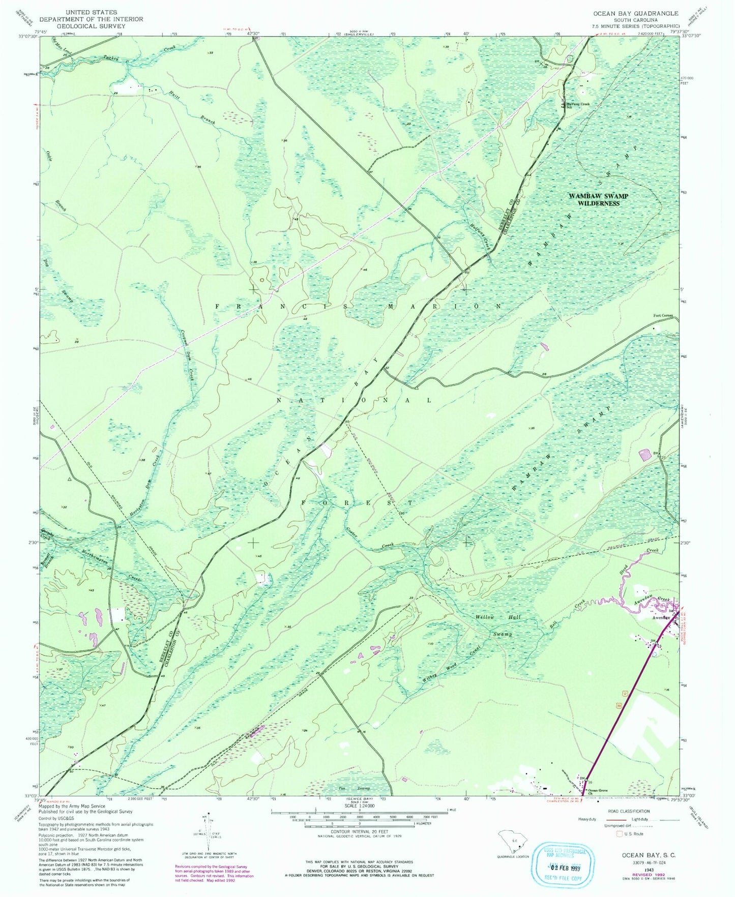
Historical USGS topographic quad map of Ocean Bay in the state of South Carolina. Typical map scale is 1:24,000, but may vary for certain years, if available. Print size: 24" x 27"
This quadrangle is in the following counties: Berkeley, Charleston.
The map contains contour lines, roads, rivers, towns, and lakes. Printed on high-quality waterproof paper with UV fade-resistant inks, and shipped rolled.
Contains the following named places: Oakie Branch, Bell Creek, Bennett Branch, Cooter Creek, Cropnel Dam Creek, Dog Swamp, Halfway Creek, Halfway Creek School, Huitt Branch, Northampton Creek, Oakie Branch, Ocean Bay, Ocean Grove Church, Old Man Lead, Steed Creek, Willow Hall Swamp, Withey Wood Canal, Wambaw Swamp Wilderness, Swamp Fox Trail, Fish Pond, Twin Pond Rifle Range, Halfway Creek Trail Camp, Fort Corner, Apple Old Field Cemetery, Halfway Creek, Halfway Creek Cemetery, Halfway Creek Church, King Swamp, Harleston Dam Creek, Bates Still (historical), Awendaw Church, Lake Awendaw, Porcher Elementary School, Twenty Four Mile School