MyTopo
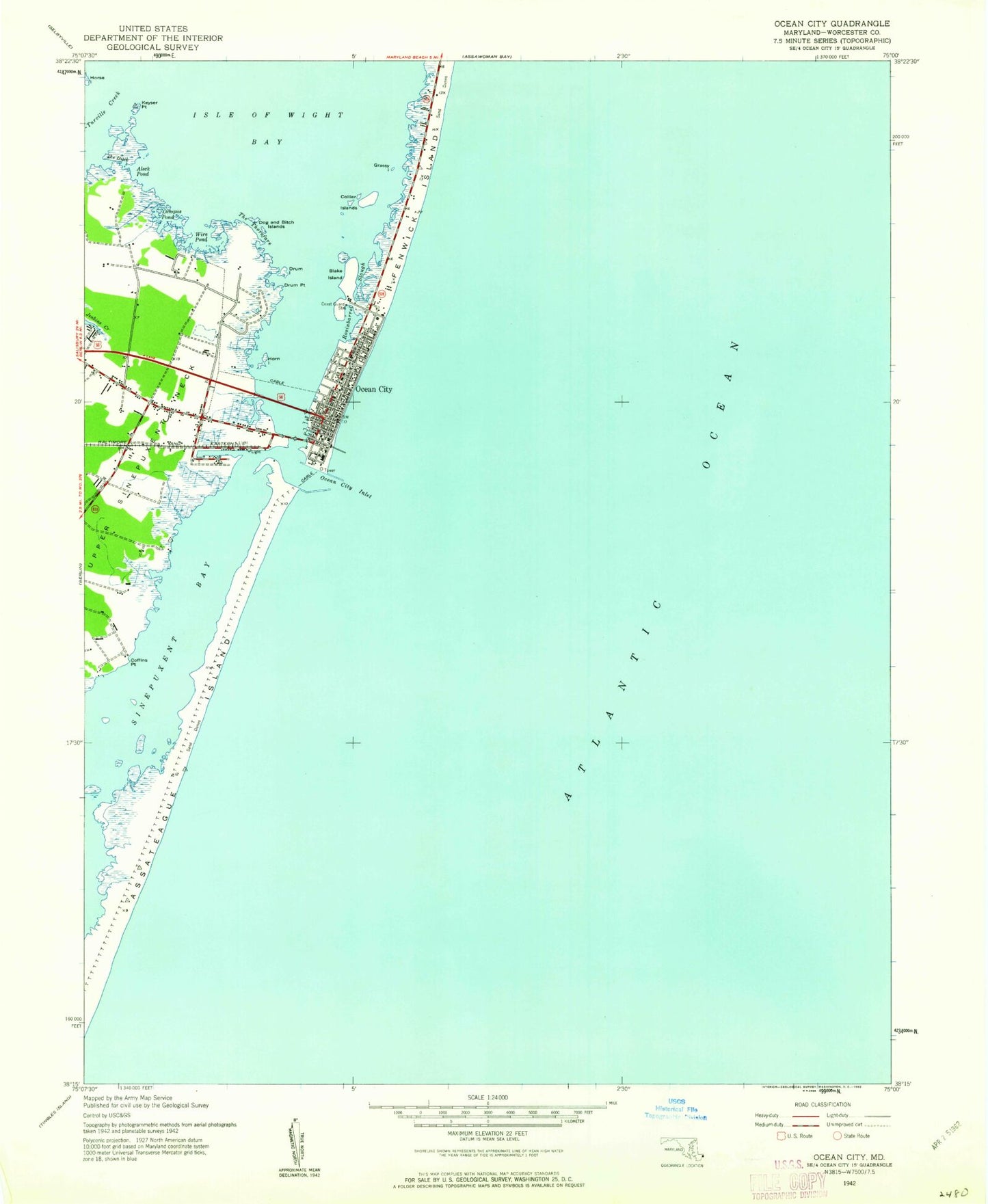
Classic USGS Ocean City Maryland 7.5'x7.5' Topo Map
Couldn't load pickup availability
Historical USGS topographic quad map of Ocean City in the state of Maryland. Map scale may vary for some years, but is generally around 1:24,000. Print size is approximately 24" x 27"
This quadrangle is in the following counties: Worcester.
The map contains contour lines, roads, rivers, towns, and lakes. Printed on high-quality waterproof paper with UV fade-resistant inks, and shipped rolled.
Contains the following named places: Aleck Pond, Atlantic United Methodist Church, Bahia Marina, Bay Shore Acres, Bayshore Estates, Bluefish Cove, Butterfish Cove, Cape Isle of Wight, Captains Hill, Captains Knoll, Coffins Point, Collier Island, Collier Islands, Dog and Bitch Islands, Drum Island, Drum Point, Eagles Nest Mobile Home Park, First Presbyterian Church, Fishermans Marina, Grassy Island, Great Gull Bank, Green Ridge Mobile Home Park, Greenwood Place, Harbor Mist Estates, Harry W Kelly Memorial Bridge, Herring Landing, Holy Savior Catholic Church, Hoopers Heliport, Horn Island, Isle of Wight Bay, Jolly Roger Amusement Park, Keyser Point, Little Gull Bank, Mallard Island, Midway Shopping Center, Minnow Creek, Mystic Harbor, North Ocean City, Ocean City, Ocean City Baptist Church, Ocean City Branch Library, Ocean City Christian School, Ocean City City Hall, Ocean City Elementary School, Ocean City Finance Post Office, Ocean City Fire Marshal's Office, Ocean City Harbor, Ocean City Inlet, Ocean City Municipal Airport, Ocean City Police Department Boardwalk Substation, Ocean City State School, Ocean City Volunteer Fire Company Station 2, Ocean City Volunteer Fire Company Station 3, Ocean City Volunteer Fire Company Station 5, Octopus Pond, Rosinbarrel Slough, Route 611 Business Center, Saint Marys Star of the Sea Catholic Church, Saint Pauls-by-the-Sea Episcopal Church, Sea Isle Mobile Home Park, Sixteenth Street Medical Center, Sunset Business Park, Sunset Marina, Swordfish Basin, Tenth Street Medical Center, The Ditch, The Thorofare, Trout Creek, Turville Creek, Twentysixth Street Medical Center, United State Lifesaving Station Museum, Upper Sinepuxent Neck, Village Shopping Center, West Ocean City, West Ocean City Census Designated Place, West Ocean City Post Office, White Marlin Marina, Wire Pond