MyTopo
Classic USGS Oceola Ohio 7.5'x7.5' Topo Map
Couldn't load pickup availability
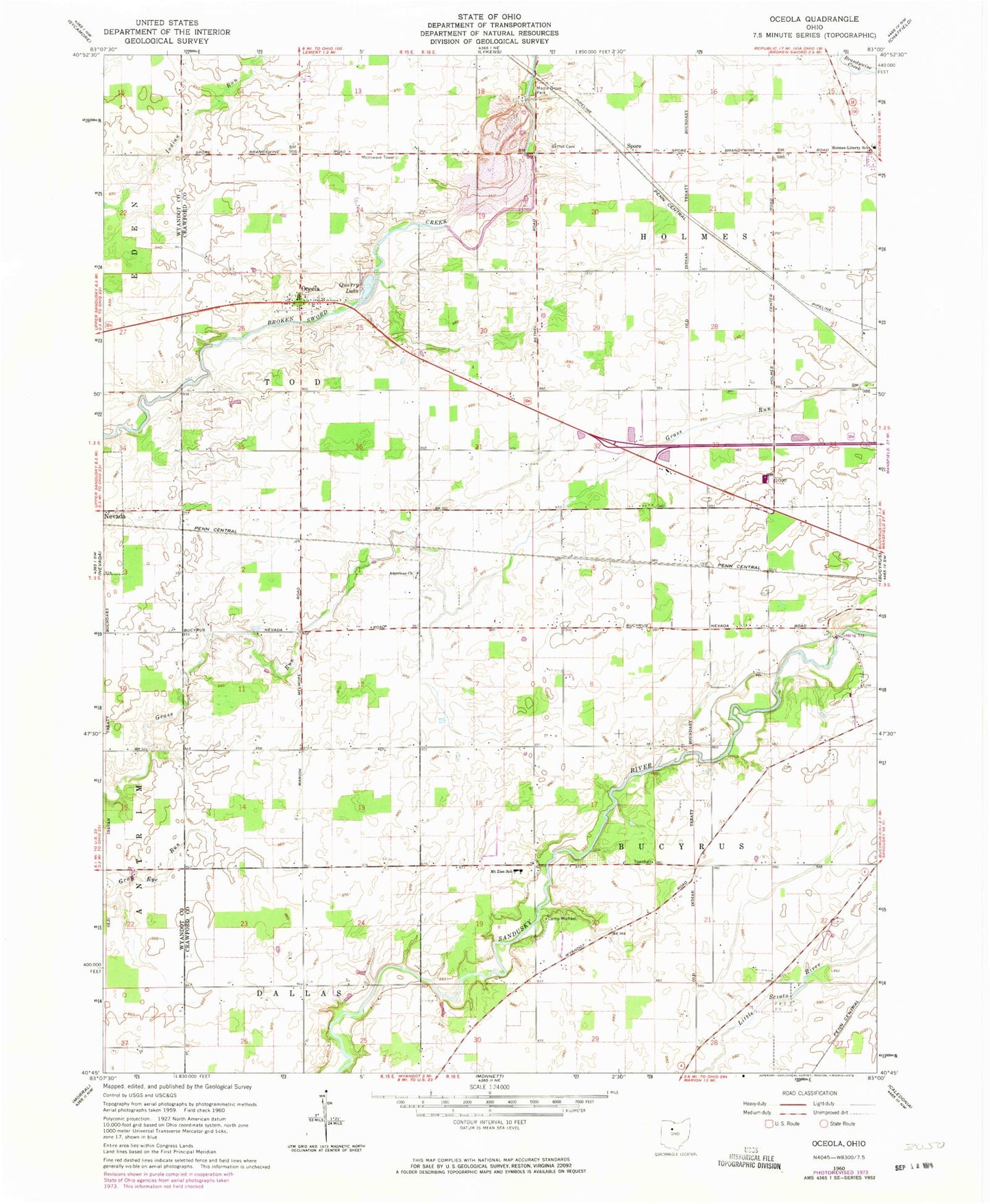
Historical USGS topographic quad map of Oceola in the state of Ohio. Map scale may vary for some years, but is generally around 1:24,000. Print size is approximately 24" x 27"
This quadrangle is in the following counties: Crawford, Wyandot.
The map contains contour lines, roads, rivers, towns, and lakes. Printed on high-quality waterproof paper with UV fade-resistant inks, and shipped rolled.
Contains the following named places: American Church, Bethel Cemetery, Bucyrus Township Fire Department, Camp Michael, Carmean Woods State Nature Preserve, German Reformed Cemetery, Glenville, Holmes Township Volunteer Fire Department, Holmes-Liberty School, Mount Zion Cemetery, Mount Zion United Methodist Church, Oceola, Oceola Census Designated Place, Oceola Number 1 Cemetery, Oceola Number 2 Cemetery, Oceola Number 3 Cemetery, Oceola Post Office, Oceola United Methodist Church, Paul B Sears Woods State Nature Preserve, Quarry Lake, Spore, Township of Bucyrus, Township of Holmes, Township of Tod, Wayside Christian School, Wynford High School, Wynford Middle School