
MyTopo
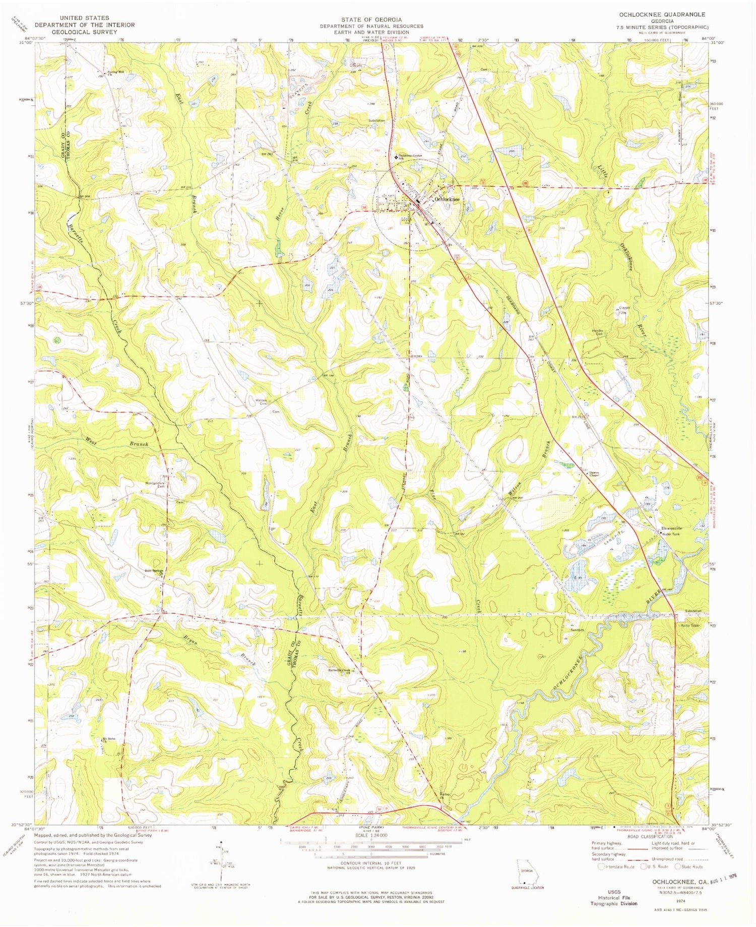
Classic USGS Ochlocknee Georgia 7.5'x7.5' Topo Map
Couldn't load pickup availability
Historical USGS topographic quad map of Ochlocknee in the state of Georgia. Map scale may vary for some years, but is generally around 1:24,000. Print size is approximately 24" x 27"
This quadrangle is in the following counties: Grady, Thomas.
The map contains contour lines, roads, rivers, towns, and lakes. Printed on high-quality waterproof paper with UV fade-resistant inks, and shipped rolled.
Contains the following named places: Arbordale Church, Barnett's Creek Baptist Church Cemetery, Barnetts Creek Church, Barnetts Creek Volunteer Fire Department Station 6, Beverly Lake, Beverly Lake Dam, Bold Springs Cemetery, Bold Springs Church, Bryan Branch, Bullock Mill, Children Center School, Dawes Chapel, Dawesville, East Branch Barnetts Creek, Hadley Church, Hadley Church Cemetery, Hendry Cemetery, Horse Creek, Jones Cemetery, Maranatha Church, Montgomery Cemetery, Mount Nebo Cemetery, Mount Nebo Church, Mount Phisby Church, Ochlocknee, Ochlocknee Cemetery, Ochlocknee Division, Ochlocknee Fire Department Station 8, Ochlocknee Post Office, Pine Creek, Roddenberry Camp, Scullys Store, Singletary Cemetery, Singletary Cemetery 1, Singletary Lake, Singletary Lake Dam, Singletary Lake Dam Number Three, Singletary Lake Dam Number Two, Singletary Lake Number Three, Spring Hill Church, Spring Hill School, Springhill Church Cemetery, Town of Ochlocknee, Union School, Walden Cemetery, Wesleyan Church, West Branch Barnetts Creek, Wilson Branch, ZIP Code: 31773


