MyTopo
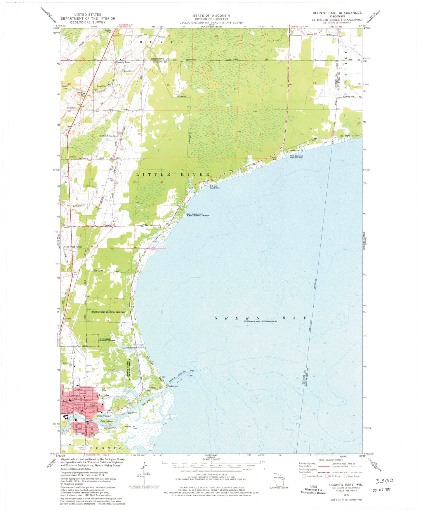
Classic USGS Oconto East Wisconsin 7.5'x7.5' Topo Map
Couldn't load pickup availability
Historical USGS topographic quad map of Oconto East in the state of Wisconsin. Map scale may vary for some years, but is generally around 1:24,000. Print size is approximately 24" x 27"
This quadrangle is in the following counties: Marinette, Oconto.
The map contains contour lines, roads, rivers, towns, and lakes. Printed on high-quality waterproof paper with UV fade-resistant inks, and shipped rolled.
Contains the following named places: Ajax Island, Bellin Health Oconto Hospital and Clinic, City of Oconto, County Line, Cullen, Cullen Cemetery, D E Hall County Park, Farnsworth Public Library, First American Lutheran Church, First Presbyterian Church, Garden of Hope Cemetery, Hall School, Labbies Slough, Lincoln School, Lindsey Cemetery, Municipal Wharf, Newport Marina, North Bay Shore Recreation Area, Oconto, Oconto City Hall, Oconto County Courthouse, Oconto County Hospital, Oconto County Jail, Oconto County Sheriff's Office, Oconto Elementary School, Oconto Fire and Rescue Department, Oconto Gospel Chapel, Oconto High School, Oconto Literacy Charter School, Oconto Marsh State Game Refuge, Oconto Marsh Wildlife Area 3WR350 Dam, Oconto Middle School, Oconto Police Department, Oconto Post Office, Oconto River, Oconto Utility Commission Wastewater Treatment Facility, Oconto Yacht Club, Rush Point State Public Hunting Grounds, Saint Joseph Church, Saint Josephs School, Saint Marks Episcopal Church, Saint Pauls German Evangelical Church, South Pierh Light, Sweetwater Bay Seaplane Base, Thomas Slough, Trinity Lutheran Church, Wilcox, Zion Lutheran Church