MyTopo
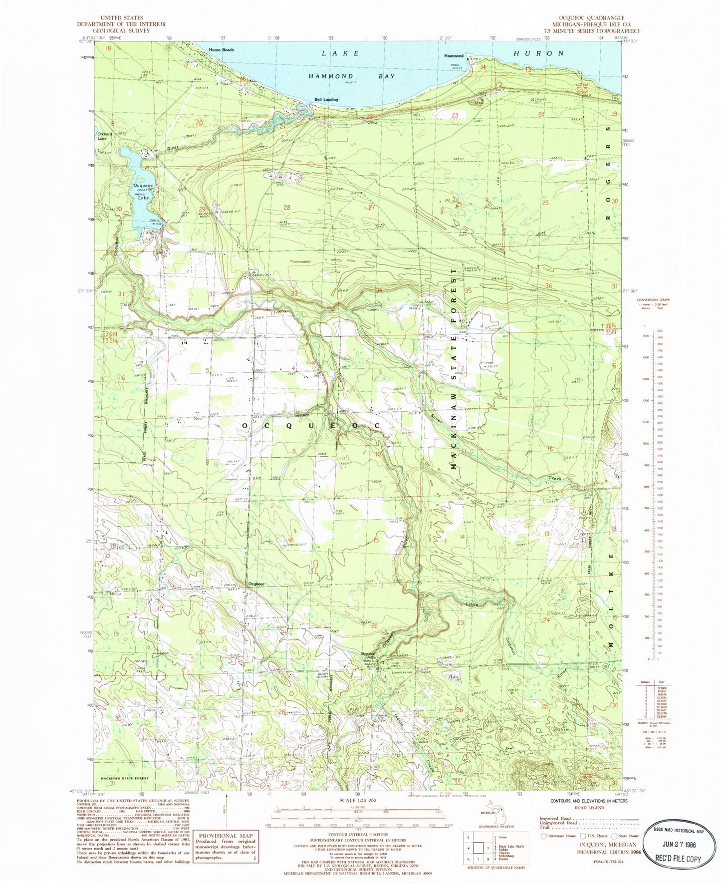
Classic USGS Ocqueoc Michigan 7.5'x7.5' Topo Map
Couldn't load pickup availability
Historical USGS topographic quad map of Ocqueoc in the state of Michigan. Map scale may vary for some years, but is generally around 1:24,000. Print size is approximately 24" x 27"
This quadrangle is in the following counties: Presque Isle.
The map contains contour lines, roads, rivers, towns, and lakes. Printed on high-quality waterproof paper with UV fade-resistant inks, and shipped rolled.
Contains the following named places: Bell Landing, Glawe School, Hammond, Hammond Bay Biological Station, Hammond Post Office, Huron Beach, Indian Creek, King Lookout Tower, Little Ocqueoc River, Methodist Cemetery, Ocqueoc, Ocqueoc - Bearinger Fire Department, Ocqueoc Cemetery, Ocqueoc Falls, Ocqueoc Falls State Forest Campground, Ocqueoc Lake, Ocqueoc Post Office, Ocqueoc River, Silver Creek, Township of Ocqueoc, Trinity Lutheran Cemetery, Trinity Lutheran Church, Vilburn School, ZIP Code: 49759