
MyTopo
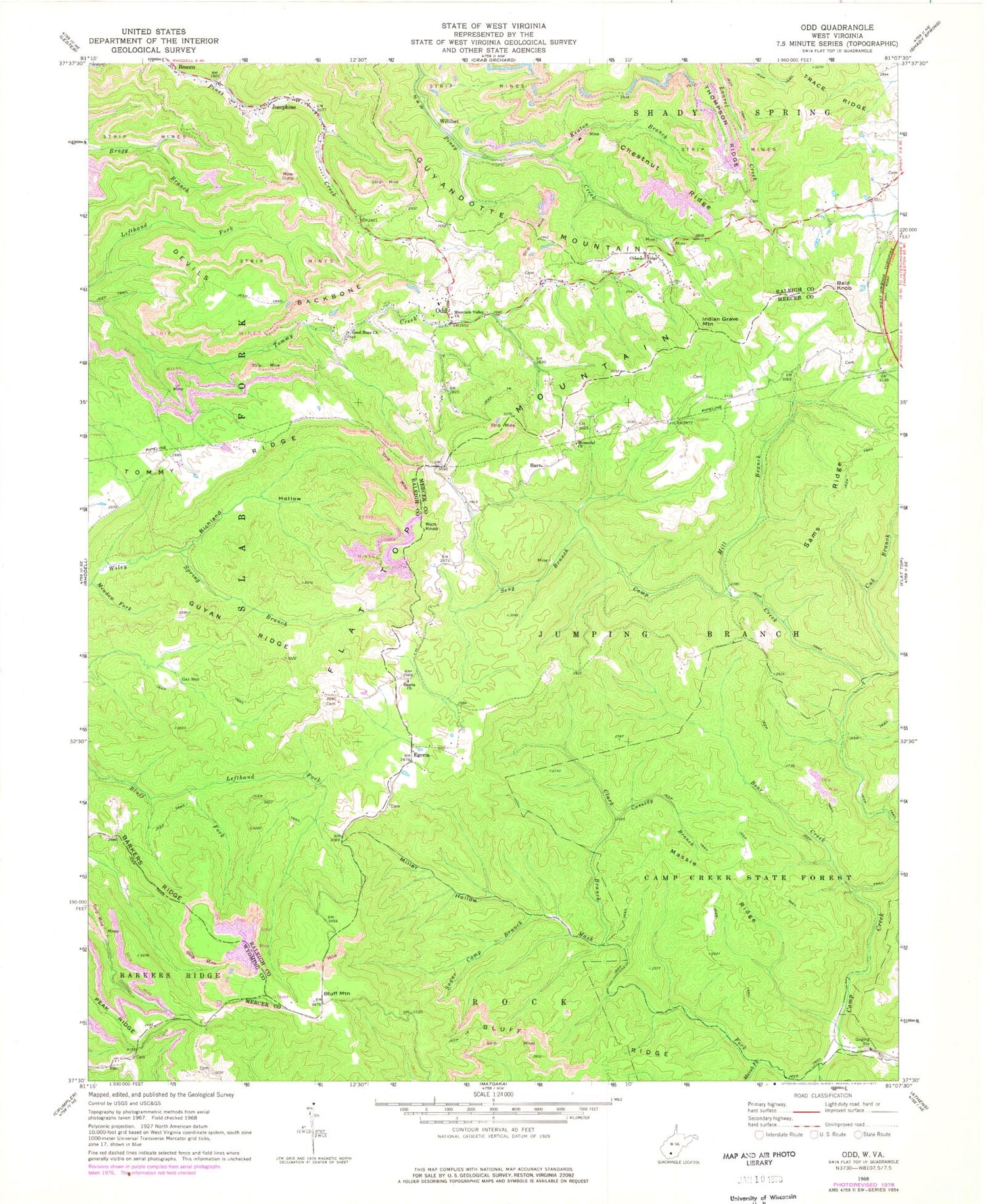
Classic USGS Odd West Virginia 7.5'x7.5' Topo Map
Couldn't load pickup availability
Historical USGS topographic quad map of Odd in the states of West Virginia, Virginia. Typical map scale is 1:24,000, but may vary for certain years, if available. Print size: 24" x 27"
This quadrangle is in the following counties: Mercer, Raleigh, Wyoming.
The map contains contour lines, roads, rivers, towns, and lakes. Printed on high-quality waterproof paper with UV fade-resistant inks, and shipped rolled.
Contains the following named places: Barn, Bear Creek, Bluff Ridge, Camp Creek State Forest, Cassidy Branch, Chestnut Ridge, Chestnut Ridge Church, Clark Branch, Devils Backbone, Egeria Church, Good Hope Church, Guyan Ridge, Keaton Branch, Lefthand Fork Bluff Fork, Marsh Fork, Mash Fork, Massie Ridge, Meadow Fork, Memorial Church, Mill Branch, Miller Hollow, Mountain Valley Church, Odd, Puzzle Branch, Richland Hollow, Sams Ridge, Seng Branch, Sugar Camp Branch, Egeria, Bald Knob, Bluff Mountain, Indian Grave Mountain, Josephine, Rich Knob, Willibet, Brammer School (historical), Fairwind School (historical), Schreder Hollow, Sneed School (historical), Howard Shrewsbury Spring, Riley Mills School (historical), Camp Wasp School (historical), Chestnut Ridge School (historical), Egeria School (historical), Hatcher School (historical), Jewell School (historical), Josephine Post Office, Long Wanted School (historical), Low Gap School (historical), Low Gap School (historical), Odd Post Office, Tommy Ridge School (historical), Camp Creek State Park, Wythe County Sheriffs Office, Giles County Sheriff's Office, Pearisburg Police Department


