MyTopo
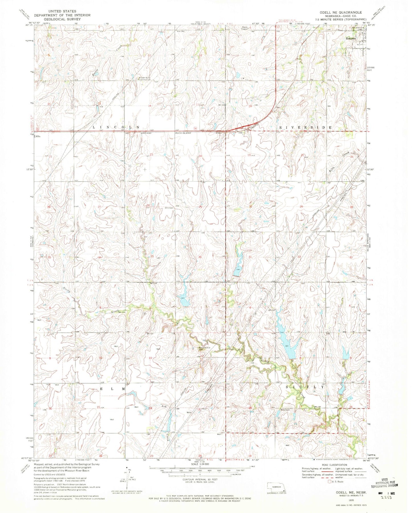
Classic USGS Odell NE Nebraska 7.5'x7.5' Topo Map
Couldn't load pickup availability
Historical USGS topographic quad map of Odell NE in the state of Nebraska. Map scale may vary for some years, but is generally around 1:24,000. Print size is approximately 24" x 27"
This quadrangle is in the following counties: Gage.
The map contains contour lines, roads, rivers, towns, and lakes. Printed on high-quality waterproof paper with UV fade-resistant inks, and shipped rolled.
Contains the following named places: Anyon Cemetery, Big Indian Creek Dam 12-1, Big Indian Creek Dam 12-A, Big Indian Creek Dam 13-B, Big Indian Creek Dam 13-C, Big Indian Creek Dam 14-A, Big Indian Creek Dam 14-B, Big Indian Creek Reservoir 12-1, Big Indian Creek Reservoir 13-B, Big Indian Creek Reservoir 13-C, Big Indian Creek Reservoir 14-A, Big Indian Creek Reservoir 14-B, Big Indian Greek Reservoir 12-A, Ellis Cemetery, Hidden Acres Country Club, Hidden Acres Golf Club, Linsenmeyer Farms, Snyder Dam, Snyder Reservoir, Township of Elm, Township of Lincoln