MyTopo
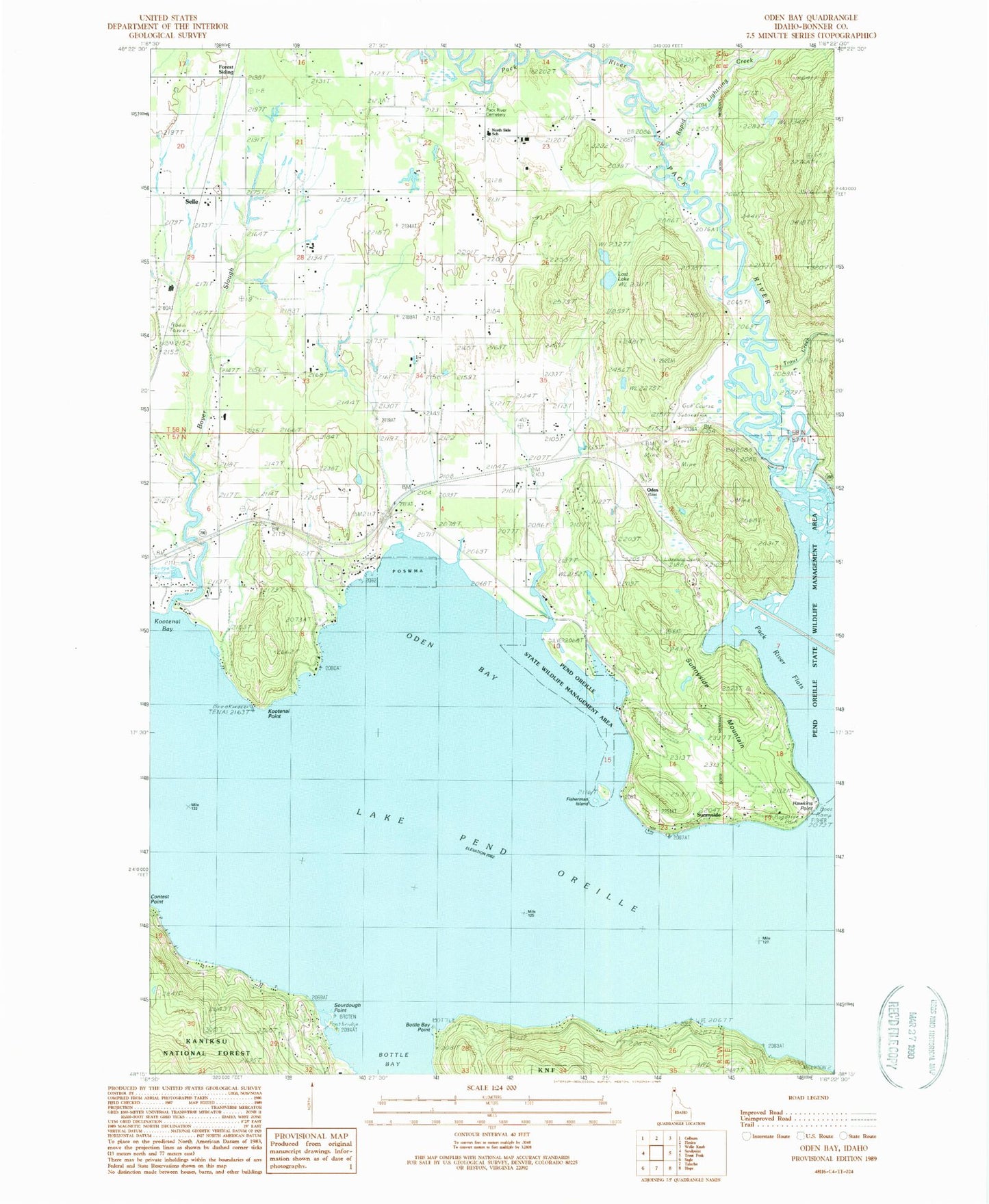
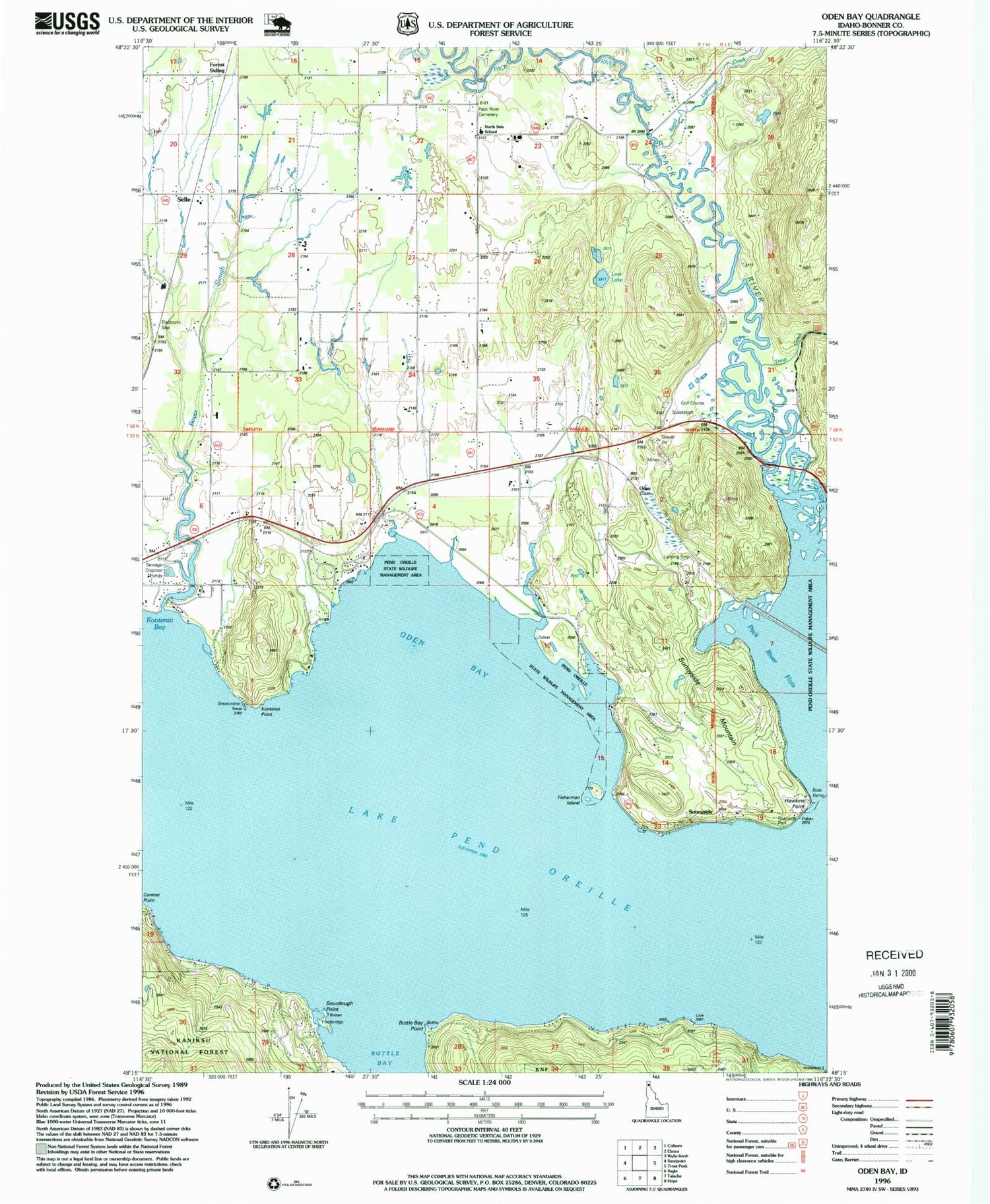
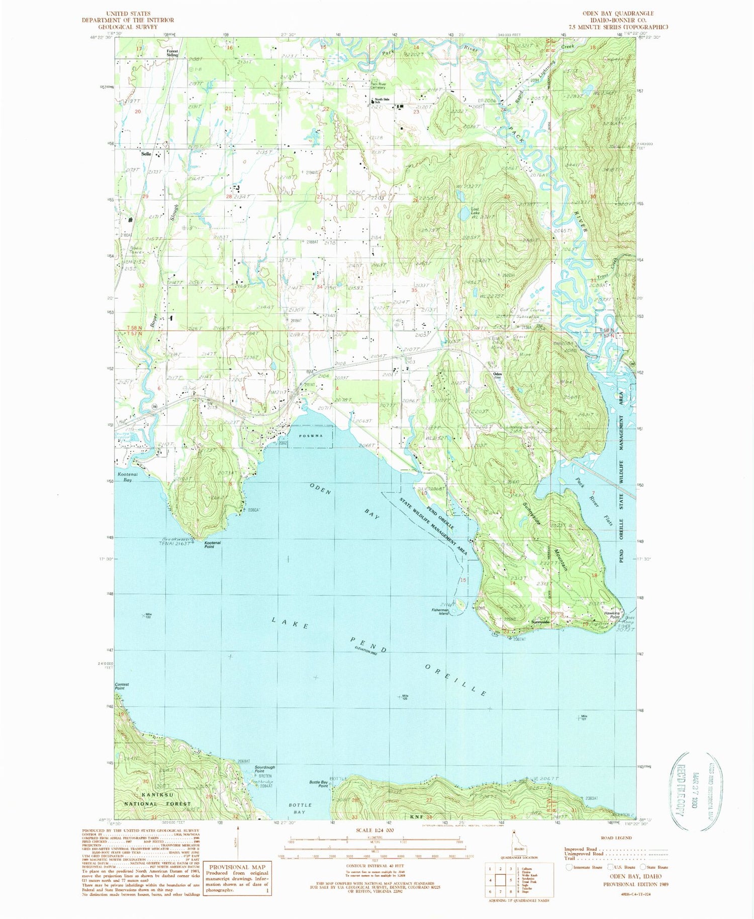
Classic USGS Oden Bay Idaho 7.5'x7.5' Topo Map
Couldn't load pickup availability
Historical USGS topographic quad map of Oden Bay in the state of Idaho. Map scale may vary for some years, but is generally around 1:24,000. Print size is approximately 24" x 27"
This quadrangle is in the following counties: Bonner.
The map contains contour lines, roads, rivers, towns, and lakes. Printed on high-quality waterproof paper with UV fade-resistant inks, and shipped rolled.
Contains the following named places: Bottle Bay Point, Boyer, Boyer Slough, Culver, Fisherman Island, Forest Siding, Gold Creek, Gold Gulch, Grange Hall, Hawkins Point, Kootenai Point, Lost Lake, Matchwood, Moose Lodge Airport, Northside Elementary School, Northside Fire District Station 3, Oden, Oden Bay, Oden Bay Game Management Area, Oden School, Pack River Boat Ramp, Pack River Cemetery, Pack River Flats, Pack River Flats Refuge, Pend Oreille Wildlife Management Area, Pend Oreille Wildlife Management Area Oden Bay Unit, Pend Oreille Wildlife Management Area Pack River Unit, Rapid Lightning Creek, Rapoport Ranch Airport, Selle, Sourdough Point, Sunnyside, Sunnyside Mountain, Sunnyside Park Access Area, Trout Creek