MyTopo
Classic USGS Odenville Alabama 7.5'x7.5' Topo Map
Couldn't load pickup availability
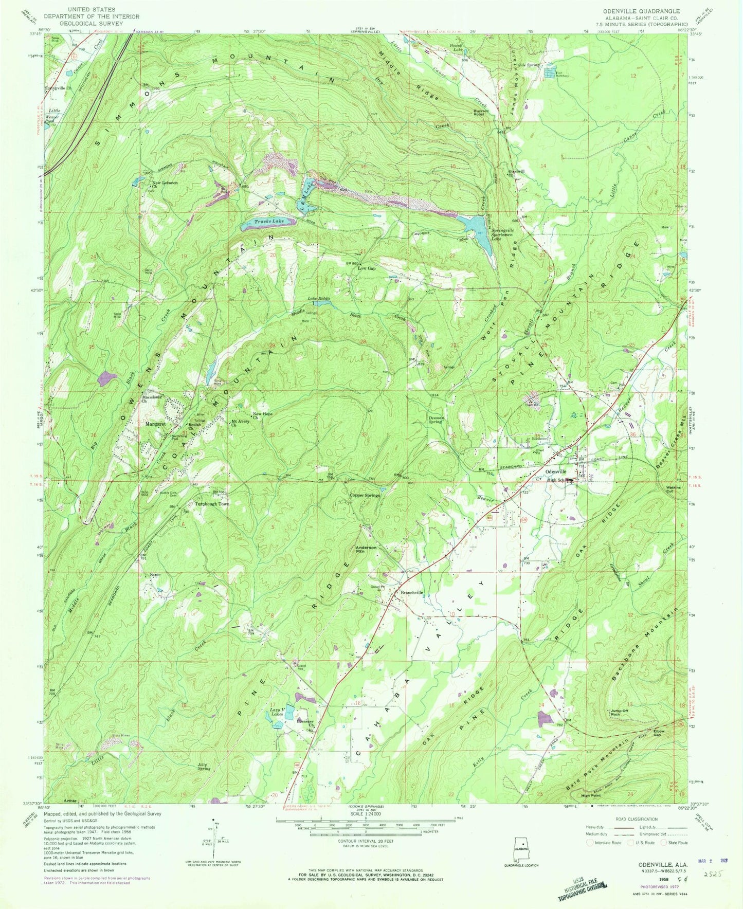
Historical USGS topographic quad map of Odenville in the state of Alabama. Map scale may vary for some years, but is generally around 1:24,000. Print size is approximately 24" x 27"
This quadrangle is in the following counties: St. Clair.
The map contains contour lines, roads, rivers, towns, and lakes. Printed on high-quality waterproof paper with UV fade-resistant inks, and shipped rolled.
Contains the following named places: Acmar Mines, Anderson Mountain, Austin Olds Cemetery, Beulah Church, Branchville, Branchville Cemetery, Branchville Police Department, Brookston Mine, Buzzard Roost, Clayton Dam, Clayton Lake, Coal Mountain, Copper Springs, Copper Springs Church, Crockertown, Crooked Creek, Denman Spring, Dry Creek, Ebenezer Baptist Church, Elbow Gap, Foremans Mine, Friendship Church, Goodwill Church, Green Acres Estates, Grindstone Branch, Havilah Hills Estates, High Point, Hill Number 1, Hill Number 2, Howell Lake, Independence Church, Jolly Spring, Jones School, Jump-Off Rock, L and M Dam, L and M Lake, Lake Melanie, Lake Riddle, Lazy V Lake, Lazy V Lake Acres, Lazy V Ranch Dam, Liberty Cemetery, Liberty Church, Low Gap, Low Gap Cemetery, Low Gap United Methodist Church, Macedonia Baptist Church, Macedonia Cemetery, Margaret, Margaret Lake, Margaret Mine, Margaret Post Office, Margaret School, Margaret Volunteer Fire Department, Martin Dam, Martin Lake, Mount Avery Church, New Hope Church, New Lebanon Church, New Life Church, Oak Ridge, Odenville, Odenville Fire and Rescue Station 1, Odenville Fire and Rescue Station 2, Odenville Fire and Rescue Station 3, Odenville Industrial Park, Odenville Post Office, Pine Ridge, Qsl Fish Hatchery Dam, Qsl Fish Hatchery Lake, Riddle Dam, Saint Clair Correctional Facility, Saint Clair County High School, Sanie, Sanie Missionary Baptist Church, Shady Acres, Side Spring, Simmons Mountain, Springville Church, Springville Division, Springville Fire and Rescue Station 2, Springville Sportsman Dam, Springville Sportsmen Lake, Stovall Branch, Stovall Mountain, Town & Country Airpark, Town of Branchville, Town of Margaret, Town of Odenville, Trucks Dam, Trucks Lake, Truss Mill, Turnbough Town, Watkins Cut, Wolf Pen Ridge, Woody Acres, ZIP Codes: 35112, 35120