MyTopo
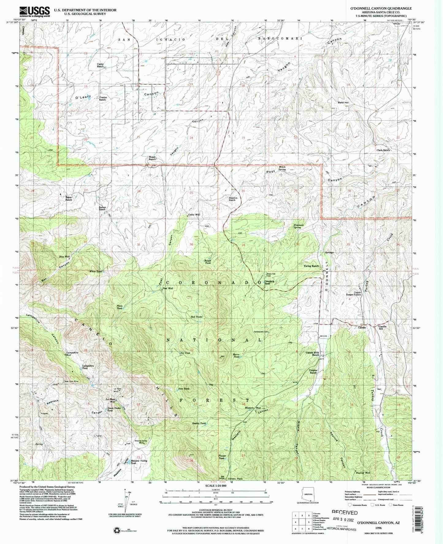
Classic USGS O'Donnell Canyon Arizona 7.5'x7.5' Topo Map
Couldn't load pickup availability
Historical USGS topographic quad map of O'Donnell Canyon in the state of Arizona. Map scale may vary for some years, but is generally around 1:24,000. Print size is approximately 24" x 27"
This quadrangle is in the following counties: Santa Cruz.
The map contains contour lines, roads, rivers, towns, and lakes. Printed on high-quality waterproof paper with UV fade-resistant inks, and shipped rolled.
Contains the following named places: Baker Ranch, Bald Hill, Black Oak Cemetery, Burro Tank, Canby Ranch, Canelo, Canelo Hills, Canelo Hills Ranch, Canelo Pass, Canelo Ranger Station, Canelo Trail Head, Canille School, Cemetery Tank, Clark Ranch, Collie Well, Dirt Tank, Double Tank, Down Under Tank, Everhart Ranch, Ewing Ranch, Far Tank, Fish Tank, Flower Tank, Forest Tank, Fort Tank, Frazier Ranch, Frazier Tank, Freeman Spring, Freeman Well, Glotts Tank, Guy Tank, Houston Ranch, Issacs Well, La Plata Mine, La Plato Well, Lampshire Tank, Lampshire Well, Lee Stock Tank, Little Water Spring, Lower Pauline Trick Tank, Meadow Valley Mine, Meadow Valley Tank, Middle Canyon, New Tank, New Well, New York Mine, North Forest Well, North Unit Stock Tank, Oak Well, O'Leary Canyon, Parker Ranch, Pauline Canyon, Pauline Well, Pinto Tank, Post Canyon, Post Well, Ralph Tank, Rattlesnake Dam, Red Tanks, Research Ranch Headquarters, Roath Ranch, Rogers Well, Triangle Ranch, Umpire Ranch, Welch Spring, West Tank, Western Canyon, Western Well, White Tank, Whitney Ranch, Wood Ranch