MyTopo
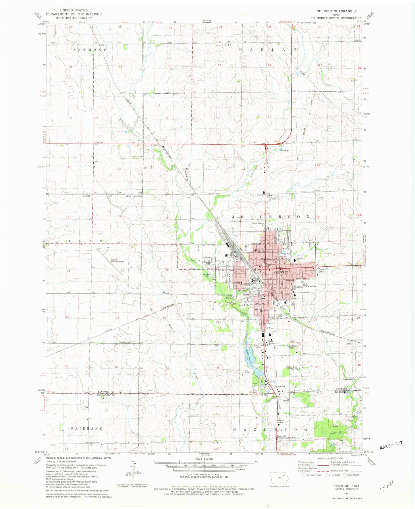
Classic USGS Oelwein Iowa 7.5'x7.5' Topo Map
Couldn't load pickup availability
Historical USGS topographic quad map of Oelwein in the state of Iowa. Map scale may vary for some years, but is generally around 1:24,000. Print size is approximately 24" x 27"
This quadrangle is in the following counties: Buchanan, Fayette.
The map contains contour lines, roads, rivers, towns, and lakes. Printed on high-quality waterproof paper with UV fade-resistant inks, and shipped rolled.
Contains the following named places: Bahai' Faith, Brown Chiropractic Clinic, Burch Log Cabin, Christ United Presbyterian Church, Church of Christ - East Side, Church of Christ - West Side, City of oelwein, Delwein City Park, Delwein Lake, Faith Baptist Church, Family Health Center, First Baptist Church, Floral Hills Memorial Gardens Cemetery, Foursome Country Club, Grace United Methodist Church, Grandview Nursing Home, Hallberg Family Practice Clinic, Harlan School, Hawkeye Dental Studio, Heine Chiropractic Clinic, Hickory Grove Country Club, Hub City Heritage Railway Museum, Jeff, Jehovahs Witnesses, Kint Cemetery, KoeL-AM (oelwein), KoeL-FM (oelwein), Lakeview Golf Course, Lakeview Mobile Home Court, Levin Park, Lighthouse Assembly of God Church, Mercy Clinic, Mercy Hospital Heliport, Mercy Hospital of Franciscan Sisters, Nibeck Wildlife Preserve, Oakdale Cemetery, Oelwein, Oelwein Area Historical Society Museum, Oelwein Care Center, Oelwein City Hall, Oelwein Community Plaza, Oelwein Elevator Company Elevator, Oelwein Family Eyecare Center, Oelwein Fire Department, Oelwein High School, Oelwein Library, Oelwein Middle School, Oelwein Municipal Airport, Oelwein Police Department, Oelwein Post Office, Oelwein Vision Clinic, Oran Post Office, Oran Township Cemetery, Orville Christophel Park, Otsego Cemetery, Otter Creek Bridge, Parkside Elementary School, Peace Lutheran Church, Platt Park, Preventative Family Dentistry Center, Red Gate Park, Reedy Park, Reorganized Church of Jesus Christ of Latter Day Saints, Sacred Heart Church, Sacred Heart Elementary School, Southside School, Township of Jefferson, Wapsie Valley Rural Elementary School Number 1, Wings Park, Wings Park Elementary School, Woodlawn Cemetery, Zion American Lutheran Church, ZIP Code: 50662