MyTopo
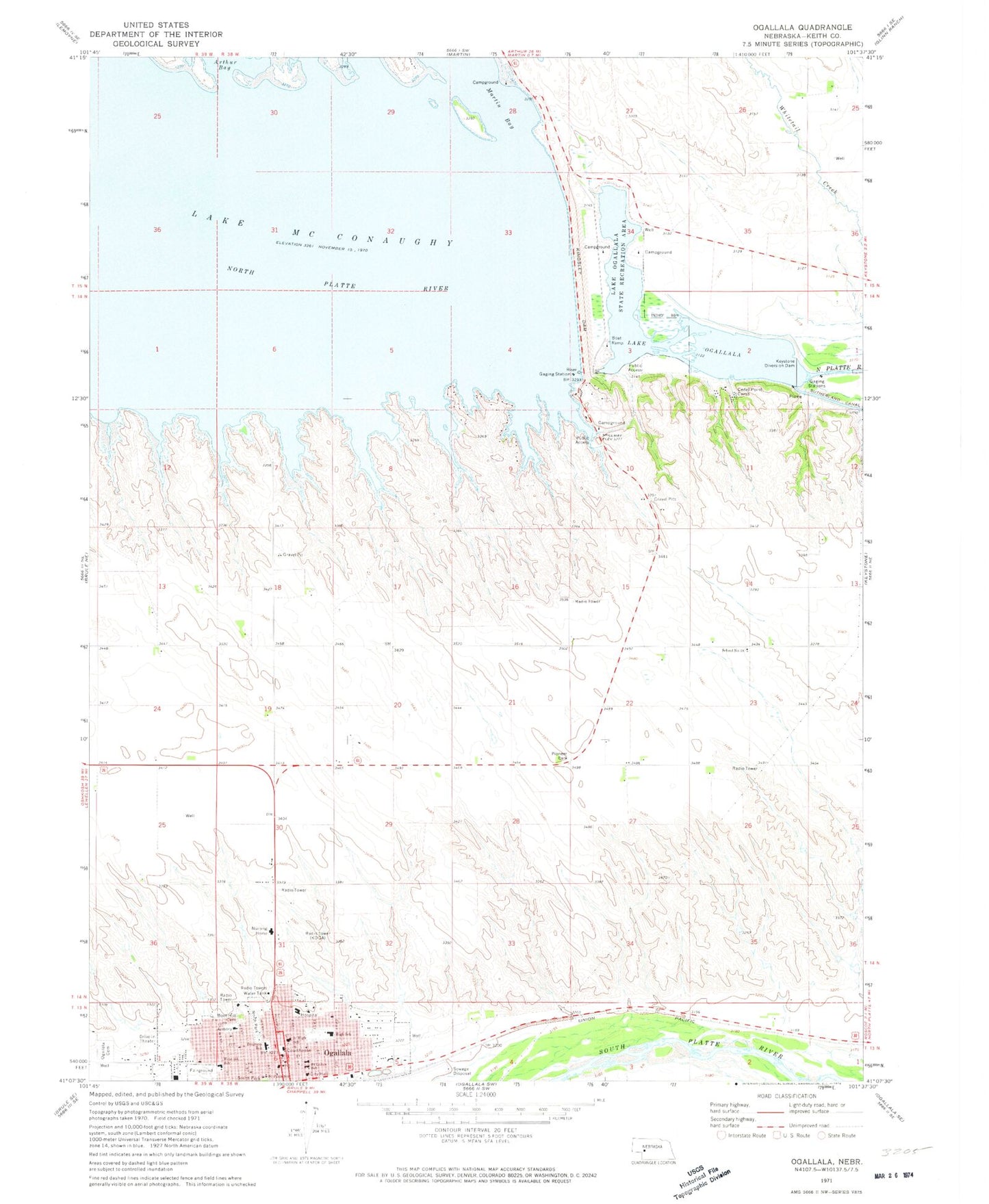
Classic USGS Ogallala Nebraska 7.5'x7.5' Topo Map
Couldn't load pickup availability
Historical USGS topographic quad map of Ogallala in the state of Nebraska. Map scale may vary for some years, but is generally around 1:24,000. Print size is approximately 24" x 27"
This quadrangle is in the following counties: Keith.
The map contains contour lines, roads, rivers, towns, and lakes. Printed on high-quality waterproof paper with UV fade-resistant inks, and shipped rolled.
Contains the following named places: Anchor Baptist Church, Arthur Bay, Berean Fundamental Church, Boot Hill Cemetery, Boot Hill Historical Marker, Caddi Shack Campground, Cedar Point Camp, Church of Christ, Church of God, City of Ogallala, Colister Park, Cowboy Capital Historical Marker, Cozy Country Cove, Cure Creek Dam 1-A, Cure Creek Reservoir 1-A, Ear Nose Throat and Sinus Clinic, Faith Evangelical Free Church, Family Medical Center, First Baptist Church, First Congregational United Church of Christ, Glines/Nye Park, Goodall City Library, Goodall Recreation Center, Humphreys Pond, Indian Hills Manor, Jehovahs Witnesses Kingdom Hall, Keith County, Keith County Courthouse, Keith County Fairgrounds, Keith County Sheriff's Office, Keystone Diversion Dam, Keystone Pond-Lake Ogallala, Kingsley Dam, Kingsley Dam Eagle Viewing Facility, Kingsley Lodge Campground, KMCX-FM (Ogallala), KOGA-AM (Ogallala), L and L Mobile Home Park, Lake Ogallala State Recreation Area, Lake Ogallala Trail, Legion Field, Lighthouse Baptist Church, Mansion on the Hill, Martin Bay, Nebraska National Trails Museum, North Park, North Platte Foot Clinic, Ogallala, Ogallala Beach Campground, Ogallala Cemetery, Ogallala Community Hospital, Ogallala Dam East, Ogallala Dam West, Ogallala High School, Ogallala Lake, Ogallala Medical Group, Ogallala Middle School, Ogallala Police Department, Ogallala Post Office, Ogallala Trail, Ogallala Volunteer Fire Department, Pioneer Park, Platte Valley Diversion-1 Dam, Prairie Mobile Clinic, Prairie View Elementary School, Progress School, Radiant Life Assembly of God Church, Saint Lukes Catholic Church, Saint Lukes School, Saint Pauls Episcopal Church, Saint Pauls Lutheran Church, Saint Pauls School, School Number 18, Searle Park, Seventh Day Adventist Church, Spillway Bay, Spillway Bay Campground, Spillway Park, United Methodist Church, United Pentecostal Church, Victory Baptist Church, West 5th School, West Park, Williams Park