MyTopo
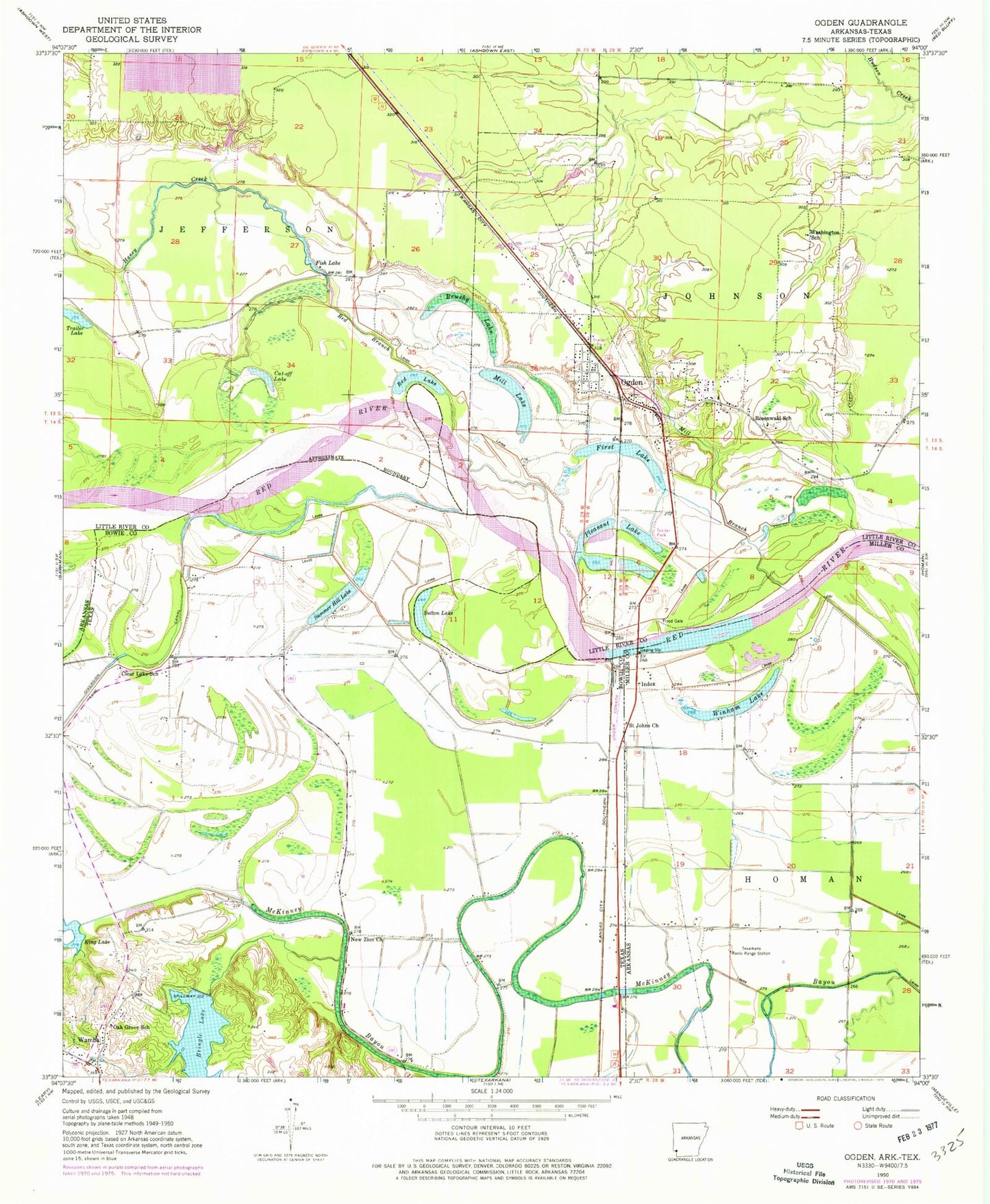
Classic USGS Ogden Arkansas 7.5'x7.5' Topo Map
Couldn't load pickup availability
Historical USGS topographic quad map of Ogden in the states of Arkansas, Texas. Map scale may vary for some years, but is generally around 1:24,000. Print size is approximately 24" x 27"
This quadrangle is in the following counties: Bowie, Little River, Miller.
The map contains contour lines, roads, rivers, towns, and lakes. Printed on high-quality waterproof paper with UV fade-resistant inks, and shipped rolled.
Contains the following named places: Bringle Lake, Bringle Lake Dam, Brushy Lake, City of Ogden, Clear Creek, Clear Lake School, Cut-off Lake, East Ogden Volunteer Fire Department, First Baptist Church of Ogden, First Lake, Fish Lake, Flying W Airport, Haney Creek, Index, Index Bridge, KTFS-FM (Ashdown), McKinney Bayou, Mill Branch, Mill Lake, Nacoosa Paper Retention Pond Levee, New Zion Church, Oak Grove School, Ogden, Ogden Post Office, Ogden Volunteer Fire Department, Pine Prairie Airport, Pleasant Grove Volunteer Fire Department, Pleasant Lake, Red Branch, Red Lake, Rosenwald School, Saint Johns Church, Summer Hill Lake, Washington School, Winham Lake