MyTopo
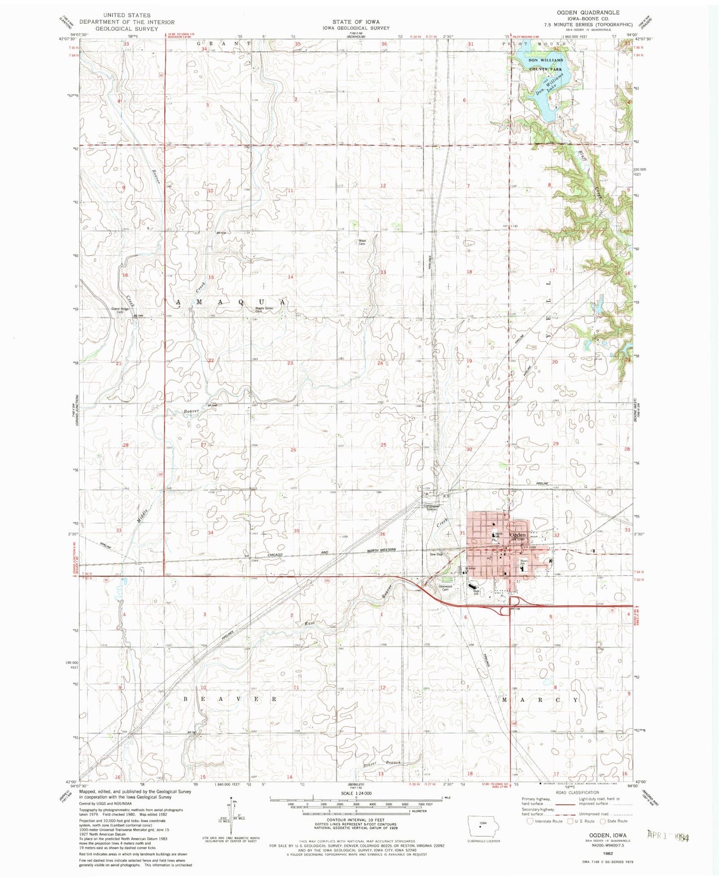
Classic USGS Ogden Iowa 7.5'x7.5' Topo Map
Couldn't load pickup availability
Historical USGS topographic quad map of Ogden in the state of Iowa. Map scale may vary for some years, but is generally around 1:24,000. Print size is approximately 24" x 27"
This quadrangle is in the following counties: Boone.
The map contains contour lines, roads, rivers, towns, and lakes. Printed on high-quality waterproof paper with UV fade-resistant inks, and shipped rolled.
Contains the following named places: Amaqua Center School, Bawa Muhaiyaddeen Fellowship of Iowa Cemetery, Boone County Waterfowl Production Area, City of Ogden, Community United Methodist Church, Don Williams Campground, Don Williams County Park, Don Williams Lake, Don Williams Lake Dam, Glenwood Cemetery, Grand Ridge Cemetery, Harrier Marsh, Harrison School, Hickory Grove Rural School Museum, Immanuel Lutheran Church, Kelly School, Leonard A Good Community Library, Leonard Good Community Center, M and S Mobile Home Park, Maas Cemetery, Maple Grove Cemetery, McFarland Clinic, Mount Olive Cemetery, Ogden, Ogden Baptist Church, Ogden Care Nursing Home, Ogden City Hall, Ogden Elementary School, Ogden First Responders Emergency Medical Services, Ogden High School, Ogden Middle School, Ogden Police Department, Ogden Post Office, Saint Johns Church, Township of Amaqua, Zion Lutheran Church, ZIP Code: 50212