MyTopo
Classic USGS Ogdensburg East New York 7.5'x7.5' Topo Map
Couldn't load pickup availability
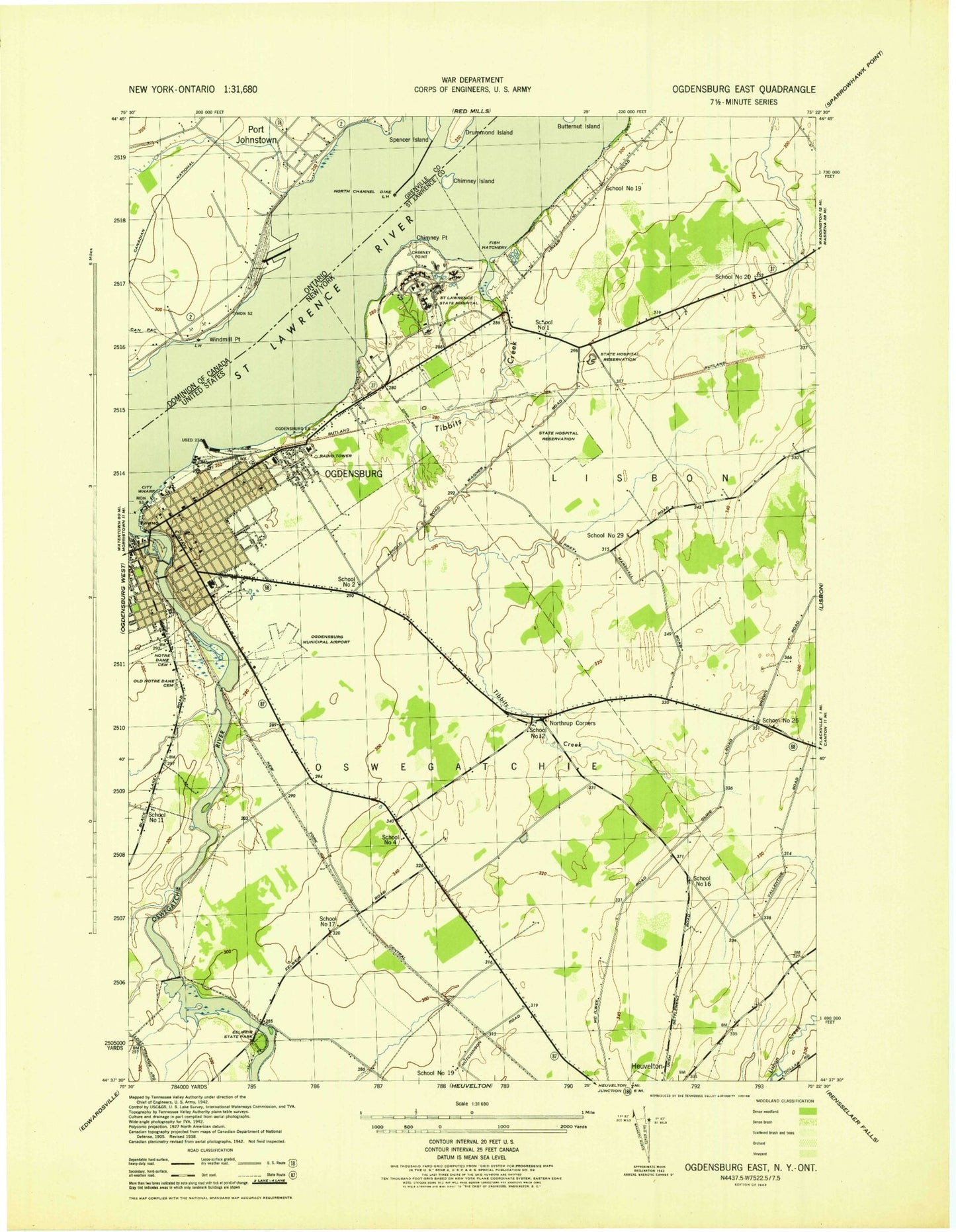
Historical USGS topographic quad map of Ogdensburg East in the state of New York. Typical map scale is 1:24,000, but may vary for certain years, if available. Print size: 24" x 27"
This quadrangle is in the following counties: St. Lawrence.
The map contains contour lines, roads, rivers, towns, and lakes. Printed on high-quality waterproof paper with UV fade-resistant inks, and shipped rolled.
Contains the following named places: Ogdensburg Bridge and Port Authority Marine Terminal, Montroys Boat Basin, Leading Light, Cubbys Marina, Briggs Cemetery, Chimney Island, Chimney Point, Eel Weir Picnic Area, Ford Cemetery, New York State Fish Hatchery (historical), Northrup Corners, Notre Dame Cemetery, Ogdensburg, Ogdensburg-Prescott International Bridge, Old Notre Dame Cemetery, Old State Hospital Cemetery, Oswegatchie River, Riverside Cemetery, Saint Lawrence Psychiatric Center, Saint Marys Cemetery, Seaway Shopping Center, State Hospital Cemetery, Tibbits Creek, Anshe Zophen Cemetery, Ogdensburg International Airport, WPFE-FM (Ogdensburg), WPAC-FM (Ogdensburg), City of Ogdensburg, Town of Oswegatchie, WSLB Radio Tower (Ticonderoga), Parish Dock, School Number 1 (historical), School Number 2 (historical), School Number 4 (historical), School Number 11 (historical), School Number 12 (historical), School Number 16 (historical), School Number 17 (historical), School Number 19 (historical), School Number 19 (historical), School Number 20 (historical), School Number 25 (historical), School Number 29 (historical), Pilgrim Holiness Church, Star Theatre, Ogdensburg State Armory, First Presbyterian Church, Temple Anshe Zophen, Strand Theatre, Ogdensburg City Hall, Frederick Remington Memorial Art Galleries, Library Park, Morissette Park, Crescent Park, Saint John's Episcopal Church, Bishop Conroy Memorial Parochial School, Saint Mary's Academy, Sacred Heart Convent, Hamilton Park, Saint Mary's Cathedral, Saint Peter's Parochial School, Lincoln Elementary School, Sherman Elementary School, First Methodist Church, Saint Joseph's Home, First Baptist Church, Ogdensburg City Water Works, Wesleyan Methodist Church, First Congregational Church, Claxton Hepburn Medical Center, Mansion Square, Public School Number 4 (historical), Saint Marguerite D'Youville Academy, Grove Park, United Helpers Orphan's Home, George B Hall Elementary and Junior High School, Helen Hall Academy, George Hall Trade School, Winter Park, Ogdensburg Fire Department, Ogdensburg Fire Station Number 2, Ogdensburg Fire Station Number 4, John F Kennedy School, Ogdensburg Post Office, Morley Mobile Home Park, Saint Joseph's Nursing Home, Ogdensburg Public Library, Ogdensburg Marina, Ogdensburg Secondary Wastewater Treatment Plant, Woodcrest Dairy, Royal - J - Acres, Debyah Farms, Ogdensburg Volunteer Rescue Squad, Ogdensburg Correctional Facility, Riverview Correctional Facility, Ogdensburg Police Department