MyTopo
Classic USGS Ohanapecosh Hot Springs Washington 7.5'x7.5' Topo Map
Couldn't load pickup availability
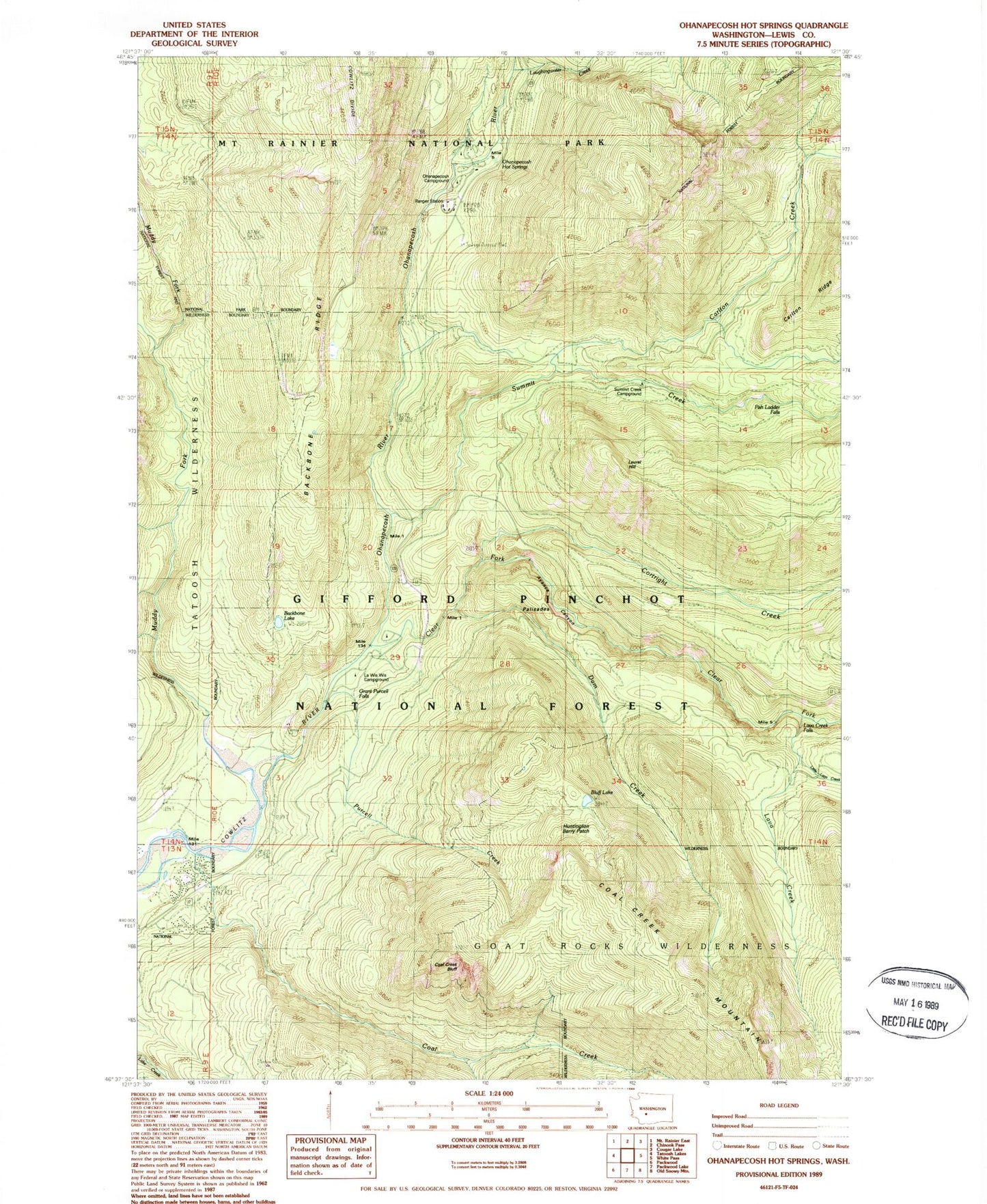
Historical USGS topographic quad map of Ohanapecosh Hot Springs in the state of Washington. Typical map scale is 1:24,000, but may vary for certain years, if available. Print size: 24" x 27"
This quadrangle is in the following counties: Lewis.
The map contains contour lines, roads, rivers, towns, and lakes. Printed on high-quality waterproof paper with UV fade-resistant inks, and shipped rolled.
Contains the following named places: Ayance Canyon, Backbone Lake, Backbone Ridge, Backbone Ridge Trail, Bluff Lake, Bluff Lake Trail, Boundary Trail, Carlton Creek, Clear Fork Cowlitz River, Coal Creek, Coal Creek Bluff, Cortright Creek, Dam Creek, Fish Ladder Falls, Grant Purcell Falls, Huntington Berry Patch, La Wis Wis Campground, Laughingwater Creek, Laurel Hill, Lava Creek, Little Lava Creek, Lost Creek, Ohanapecosh Campground, Ohanapecosh Hot Springs, Palisades, Palisades Viewpoint, Purcell Creek, River Bar Campground, Summit Creek, Summit Creek Campground, Lava Creek Falls Viewpoint, Laurel Hill Outlook, Dinky Creek, Hatchery RV Campground, Palisades Campground, Stevens Canyon, Ohanapecosh, Muddy Fork Cowlitz River, Ohanapecosh River, Coal Creek Forest Camp, Ohanapecosh Visitor Center