MyTopo
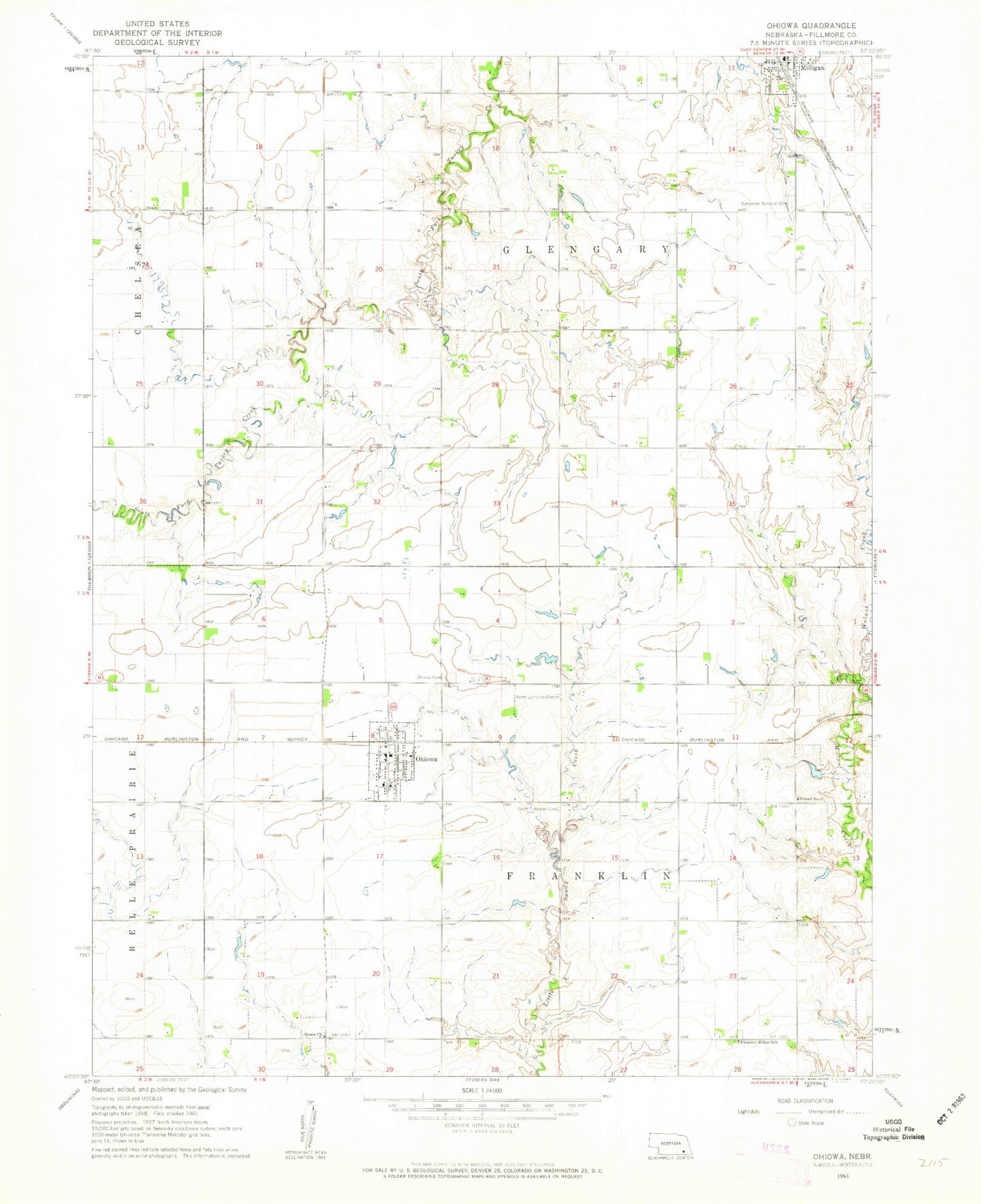
Classic USGS Ohiowa Nebraska 7.5'x7.5' Topo Map
Couldn't load pickup availability
Historical USGS topographic quad map of Ohiowa in the state of Nebraska. Map scale may vary for some years, but is generally around 1:24,000. Print size is approximately 24" x 27"
This quadrangle is in the following counties: Fillmore.
The map contains contour lines, roads, rivers, towns, and lakes. Printed on high-quality waterproof paper with UV fade-resistant inks, and shipped rolled.
Contains the following named places: Bohemian National Cemetery, Chelsea Cemetery, Dorchester Farmers Cooperative - Ohiowa Elevator, Grace Church, North Lutheran Cemetery, Ohiowa, Ohiowa Cemetery, Ohiowa Post Office, Ohiowa Public School, Ohiowa Rural Fire Department, Pioneer Cemetery, Pleasant Ridge School, Saint Johns Lutheran Church, Saint Johns Lutheran Church Cemetery North, School Number 41, South Lutheran Cemetery, Township of Franklin, Township of Glengary, Village of Ohiowa, ZIP Code: 68416