MyTopo
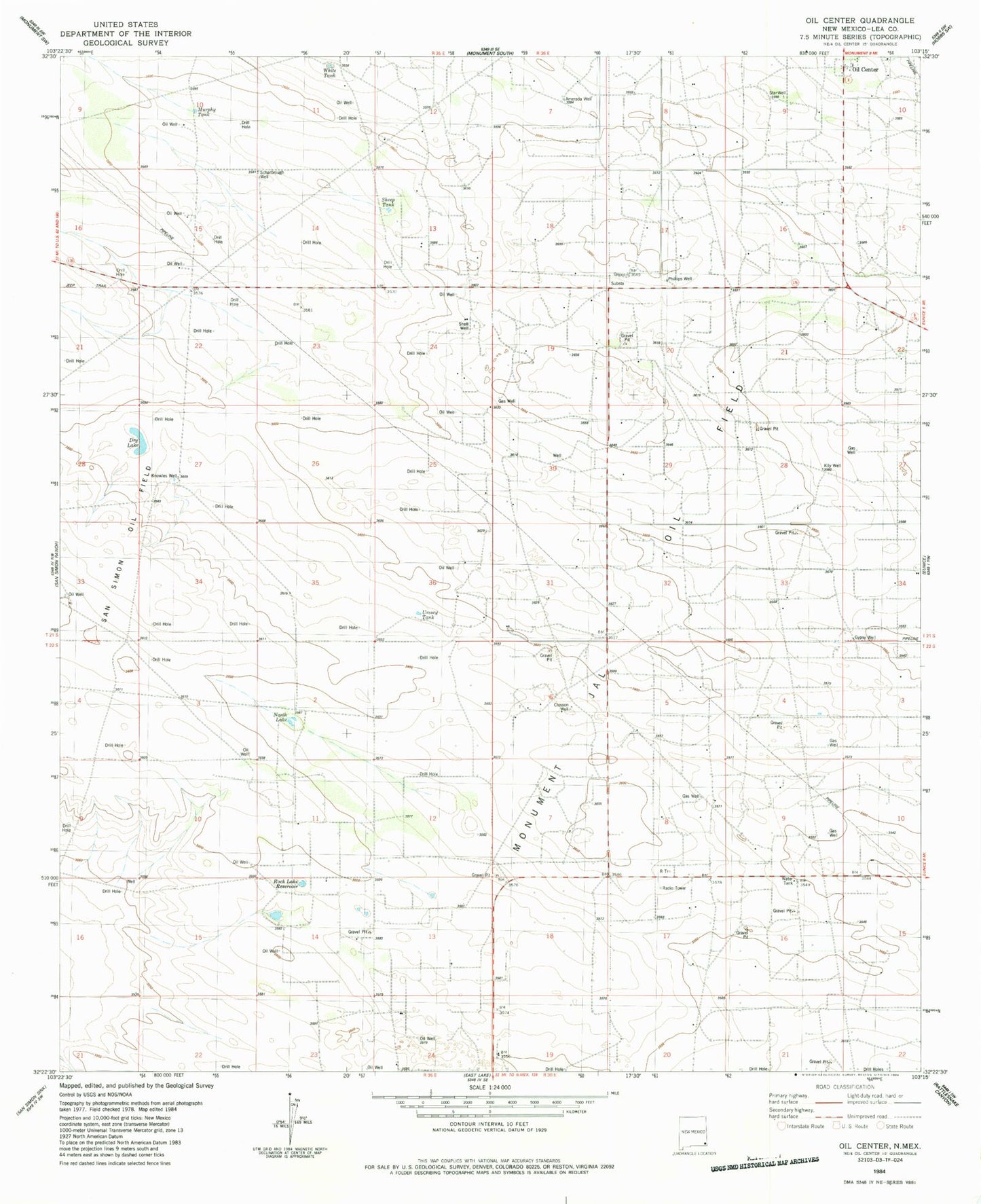
Classic USGS Oil Center New Mexico 7.5'x7.5' Topo Map
Couldn't load pickup availability
Historical USGS topographic quad map of Oil Center in the state of New Mexico. Map scale may vary for some years, but is generally around 1:24,000. Print size is approximately 24" x 27"
This quadrangle is in the following counties: Lea.
The map contains contour lines, roads, rivers, towns, and lakes. Printed on high-quality waterproof paper with UV fade-resistant inks, and shipped rolled.
Contains the following named places: 10575 Water Well, 10576 Water Well, 10577 Water Well, 10578 Water Well, 88231, Amerada Well, Closson Well, Dry Lake, Gypsy Well, Kily Well, Knowles Well, Murphy Tank, North Lake, Oil Center, Phillips Well, Rock Lake Reservoir, Scharbrough Well, Sheep Tank, Shell Well, Star Well, Urssey Tank, White Tank