MyTopo
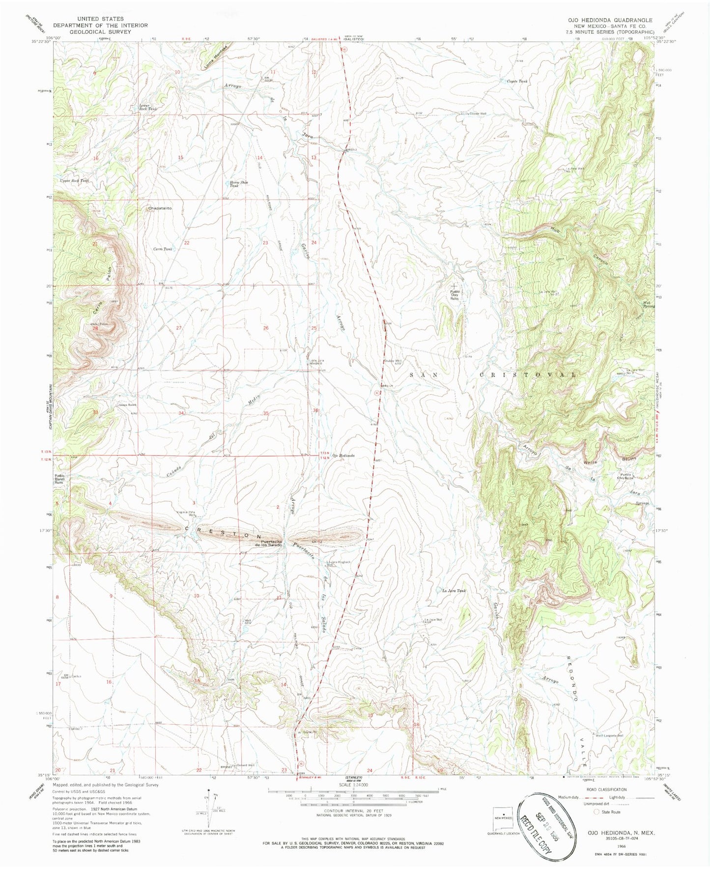
Classic USGS Ojo Hedionda New Mexico 7.5'x7.5' Topo Map
Couldn't load pickup availability
Historical USGS topographic quad map of Ojo Hedionda in the state of New Mexico. Map scale may vary for some years, but is generally around 1:24,000. Print size is approximately 24" x 27"
This quadrangle is in the following counties: Santa Fe.
The map contains contour lines, roads, rivers, towns, and lakes. Printed on high-quality waterproof paper with UV fade-resistant inks, and shipped rolled.
Contains the following named places: 10084 Water Well, Anaya 2 Water Well, Anaya Ranch, Arroyo Jara, Arroyo Puertacito de los Salado, Canada de Medio, Cerro Pelon, Cerro Tank, Chapatalito, Coyote Tank, Coyote Well, Creston, Gaviso Arroyo, Horse Shoe Tank, Hub Canyon, Hub Spring, Hub Well, La Jaca Well Number 1, La Jara HB water Well, La Jara Hogback Well, La Jara Tank, La Jara Well, La Jara Well Number 2, La Jara Well Number 3, Little Jara Windmill, Lower Rock Tank, Mckee A Water Well, Ojo Hedionda, Oxnard Well, Pueblo Blanco Ruins, Pueblo Chey Ruins, Puertacito de los Salado, Redondo Valle, RG-31969 Water Well, Stubby Well, Upper Rock Tank, Virginia Pina Well, West Largoeta Well, White Bluffs