MyTopo
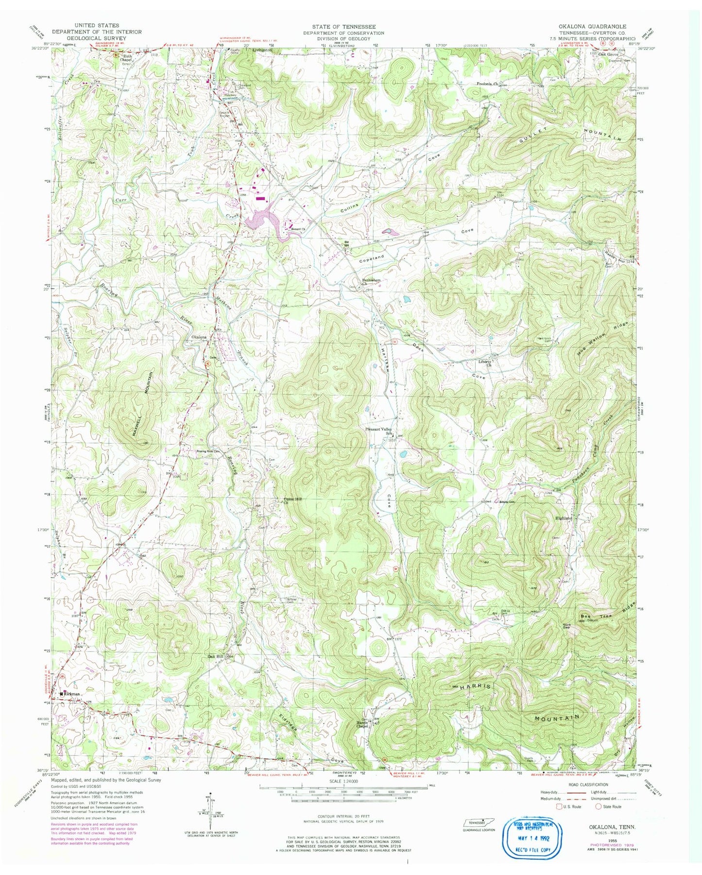
Classic USGS Okalona Tennessee 7.5'x7.5' Topo Map
Couldn't load pickup availability
Historical USGS topographic quad map of Okalona in the state of Tennessee. Map scale may vary for some years, but is generally around 1:24,000. Print size is approximately 24" x 27"
This quadrangle is in the following counties: Overton.
The map contains contour lines, roads, rivers, towns, and lakes. Printed on high-quality waterproof paper with UV fade-resistant inks, and shipped rolled.
Contains the following named places: Bethlehem Cemetery, Bethlehem Church, Bilbrey Cemetery, Brushy Mountain, Carr Cemetery, Collins Branch, Collins Cove, Commissioner District 4, Copeland Cemetery, Copeland Cove, Copeland Creek, Copelands Mill, Cullom, Deck Cove, Eldridge Cove, Fairgrounds Volunteer Fire Department, Fredonia Cemetery, Fredonia Church, Gullet Mountain, Hammock Cemetery, Harris Chapel, Harris Chapel Cemetery, Harris Mountain, Hartsaw Cemetery, Hartsaw Cove, Hellhole Mountain, Henard, Henard Church, Highland, Highland Cemetery, Lee, Liberty Cemetery, Liberty Church, Livingston City Lake, Livingston City Lake Dam, Mathews Branch, Maxwell Mountain, Oak Grove Cemetery, Oak Hill, Oakley Cemetery, Okalona, Okalona United Methodist Church, Okolona Cemetery, Overton County, Overton County Highway Department Quarry, Overton County Rescue Squad, Pleasant Valley School, Polk Bilbrey Cemetery, Qualls Cemetery, Rickman Elementary School, Rickman Volunteer Fire Department, Roaring River Cemetery, Ruth Chapel, Ruths Chapel Cemetery, Stephen Wells Cemetery, Sulphur Branch, Town Creek, Union Hill, Union Hill Church, WLIV-AM (Livingston), WXKG-FM (Livingston), York Gap, ZIP Code: 38580