MyTopo
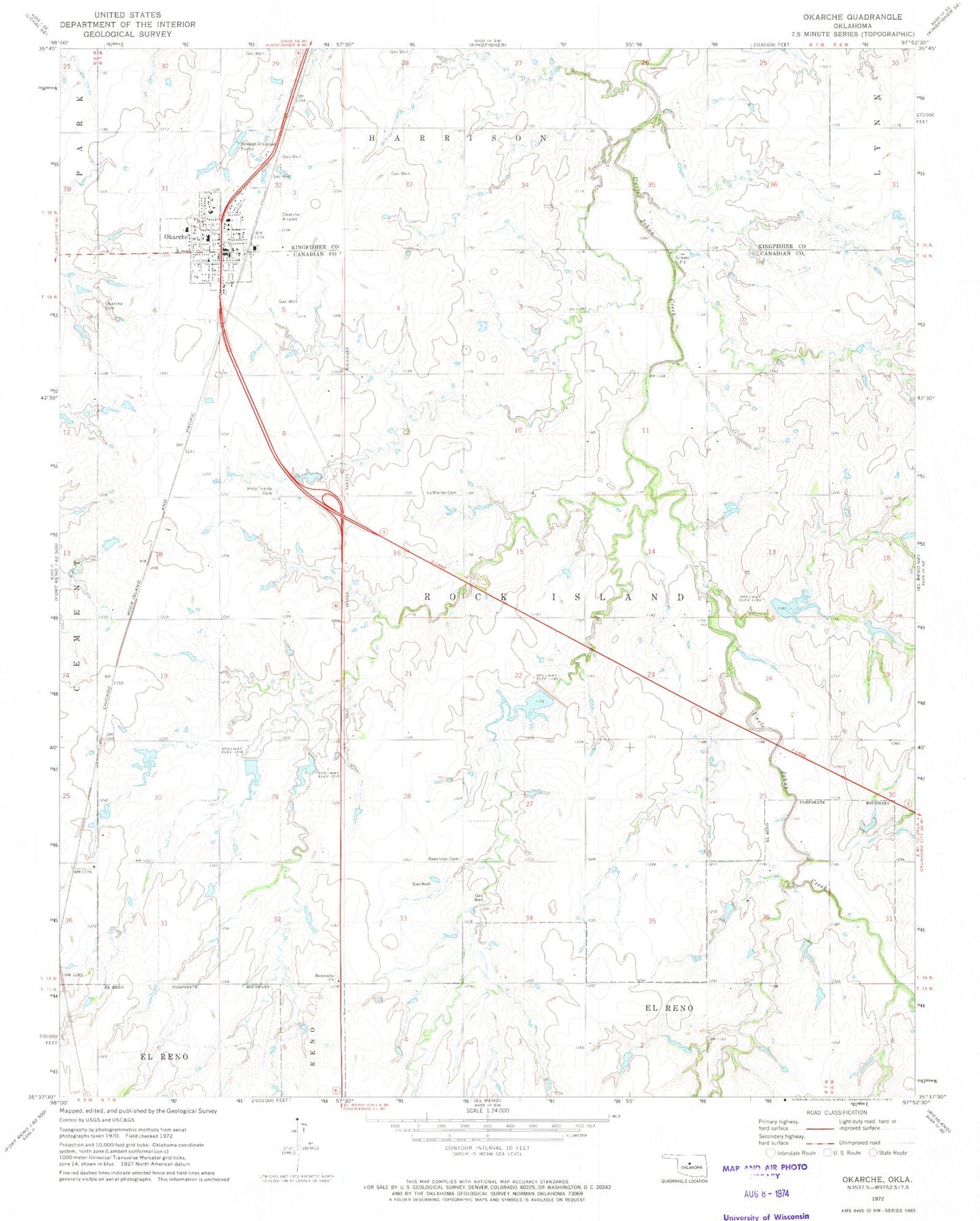
Classic USGS Okarche Oklahoma 7.5'x7.5' Topo Map
Couldn't load pickup availability
Historical USGS topographic quad map of Okarche in the state of Oklahoma. Map scale may vary for some years, but is generally around 1:24,000. Print size is approximately 24" x 27"
This quadrangle is in the following counties: Canadian, Kingfisher.
The map contains contour lines, roads, rivers, towns, and lakes. Printed on high-quality waterproof paper with UV fade-resistant inks, and shipped rolled.
Contains the following named places: Beecham Cemetery, Chandler Armory Heliport, Cheyenne and Arapahoe District 2, Holy Trinity Catholic School, Holy Trinity Cemetery, Mennonville Mennonite Cemetery, Okarche, Okarche Airport, Okarche Cemetery, Okarche Elementary School, Okarche Fire Department, Okarche High School, Okarche Junior High School, Okarche Police Department, Okarche Post Office, Oknoname 017004 Dam, Oknoname 017006 Dam, Oknoname 017007 Dam, Oknoname 4 Lake, Oknoname 6 Lake, Oknoname Canadian County 7 Lake, Saint John Lutheran School, Town of Okarche, Township of Rock Island, Uncle John Creek Site 11 Dam, Uncle John Creek Site 11 Reservoir, Uncle John Creek Site 4 Dam, Uncle John Creek Site 4 Reservoir, Uncle John Creek Site 5 Dam, Uncle John Creek Site 5 Reservoir, Uncle John Creek Site 6 Dam, Uncle John Creek Site 6 Reservoir, Uncle John Creek Site 7 Dam, Uncle John Creek Site 7 Reservoir, Uncle John Creek Site 8 Dam, Uncle John Creek Site 8 Reservoir, Uncle John Creek Site 9 Dam, Uncle John Creek Site 9 Reservoir, ZIP Code: 73762