MyTopo
Classic USGS Okaton South Dakota 7.5'x7.5' Topo Map
Couldn't load pickup availability
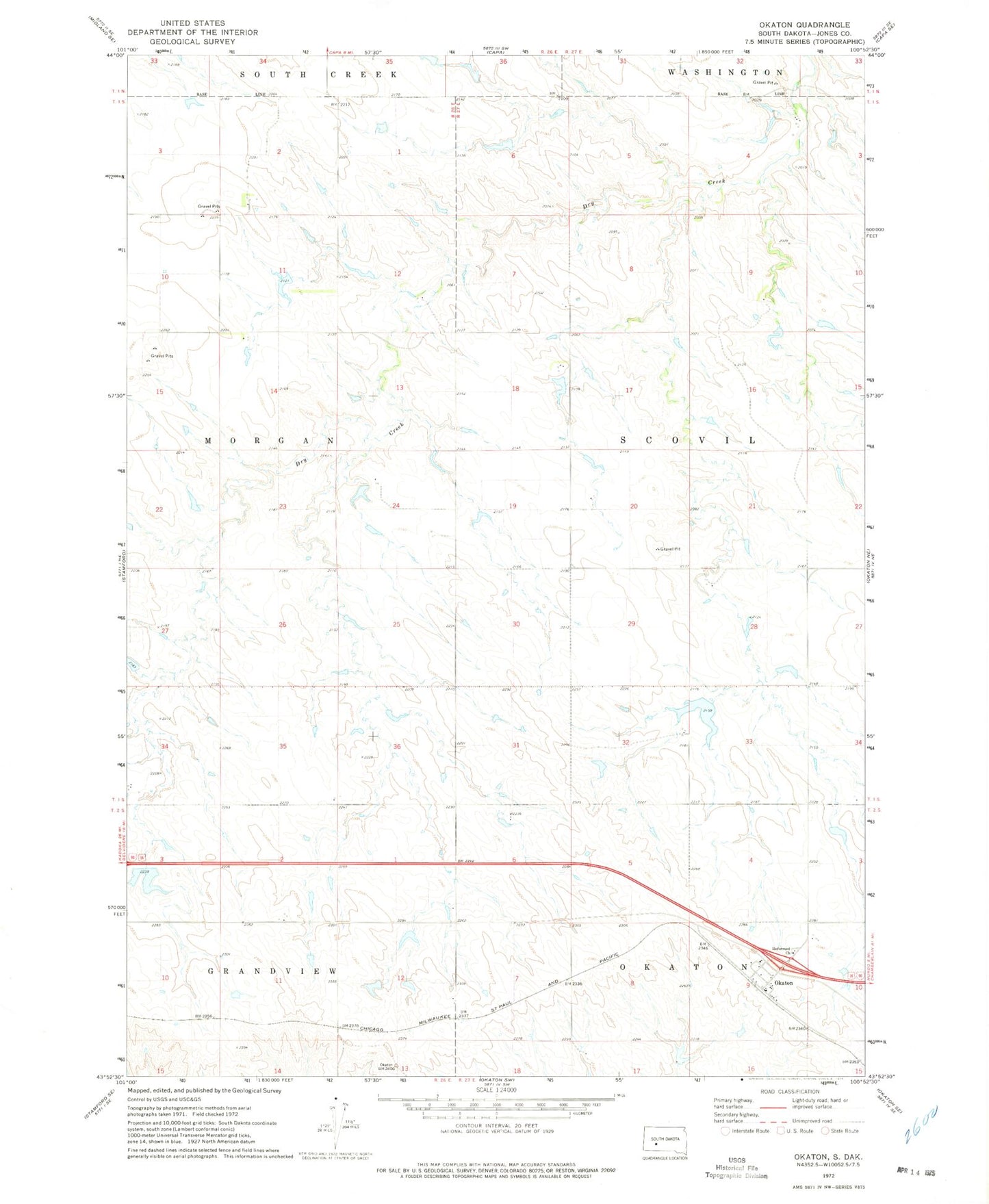
Historical USGS topographic quad map of Okaton in the state of South Dakota. Map scale may vary for some years, but is generally around 1:24,000. Print size is approximately 24" x 27"
This quadrangle is in the following counties: Jones.
The map contains contour lines, roads, rivers, towns, and lakes. Printed on high-quality waterproof paper with UV fade-resistant inks, and shipped rolled.
Contains the following named places: Arp Number 1 Dam, Bork Number 2 Dam, Esmay and Sandy Number 2 Dam, Gothiermink Number 2 Dam, Highland, Hurst Number 1 Dam, Hurst Number 2 Dam, Hurst Number 3 Dam, Lyman Number 1 Dam, Lyman Number 2 Dam, Okaton, Okaton Post Office, Peters Number 1 Dam, Roghair Number 1 Dam, Sandy Number 2 Dam, Township of Morgan, Township of Scovil, ZIP Code: 57562