
MyTopo
Classic USGS Okawville Illinois 7.5'x7.5' Topo Map
Couldn't load pickup availability
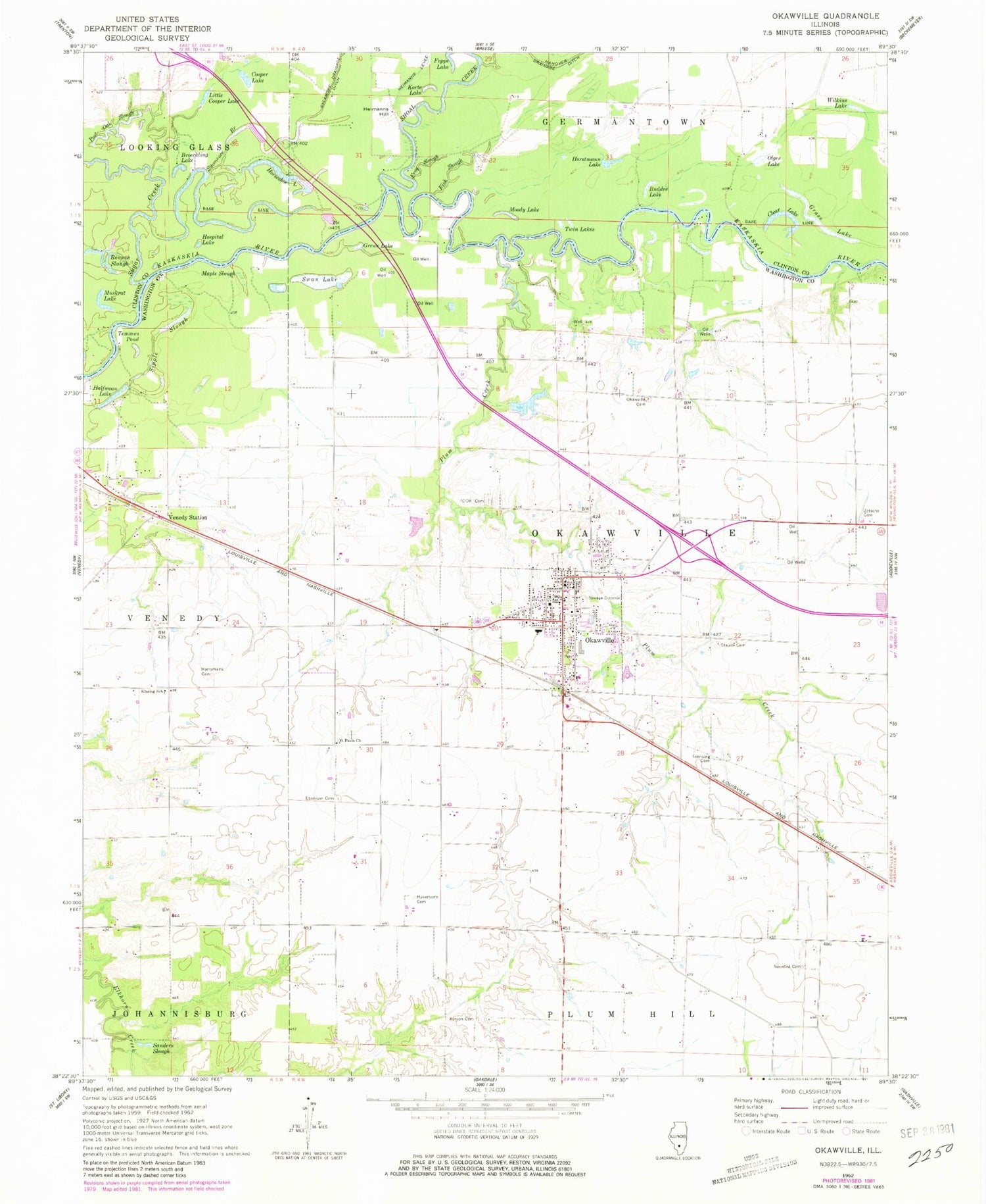
Historical USGS topographic quad map of Okawville in the state of Illinois. Map scale may vary for some years, but is generally around 1:24,000. Print size is approximately 24" x 27"
This quadrangle is in the following counties: Clinton, Washington.
The map contains contour lines, roads, rivers, towns, and lakes. Printed on high-quality waterproof paper with UV fade-resistant inks, and shipped rolled.
Contains the following named places: Benson Slough, Broeckling Lake, Buddes Lake, Clear Lake, Cooper Lake, Ebenezer Cemetery, Fish Slough, Foppe Lake, Frog Slough, Grass Lake, Grewe Lake, Halfmoon Lake, Harrymans Cemetery, Heimanns Hill, Horseshoe Lake, Horstmann Lake, Hospital Lake, Husemann Cemetery, Immanuel Lutheran Church, Immanuel Lutheran School, Independent Order of Oddfellows Cemetery, Kellys Pond, Kinyon Cemetery, Klasing School, Korte Lake, Little Cooper Lake, Maple Slough, Moody Lake, Muskrat Lake, Neunlist Cemetery, Okawville, Okawville Fire Protection District, Okawville Grade School, Okawville High School, Okawville Police Department, Okawville Post Office, Olges Lake, Plum Creek, Post Oak Slough, Saint Barbara Catholic Cemetery, Saint Barbara Church, Saint Pauls Church, Saint Peter United Church, Sanders Slough, Shoal Creek, Sipple Slough, Staude Cemetery, Sugar Creek, Swan Lake, Sycamore Branch, Temmes Pond, Toensing Cemetery, Township of Okawville, Twin Lakes, Venedy Station, Village of Okawville, Wilkins Lake, Zetsche Cemetery, ZIP Codes: 62214, 62271


