MyTopo
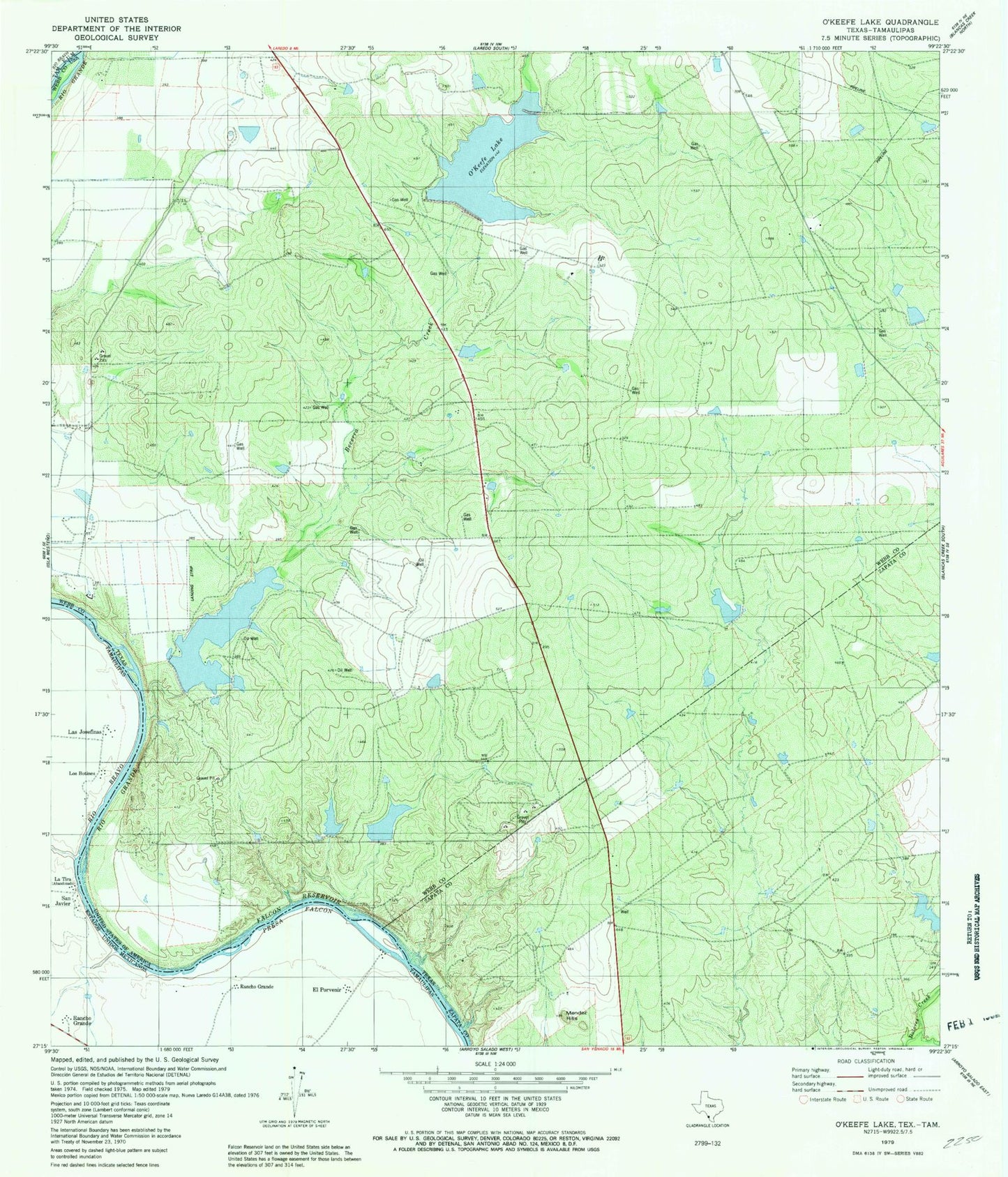
Classic USGS O'Keefe Lake Texas 7.5'x7.5' Topo Map
Couldn't load pickup availability
Historical USGS topographic quad map of O'Keefe Lake in the state of Texas. Map scale may vary for some years, but is generally around 1:24,000. Print size is approximately 24" x 27"
This quadrangle is in the following counties: Webb, Zapata.
The map contains contour lines, roads, rivers, towns, and lakes. Printed on high-quality waterproof paper with UV fade-resistant inks, and shipped rolled.
Contains the following named places: A Ambulance Service, Becerra Creek, City of Rio Bravo, Dolores Colonia, El Cenizo, La Perla Ranch Lake Number 1, La Perla Ranch Lake Number 1 Dam, Mendez Hills, O'Keefe Dam, O'Keefe Lake, Rancho Blanco Airport, Rancho Blanco Lake, Rio Bravo, Rio Bravo Annex Colonia, Rio Bravo City Hall, Rio Bravo Colonia, Rio Bravo Fire Department, Zachary Dam, Zachry Lake Number 2, Zachry Lake Number 2 Dam, Zachry Lake Number 3, Zachry Lake Number 3 Dam