MyTopo
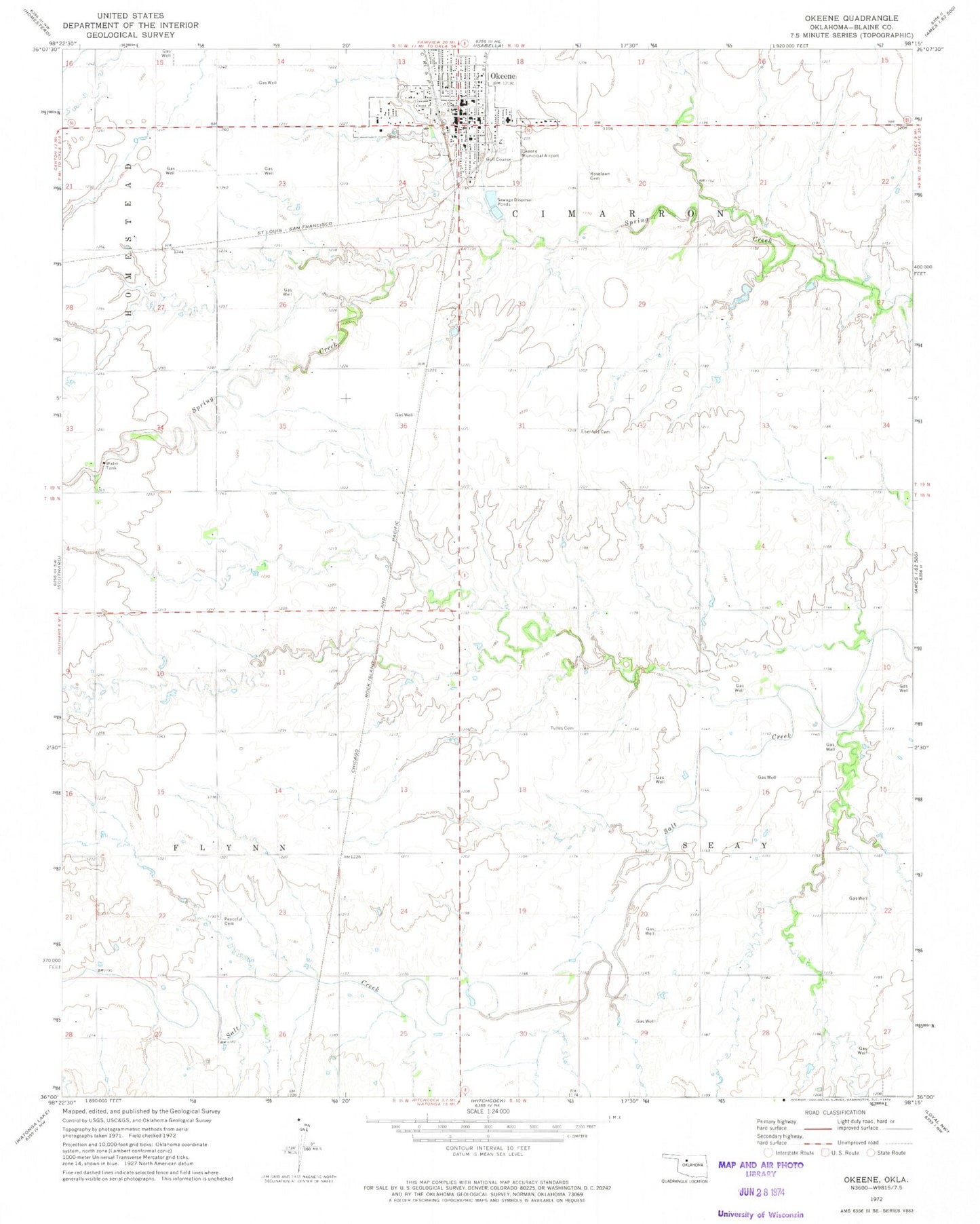
Classic USGS Okeene Oklahoma 7.5'x7.5' Topo Map
Couldn't load pickup availability
Historical USGS topographic quad map of Okeene in the state of Oklahoma. Map scale may vary for some years, but is generally around 1:24,000. Print size is approximately 24" x 27"
This quadrangle is in the following counties: Blaine.
The map contains contour lines, roads, rivers, towns, and lakes. Printed on high-quality waterproof paper with UV fade-resistant inks, and shipped rolled.
Contains the following named places: Brickman Cemetery, Christman Airfield, Church of Christ, Ebenfeld Cemetery, First Baptist Church, First Christian Church, First United Methodist Church, Lamle Airport, Okeene, Okeene Assembly of God Church, Okeene Division, Okeene Elementary School, Okeene Emergency Medical Services, Okeene Fire Department, Okeene Junior High School, Okeene Municipal Hospital, Okeene Police Department, Okeene Post Office, Okeene Senior High School, Okeene Sewage Disposal Pond North, Okeene Sewage Disposal Pond North Dam, Okeene Sewage Disposal Pond South, Okeene Sewage Disposal Pond South Dam, Peaceful Cemetery, Roselawn Cemetery, Saint Anthonys Catholic Church, Saint John United Church, Seventh Day Adventist Church, Tonkawa Creek Site 4 Dam, Tonkawa Creek Site 4 Reservoir, Town of Okeene, Township of Cimarron, Township of Flynn, Township of Seay, Tulles Cemetery, ZIP Code: 73763