MyTopo
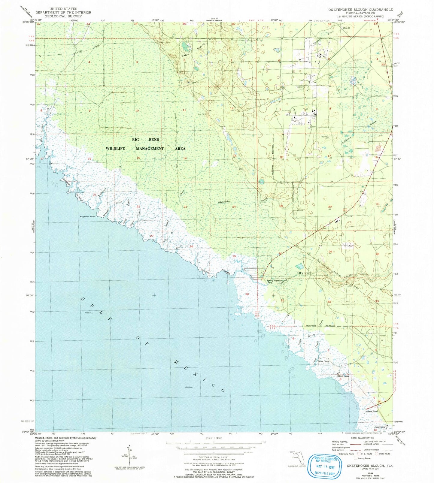
Classic USGS Okefenokee Slough Florida 7.5'x7.5' Topo Map
Couldn't load pickup availability
Historical USGS topographic quad map of Okefenokee Slough in the state of Florida. Map scale may vary for some years, but is generally around 1:24,000. Print size is approximately 24" x 27"
This quadrangle is in the following counties: Taylor.
The map contains contour lines, roads, rivers, towns, and lakes. Printed on high-quality waterproof paper with UV fade-resistant inks, and shipped rolled.
Contains the following named places: Adams Beach, Big Spring Creek, Bonita Beach, Brannen Creek, Eagle Prairie, Eaglenest Creek, Eaglenest Point, Ezell Camp, Holy Creek, Island Creek, Jabo Camp, Little Spring Creek, Mullet Creek, Okefenokee Slough, Otter Creek, Sand Creek, Spring Warrior Camp, Spring Warrior Creek, Spring Warriors, Taylor County, Turkey Roost Slough, Yates Camp, Yates Creek